MyTopo
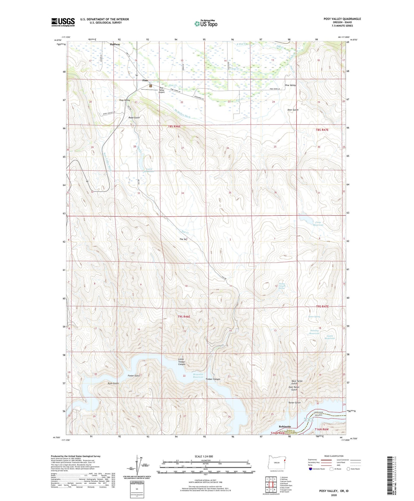
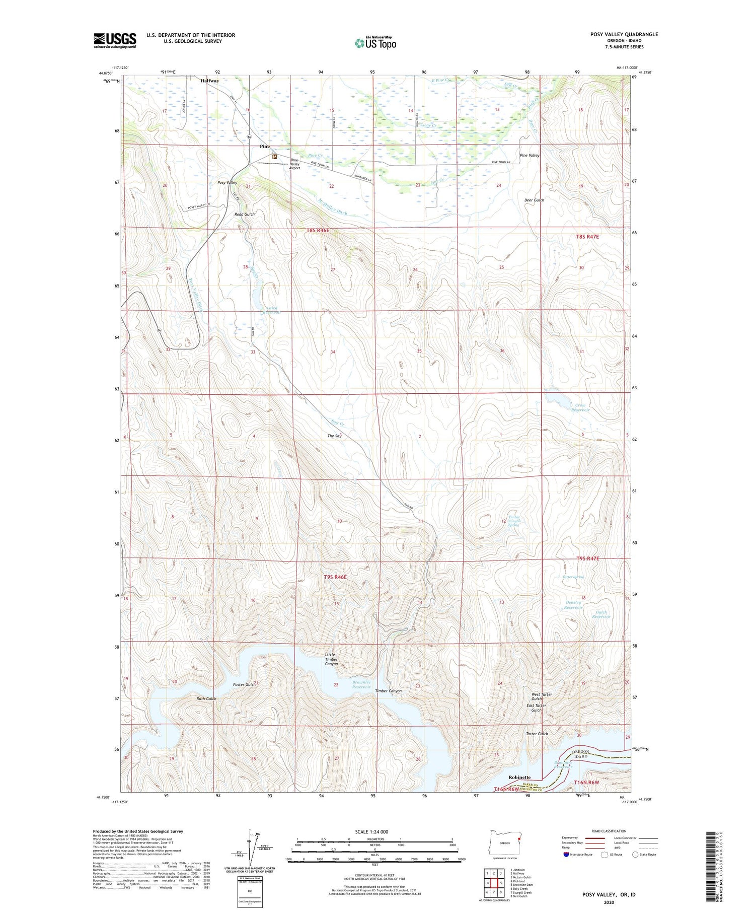
Posy Valley Oregon US Topo Map
Couldn't load pickup availability
2020 topographic map quadrangle Posy Valley in the states of Idaho, Oregon. Scale: 1:24000. Based on the newly updated USGS 7.5' US Topo map series, this map is in the following counties: Baker, Washington. The map contains contour data, water features, and other items you are used to seeing on USGS maps, but also has updated roads and other features. This is the next generation of topographic maps. Printed on high-quality waterproof paper with UV fade-resistant inks.
Quads adjacent to this one:
West: Richland
Northwest: Jimtown
North: Halfway
Northeast: McLain Gulch
East: Brownlee Dam
Southeast: Neil Gulch
South: Sturgill Creek
Southwest: Daly Creek
Contains the following named places: Baker County Fairgrounds, Baker County Panhandle Rodeo Arena, Clear Creek, Cottonwood Creek, Crow Reservoir, Deer Creek, Deer Gulch, Densley Reservoir, Dry Creek, East Pine Creek, East Tarter Gulch, F M Crow Dam, Foster Gulch, Gulch Reservoir, Hewitt / Holcomb Parks Boat Ramp 3, Hewitt / Holcomb Parks Marina, Laird Dam, Laird Reservoir, Lee Creek, Little Timber Canyon, McMullen Ditch, Pine, Pine Post Office, Pine Ranger Station, Pine Valley, Pine Valley Airport, Posy Valley, Road Gulch, Robinette, Robinette Post Office, Ruth Gulch, Sag Creek, Tarter Gulch, Tarter Spring, The Sag, Timber Canyon, Timber Canyon Spring, Timber Canyon Waterhole, West Tarter Gulch