MyTopo
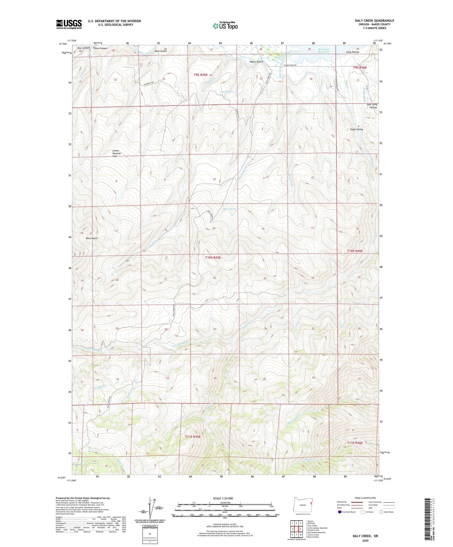
Daly Creek Oregon US Topo Map
Couldn't load pickup availability
Also explore the Daly Creek Forest Service Topo of this same quad for updated USFS data
2023 topographic map quadrangle Daly Creek in the state of Oregon. Scale: 1:24000. Based on the newly updated USGS 7.5' US Topo map series, this map is in the following counties: Baker. The map contains contour data, water features, and other items you are used to seeing on USGS maps, but also has updated roads and other features. This is the next generation of topographic maps. Printed on high-quality waterproof paper with UV fade-resistant inks.
Quads adjacent to this one:
West: Little Lookout Mountain
Northwest: Sparta
North: Richland
Northeast: Posy Valley
East: Sturgill Creek
Southeast: Monroe Butte
South: Connor Creek
Southwest: Big Lookout Mountain
This map covers the same area as the classic USGS quad with code o44117f2.
Contains the following named places: Badland Creek, Brady Creek, Chalk Creek, Cherry Spring, Cherry Spring Creek, Daly Creek, Eagle Creek, Eagle Valley, East Long Hollow, Haawpa Creek, Kirby Creek, Long Hollow, Lower Peavine Flat, Myers Gulch, North Fork Daly Creek, Poison Spring, Siegle Ditch, Wilkins Creek