MyTopo
Powell Butte Oregon US Topo Map
Couldn't load pickup availability
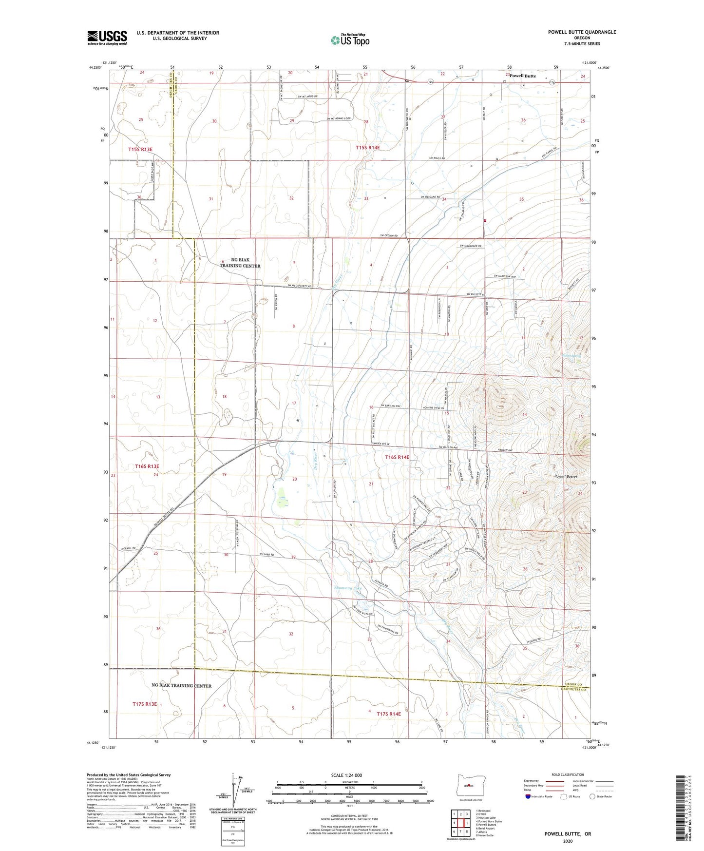
2023 topographic map quadrangle Powell Butte in the state of Oregon. Scale: 1:24000. Based on the newly updated USGS 7.5' US Topo map series, this map is in the following counties: Crook, Deschutes. The map contains contour data, water features, and other items you are used to seeing on USGS maps, but also has updated roads and other features. This is the next generation of topographic maps. Printed on high-quality waterproof paper with UV fade-resistant inks.
Quads adjacent to this one:
West: Forked Horn Butte
Northwest: Redmond
Northeast: Houston Lake
East: Powell Buttes
Southeast: Horse Butte
South: Alfalfa
Southwest: Bend Airport
This map covers the same area as the classic USGS quad with code o44121b1.
Contains the following named places: Crook County Fire and Rescue Powell Butte Station, Picket Spring, Powell Butte, Powell Butte Community Charter School, Powell Butte Post Office, Shumway Lake, ZIP Code: 97753