MyTopo
Horse Butte Oregon US Topo Map
Couldn't load pickup availability
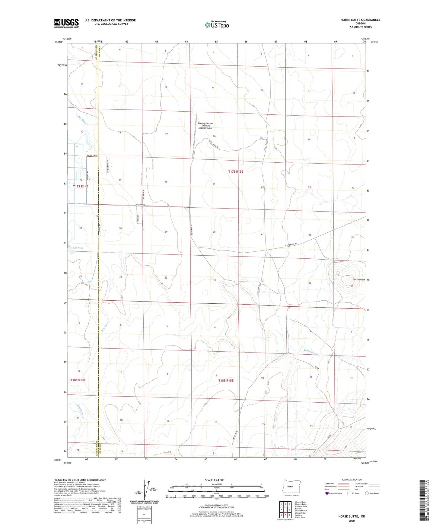
2023 topographic map quadrangle Horse Butte in the state of Oregon. Scale: 1:24000. Based on the newly updated USGS 7.5' US Topo map series, this map is in the following counties: Crook, Deschutes. The map contains contour data, water features, and other items you are used to seeing on USGS maps, but also has updated roads and other features. This is the next generation of topographic maps. Printed on high-quality waterproof paper with UV fade-resistant inks.
Quads adjacent to this one:
West: Alfalfa
Northwest: Powell Butte
North: Powell Buttes
Northeast: Stearns Butte
East: Bowman Dam
Southeast: West Butte
South: Millican
Southwest: Horse Ridge
This map covers the same area as the classic USGS quad with code o44120a8.
Contains the following named places: Goering Ranches / Crocheta Airport Estates, Hay Creek Post Office, Horse Butte, Williamson Creek