MyTopo
Bend Airport Oregon US Topo Map
Couldn't load pickup availability
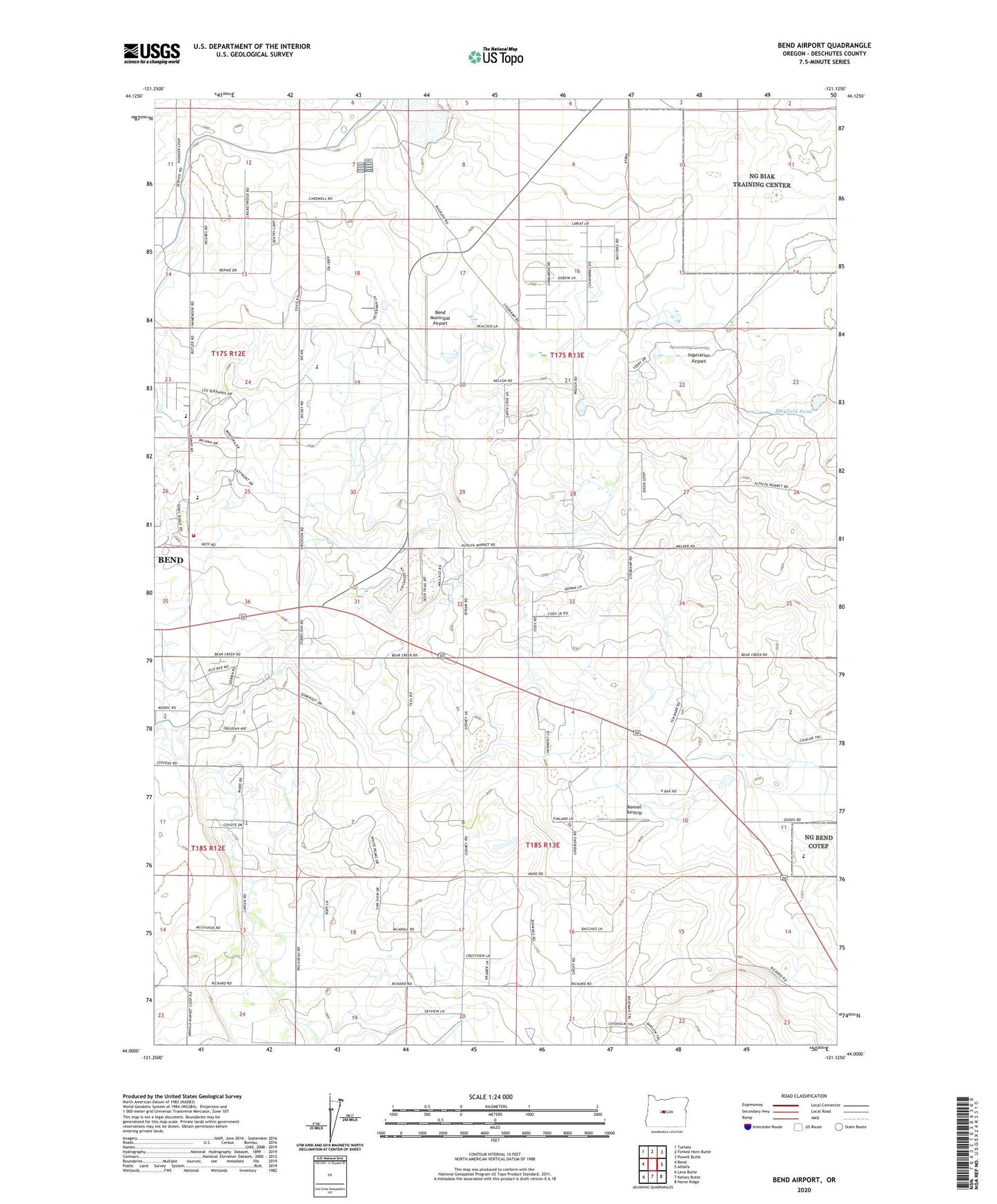
2024 topographic map quadrangle Bend Airport in the state of Oregon. Scale: 1:24000. Based on the newly updated USGS 7.5' US Topo map series, this map is in the following counties: Deschutes. The map contains contour data, water features, and other items you are used to seeing on USGS maps, but also has updated roads and other features. This is the next generation of topographic maps. Printed on high-quality waterproof paper with UV fade-resistant inks.
Quads adjacent to this one:
West: Bend
Northwest: Tumalo
North: Forked Horn Butte
Northeast: Powell Butte
East: Alfalfa
Southeast: Horse Ridge
South: Kelsey Butte
Southwest: Lava Butte
This map covers the same area as the classic USGS quad with code o44121a2.
Contains the following named places: Bend Division, Bend Municipal Airport, Bend Wastewater Treatment Plant, Big Sky Park and Sports Complex, Buckingham Elementary School, City of Bend Fire Department Station 304 East Fire Station, Eastern Star Grange Hall, Inspiration Airport, KBND-AM, Kennel Airstrip, Lava Rock School, Mayfield Pond, Mercer, Young School, ZIP Codes: 97701, 97702