MyTopo
Riverton Oregon US Topo Map
Couldn't load pickup availability
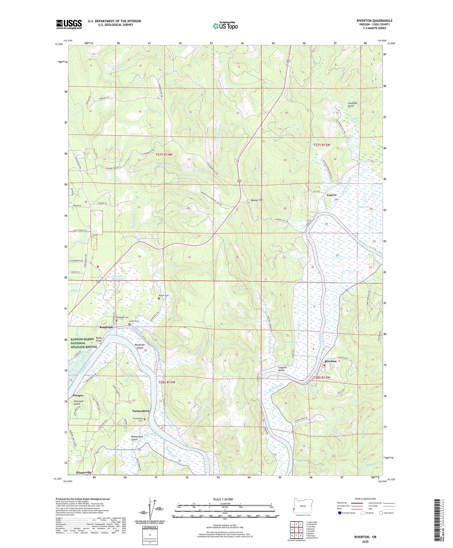
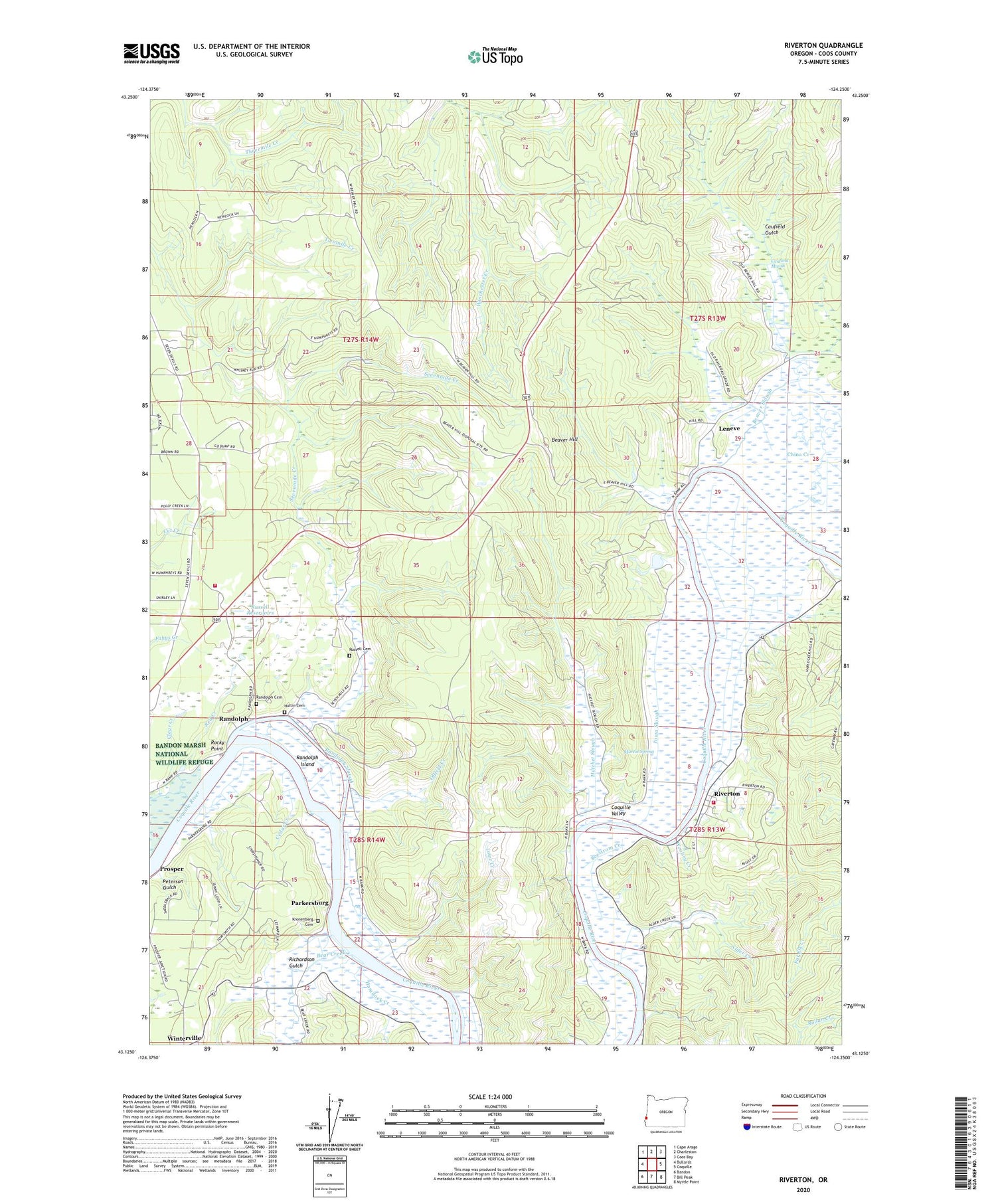
2020 topographic map quadrangle Riverton in the state of Oregon. Scale: 1:24000. Based on the newly updated USGS 7.5' US Topo map series, this map is in the following counties: Coos. The map contains contour data, water features, and other items you are used to seeing on USGS maps, but also has updated roads and other features. This is the next generation of topographic maps. Printed on high-quality waterproof paper with UV fade-resistant inks.
Quads adjacent to this one:
West: Bullards
Northwest: Cape Arago
North: Charleston
Northeast: Coos Bay
East: Coquille
Southeast: Myrtle Point
South: Bill Peak
Southwest: Bandon
Contains the following named places: Alder Creek, Bandon Rural Fire Protection District Randolph Station, Bear Creek, Beaver Hill, Beaver Lookout, Beaver Slough, Beaverton, Cannery Spring, Caufield Gulch, Caufield Marsh, Cedar Creek, Central City Post Office, China Creek, Clear Creek, Coos County Forest, Coquille Fire Department Station 3, Coquille Valley, Eagle Mine, Freedom Post Office, Hamdock Creek, Hatchet Slough, Hultin Cemetery, Hultin Creek, Iowa Slough, Iowa Slough Post Office, Judah Parker County Park, Kronenberg Cemetery, Leneve, Leneve Post Office, Lowe Creek, Martin Spring, Offield Creek, Parkersburg, Parkersburgh Post Office, Peterson Gulch, Polly Creek, Preuss Post Office, Prosper, Prosper Post Office, Randolph, Randolph Cemetery, Randolph Island, Randolph Post Office, Randolph Slough, Red Creek, Richardson Gulch, Riverton, Riverton Boat Ramp, Riverton Post Office, Rocky Point, Rocky Point Boat Ramp, Rose Mine, Russell Cemetery, Russell Reservoirs, Seestrom Creek, Seven Devils Mine, Sevenmile Creek, Sevenmile Slough, Woolsey Creek