MyTopo
Rodman Rim Oregon US Topo Map
Couldn't load pickup availability
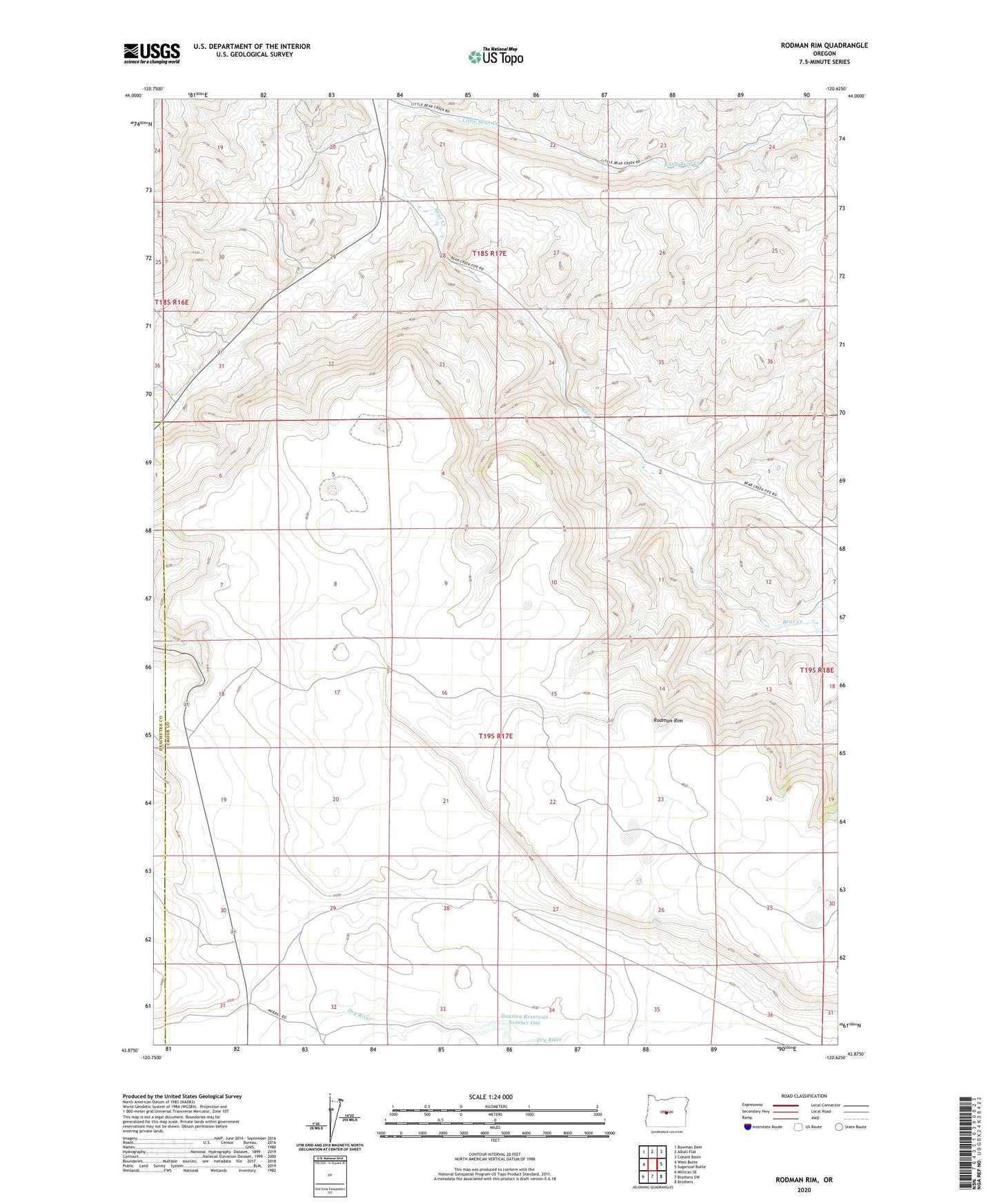
2023 topographic map quadrangle Rodman Rim in the state of Oregon. Scale: 1:24000. Based on the newly updated USGS 7.5' US Topo map series, this map is in the following counties: Crook, Deschutes. The map contains contour data, water features, and other items you are used to seeing on USGS maps, but also has updated roads and other features. This is the next generation of topographic maps. Printed on high-quality waterproof paper with UV fade-resistant inks.
Quads adjacent to this one:
West: West Butte
Northwest: Bowman Dam
North: Alkali Flat
Northeast: Conant Basin
East: Sugarloaf Butte
Southeast: Brothers
South: Brothers SW
Southwest: Millican SE
This map covers the same area as the classic USGS quad with code o43120h6.
Contains the following named places: Crook Post Office, Houston Reservoir Number One, Little Bear Creek, Rodman Rim