MyTopo
Bowman Dam Oregon US Topo Map
Couldn't load pickup availability
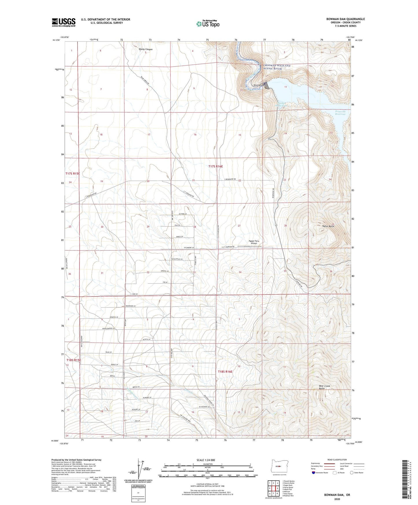
2024 topographic map quadrangle Bowman Dam in the state of Oregon. Scale: 1:24000. Based on the newly updated USGS 7.5' US Topo map series, this map is in the following counties: Crook. The map contains contour data, water features, and other items you are used to seeing on USGS maps, but also has updated roads and other features. This is the next generation of topographic maps. Printed on high-quality waterproof paper with UV fade-resistant inks.
Quads adjacent to this one:
West: Horse Butte
Northwest: Powell Buttes
North: Stearns Butte
Northeast: Eagle Rock
East: Alkali Flat
Southeast: Rodman Rim
South: West Butte
Southwest: Millican
This map covers the same area as the classic USGS quad with code o44120a7.
Contains the following named places: Agape Farm Airport, Bear Creek, Bear Creek Agate Beds, Bear Creek Butte, Bowman Dam, Perry Creek, Powder House Cove, Powder House Cove Boat Ramp, Taylor Butte