MyTopo
Alkali Flat Oregon US Topo Map
Couldn't load pickup availability
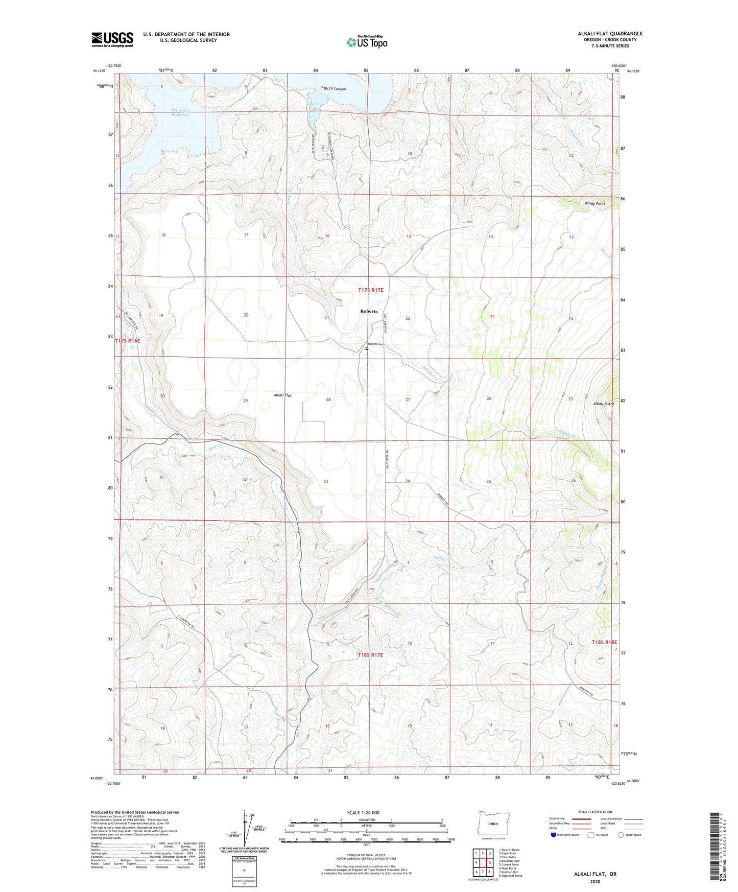
2024 topographic map quadrangle Alkali Flat in the state of Oregon. Scale: 1:24000. Based on the newly updated USGS 7.5' US Topo map series, this map is in the following counties: Crook. The map contains contour data, water features, and other items you are used to seeing on USGS maps, but also has updated roads and other features. This is the next generation of topographic maps. Printed on high-quality waterproof paper with UV fade-resistant inks.
Quads adjacent to this one:
West: Bowman Dam
Northwest: Stearns Butte
North: Eagle Rock
Northeast: Pilot Butte
East: Conant Basin
Southeast: Sugarloaf Butte
South: Rodman Rim
Southwest: West Butte
This map covers the same area as the classic USGS quad with code o44120a6.
Contains the following named places: Alkali Creek, Alkali Flat, Birch Canyon, Bottero Park, Home Hollow Creek, Prineville Reservoir Resort, Prineville Reservoir Resort Boat Ramp, Prineville Reservoir Resort Marina, Roberts, Roberts Bay, Roberts Cemetery, Roberts Post Office, Salt Creek, Windy Point