MyTopo
Rogers Peak Oregon US Topo Map
Couldn't load pickup availability
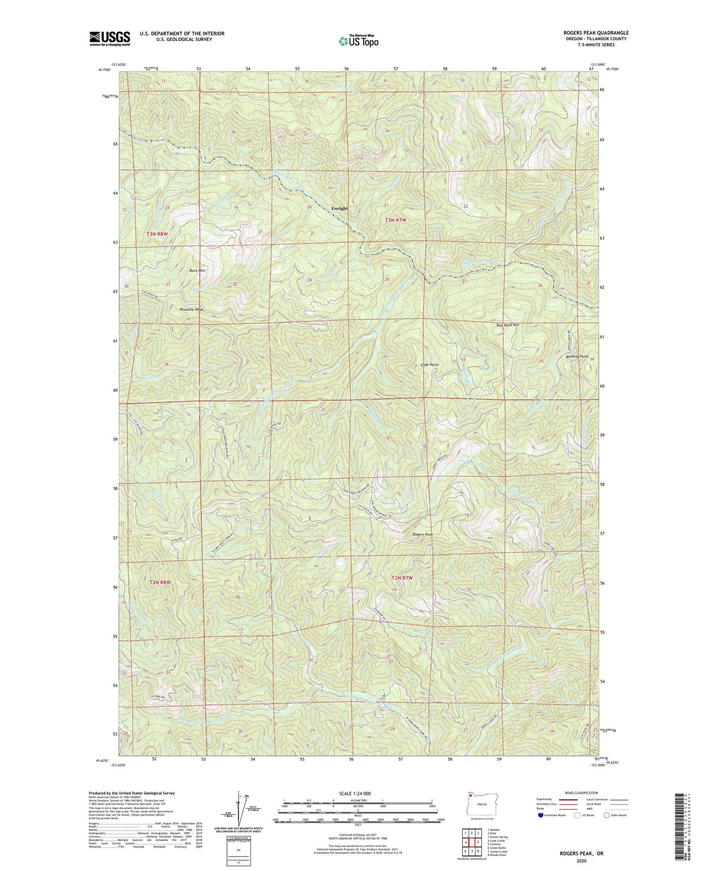
2020 topographic map quadrangle Rogers Peak in the state of Oregon. Scale: 1:24000. Based on the newly updated USGS 7.5' US Topo map series, this map is in the following counties: Tillamook. The map contains contour data, water features, and other items you are used to seeing on USGS maps, but also has updated roads and other features. This is the next generation of topographic maps. Printed on high-quality waterproof paper with UV fade-resistant inks.
Quads adjacent to this one:
West: Cook Creek
Northwest: Hamlet
North: Elsie
Northeast: Sunset Spring
East: Cochran
Southeast: Woods Point
South: Jordan Creek
Southwest: Cedar Butte
Contains the following named places: Bathtub Creek, Belding, Belding Creek, Belding Point, Belfort, Belfort Creek, Blue Lake, Blue Lake Guard Station, Brix Creek, Buck Mountain, Clay Creek, Creekside, Edwards, Enright, Enright Post Office, Forks Creek, Hammond Tillamook Lumber Company, Killen, Morris Creek, North Fork Salmonberry River, Pinochle Peak, Preston, Preston Creek, Red Rock Hill, Ripple, Rogers Creek, Rogers Peak, Slide Point, South Fork Salmonberry River, South Fork Timber Company, Tank Creek, Tunnel Creek