MyTopo
Round Butte Dam Oregon US Topo Map
Couldn't load pickup availability
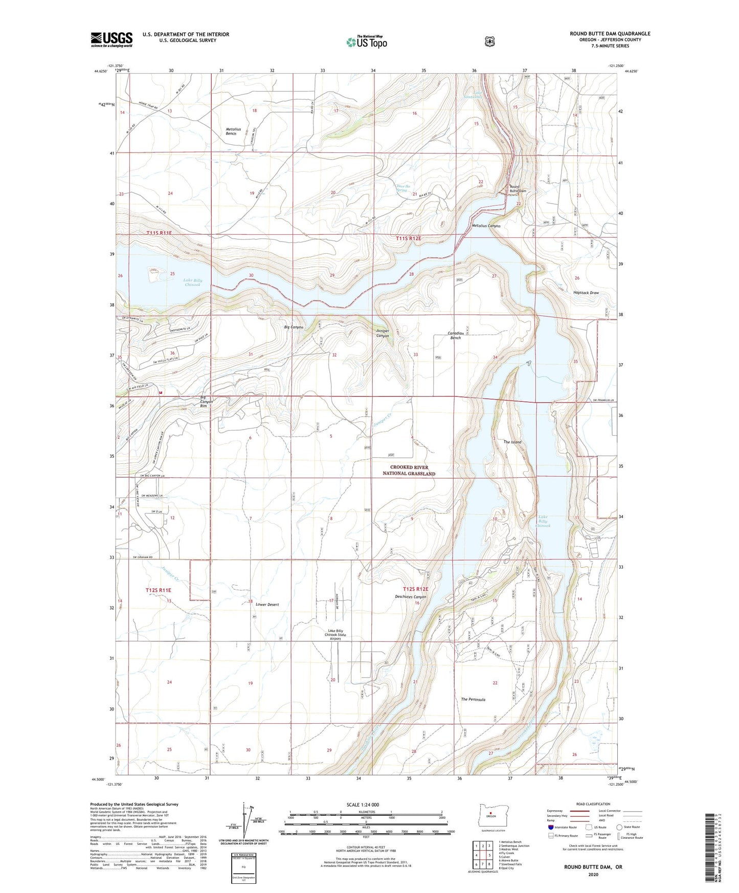
2020 topographic map quadrangle Round Butte Dam in the state of Oregon. Scale: 1:24000. Based on the newly updated USGS 7.5' US Topo map series, this map is in the following counties: Jefferson. The map contains contour data, water features, and other items you are used to seeing on USGS maps, but also has updated roads and other features. This is the next generation of topographic maps. Printed on high-quality waterproof paper with UV fade-resistant inks.
Quads adjacent to this one:
West: Fly Creek
Northwest: Metolius Bench
North: Seekseequa Junction
Northeast: Madras West
East: Culver
Southeast: Opal City
South: Steelhead Falls
Southwest: Akawa Butte
Contains the following named places: Big Canyon, Big Canyon Rim, Canadian Bench, Cove Palisades - Lower Deschutes Boat Ramp, Cove Palisades - Upper Deschutes Boat Ramp, Cove Palisades Marina, Crooked River, Crooked River Campground Boat Ramp, Crooked River Gorge, Dam Observatory, Dave Ike Spring, Deschutes Canyon, Grandview, Grandview Post Office, Haystack Draw, Juniper Canyon, Juniper Creek, Lake Billy Chinook, Lake Billy Chinook State Airport, Metolius Canyon, Metolius River, Round Butte Dam, Round Butte Heliport, The Cove Palisades Boat Ramp, The Cove Palisades State Park, The Island, Three Rivers Volunteer Fire Department, ZIP Code: 97734