MyTopo
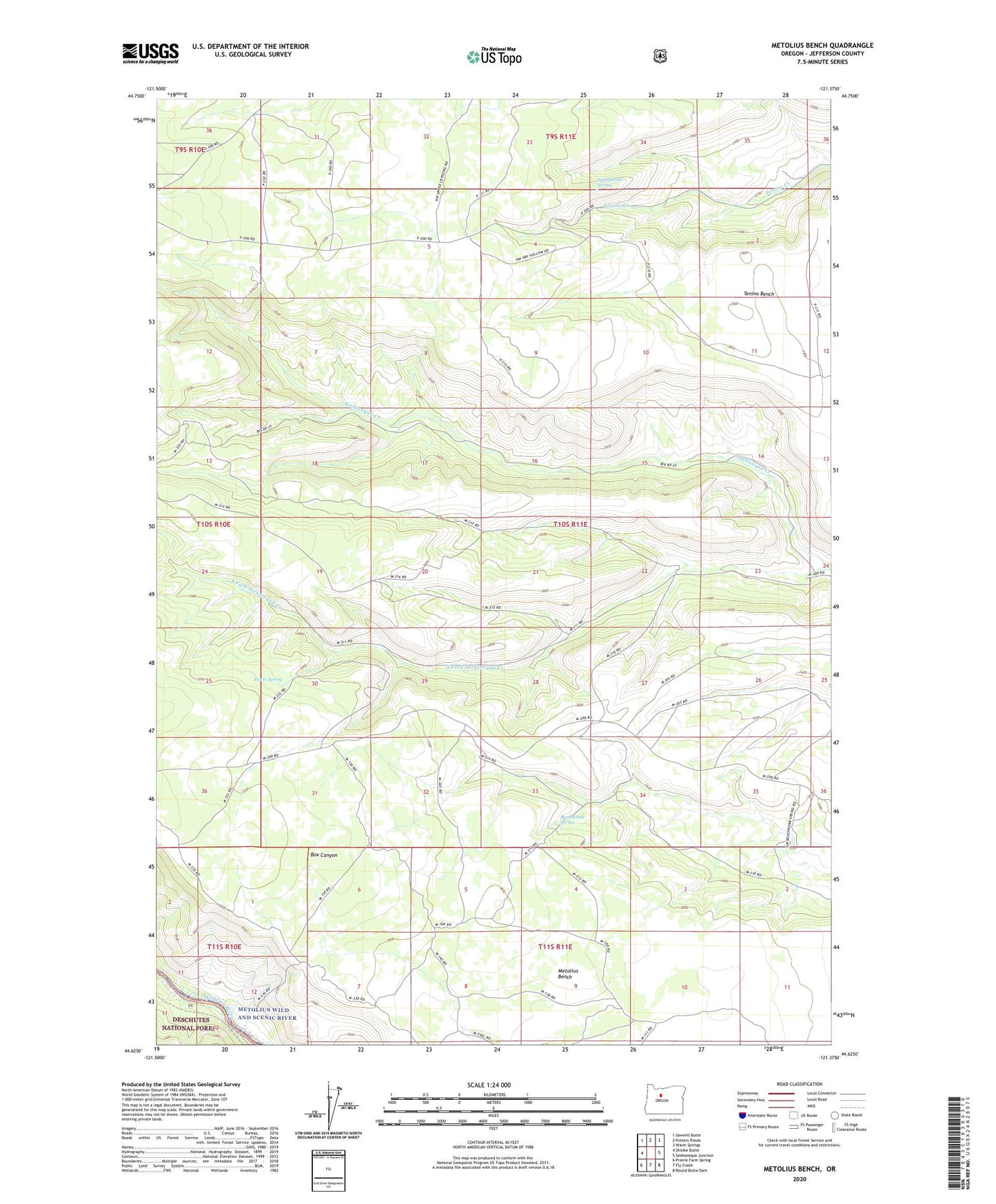
Metolius Bench Oregon US Topo Map
Couldn't load pickup availability
Also explore the Metolius Bench Forest Service Topo of this same quad for updated USFS data
2023 topographic map quadrangle Metolius Bench in the state of Oregon. Scale: 1:24000. Based on the newly updated USGS 7.5' US Topo map series, this map is in the following counties: Jefferson. The map contains contour data, water features, and other items you are used to seeing on USGS maps, but also has updated roads and other features. This is the next generation of topographic maps. Printed on high-quality waterproof paper with UV fade-resistant inks.
Quads adjacent to this one:
West: Shitike Butte
Northwest: Sawmill Butte
North: Potters Ponds
Northeast: Warm Springs
East: Seekseequa Junction
Southeast: Round Butte Dam
South: Fly Creek
Southwest: Prairie Farm Spring
This map covers the same area as the classic USGS quad with code o44121f4.
Contains the following named places: Beachkomb Spring, Bean Creek, Drift Campground, Drift Creek, Metolius Bench, Monty Recreation Site, Peters Spring, Squeeksville Spring, Warm Springs Division