MyTopo
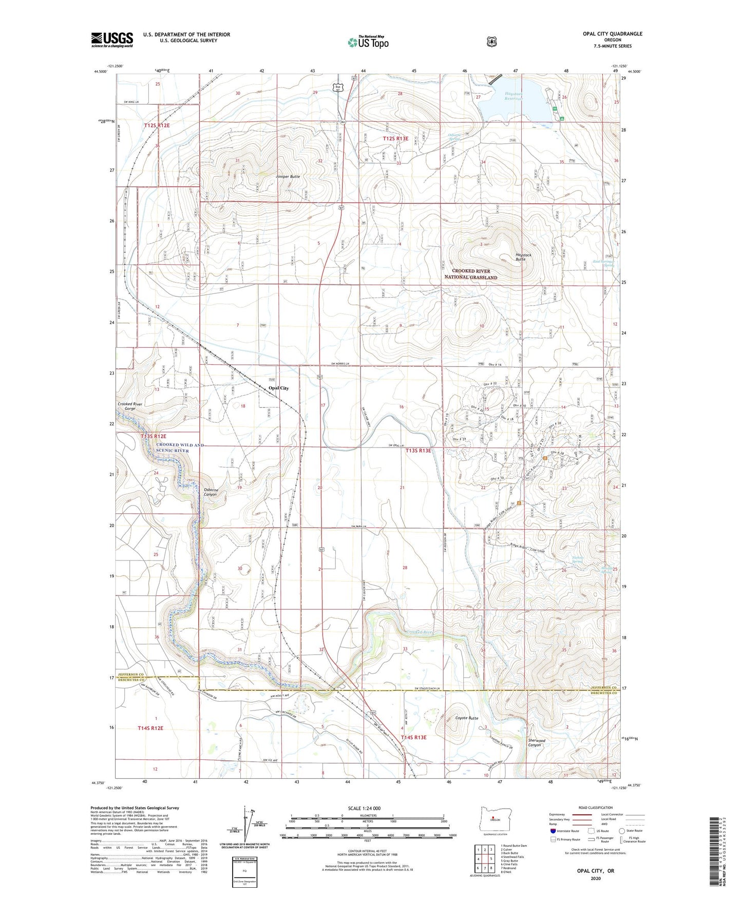
Opal City Oregon US Topo Map
Couldn't load pickup availability
Also explore the Opal City Forest Service Topo of this same quad for updated USFS data
2024 topographic map quadrangle Opal City in the state of Oregon. Scale: 1:24000. Based on the newly updated USGS 7.5' US Topo map series, this map is in the following counties: Jefferson, Deschutes. The map contains contour data, water features, and other items you are used to seeing on USGS maps, but also has updated roads and other features. This is the next generation of topographic maps. Printed on high-quality waterproof paper with UV fade-resistant inks.
Quads adjacent to this one:
West: Steelhead Falls
Northwest: Round Butte Dam
North: Culver
Northeast: Buck Butte
East: Gray Butte
South: Redmond
Southwest: Cline Falls
This map covers the same area as the classic USGS quad with code o44121d2.
Contains the following named places: Coyote Butte, Crooked River Ranch, Crooked River Ranch Post Office, Crooked Wild and Scenic River, East Springer Spring, Haystack Butte, Haystack Campground Boat Ramp, Haystack Dam, Haystack Post Office, Haystack Reservoir, Haystack Reservoir Recreation Site, Haystack West Boat Ramp, Haystack West Shore Recreation Site, Juniper Butte, Meralle Spring, Nichols Spring, Opal City, Opal City Post Office, Opal City School, Osborne Canyon, Osborne Spring, Peter Skene Ogden State Park, Sherwood Canyon, ZIP Code: 97760