MyTopo
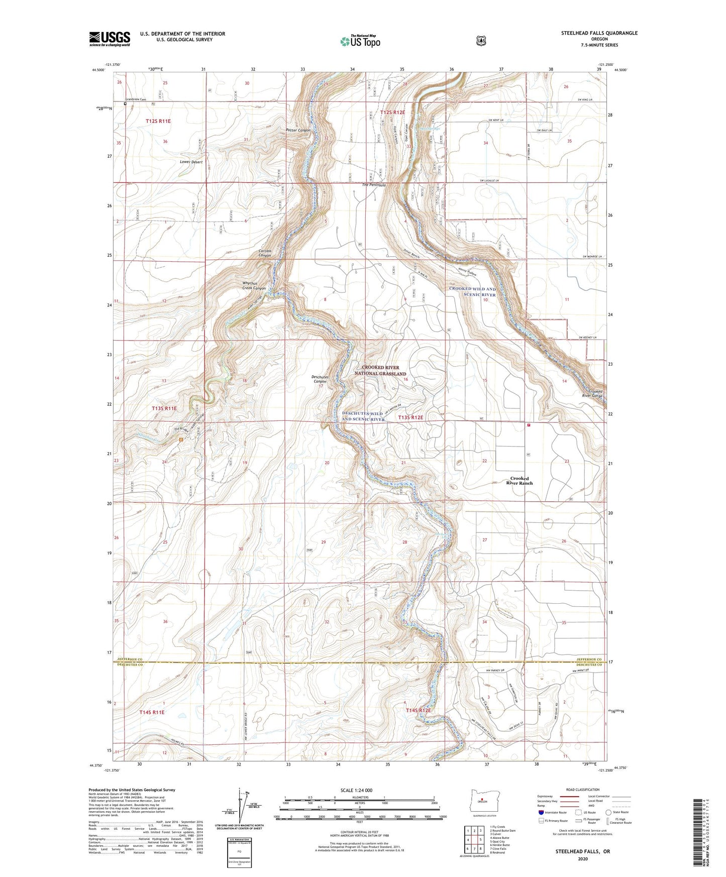
Steelhead Falls Oregon US Topo Map
Couldn't load pickup availability
Also explore the Steelhead Falls Forest Service Topo of this same quad for updated USFS data
2023 topographic map quadrangle Steelhead Falls in the state of Oregon. Scale: 1:24000. Based on the newly updated USGS 7.5' US Topo map series, this map is in the following counties: Jefferson, Deschutes. The map contains contour data, water features, and other items you are used to seeing on USGS maps, but also has updated roads and other features. This is the next generation of topographic maps. Printed on high-quality waterproof paper with UV fade-resistant inks.
Quads adjacent to this one:
West: Akawa Butte
Northwest: Fly Creek
North: Round Butte Dam
Northeast: Culver
East: Opal City
Southeast: Redmond
South: Cline Falls
Southwest: Henkle Butte
This map covers the same area as the classic USGS quad with code o44121d3.
Contains the following named places: Carcass Canyon, Crooked River Ranch Census Designated Place, Crooked River Ranch Fire District, Gates Ranch, Geneva Overlook, Grandview Cemetery, Holmes Ranch, Lower Bridge School, Opal Springs, Potter Canyon, Steelhead Falls, The Peninsula, Trahan Canyon, Whychus Creek, Whychus Creek Canyon