MyTopo
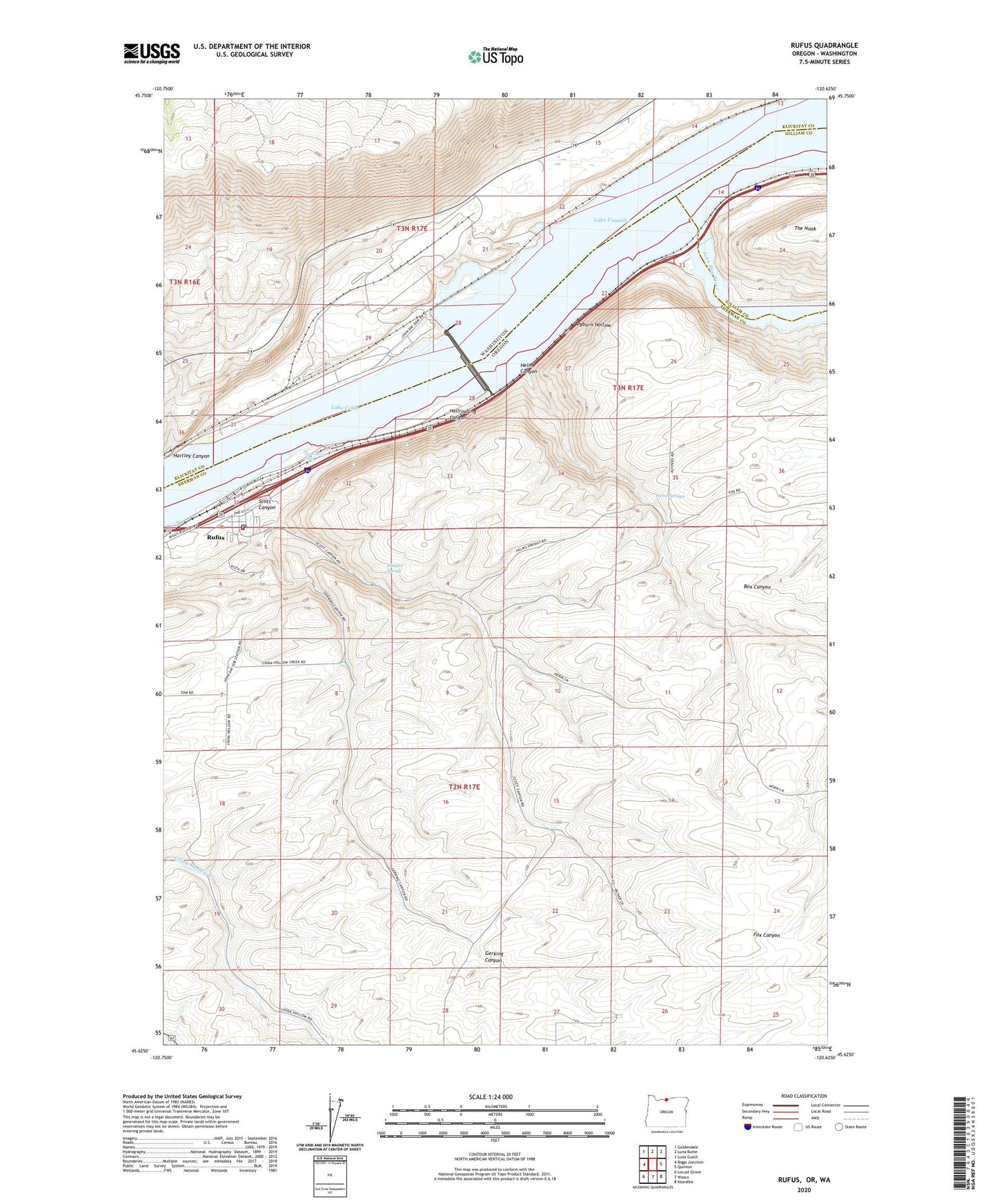
Rufus Oregon US Topo Map
Couldn't load pickup availability
2020 topographic map quadrangle Rufus in the states of Oregon, Washington. Scale: 1:24000. Based on the newly updated USGS 7.5' US Topo map series, this map is in the following counties: Sherman, Klickitat, Gilliam. The map contains contour data, water features, and other items you are used to seeing on USGS maps, but also has updated roads and other features. This is the next generation of topographic maps. Printed on high-quality waterproof paper with UV fade-resistant inks.
Quads adjacent to this one:
West: Biggs Junction
Northwest: Goldendale
North: Luna Butte
Northeast: Luna Gulch
East: Quinton
Southeast: Klondike
South: Wasco
Southwest: Locust Grove
Contains the following named places: City of Rufus, Cliffs, Day, Gerking Canyon, Giles French Park Boat Ramp, Goff, Hartley Canyon, Hellroaring Canyon, Helm Canyon, Helm Springs, John Day Dam, John Day Dam Fish Ladder, John Day River, John Day Substation, John Days, Le Page Park, Le Page Park Boat Ramp, Le Page Treaty Fishing Access Site, Le Paige Park Marina, Lower John Day Rapids, North Shore Treaty Fishing Access Site, Pioneer Spring, Preachers Eddy, Preachers Eddy Treaty Fishing Access Site, Pyburn Hollow, Rufus, Rufus City Hall, Rufus Community Center, Rufus Department of Public Works, Rufus Post Office, Rufus Sewer System, Rufus Treaty Fishing Access Site, Rufus Volunteer Fire Department and Ambulance Service, Schofield Rapids, Scott Canyon, Upper John Day Rapids