MyTopo
Goldendale Washington US Topo Map
Couldn't load pickup availability
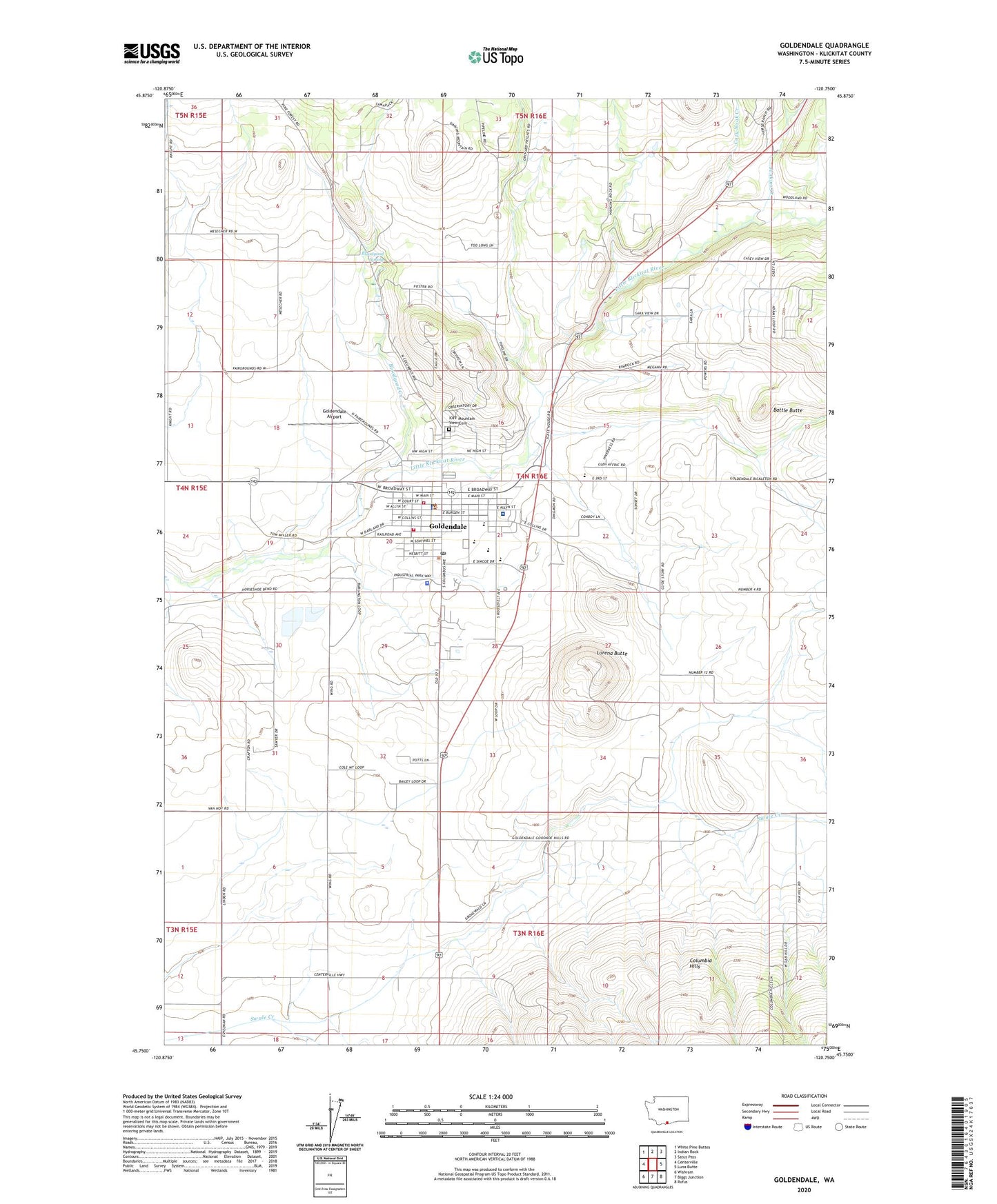
2023 topographic map quadrangle Goldendale in the state of Washington. Scale: 1:24000. Based on the newly updated USGS 7.5' US Topo map series, this map is in the following counties: Klickitat. The map contains contour data, water features, and other items you are used to seeing on USGS maps, but also has updated roads and other features. This is the next generation of topographic maps. Printed on high-quality waterproof paper with UV fade-resistant inks.
Quads adjacent to this one:
West: Centerville
Northwest: White Pine Buttes
North: Indian Rock
Northeast: Satus Pass
East: Luna Butte
Southeast: Rufus
South: Biggs Junction
Southwest: Wishram
This map covers the same area as the classic USGS quad with code o45120g7.
Contains the following named places: Amidon Ranch, Battle Butte, Bloodgood Creek, Bloodgood Spring, Broken Boulder Farm, City of Goldendale, Cozy Nook Creek, Econe Park, Goldendale, Goldendale Airport, Goldendale Astronomical Observatory, Goldendale Country Club Golf Course, Goldendale Division, Goldendale High School, Goldendale Middle School, Goldendale Police Department, Goldendale Post Office, Goldendale Primary School, IOFF Mountain View Cemetery, Jenkins Creek, KLCK-AM (Goldendale), Klickitat County, Klickitat County Fairgrounds, Klickitat County Jail, Klickitat County Rural 7 Fire and Rescue Station 1, Klickitat Valley Ambulance, Klickitat Valley Hospital, KZPC-FM (Goldendale), Lorena Butte, Van Aelst Dam, ZIP Code: 98620