MyTopo
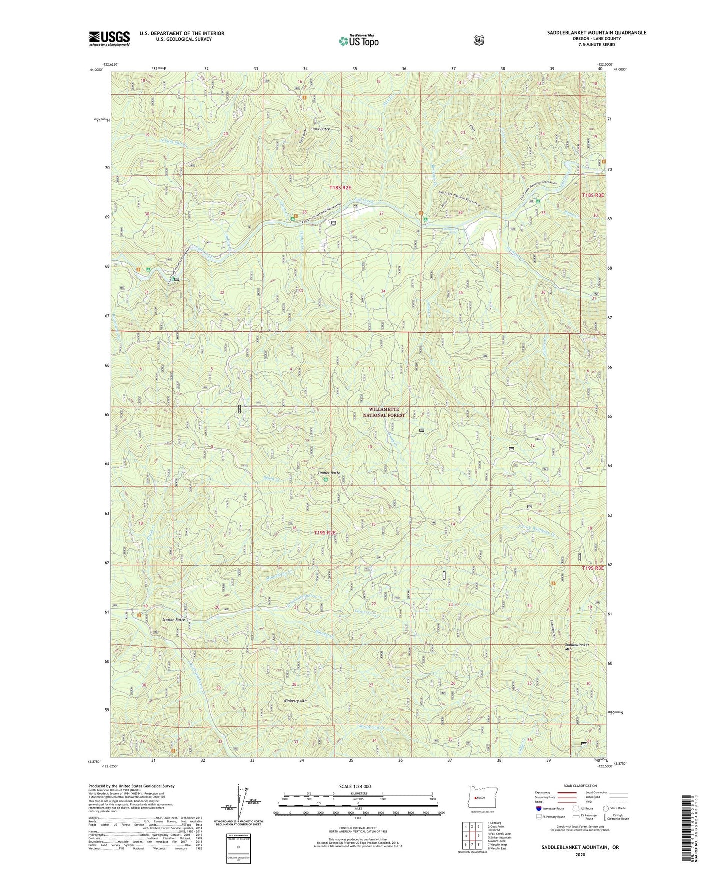
Saddleblanket Mountain Oregon US Topo Map
Couldn't load pickup availability
Also explore the Saddleblanket Mountain Forest Service Topo of this same quad for updated USFS data
2024 topographic map quadrangle Saddleblanket Mountain in the state of Oregon. Scale: 1:24000. Based on the newly updated USGS 7.5' US Topo map series, this map is in the following counties: Lane. The map contains contour data, water features, and other items you are used to seeing on USGS maps, but also has updated roads and other features. This is the next generation of topographic maps. Printed on high-quality waterproof paper with UV fade-resistant inks.
Quads adjacent to this one:
West: Fall Creek Lake
Northwest: Leaburg
North: Goat Point
Northeast: Nimrod
East: Sinker Mountain
Southeast: Westfir East
South: Westfir West
Southwest: Mount June
This map covers the same area as the classic USGS quad with code o43122h5.
Contains the following named places: Andy Creek, Bedrock Creek, Bedrock Recreation Site, Big Pool Recreation Site, Blanket Creek, Boundary Creek, Broken Bowl Recreation Site, Brush Creek, Chichester Falls, Clark Butte, Clark Creek, Clark Creek Group Camp, Dolly Varden Recreation Site, Fall Creek Guard Station, Fall Creek National Recreation Trail, Fall Creek Work Center, Indian Creek, Johnny Creek Nature Trail, Johnny Creek Recreation Site, Jones Creek, Little Blanket Shelter, Minnehaha Creek, North Fork Winberry Creek, Portland Creek, Puma Creek, Puma Creek Recreation Site, Rubble Creek, Saddleblanket Mountain, Slick Creek, South Fork Winberry Creek, Station Butte, Timber Butte, Timber Creek, Traverse Creek, Winberry Mountain, Winberry Recreation Site