MyTopo
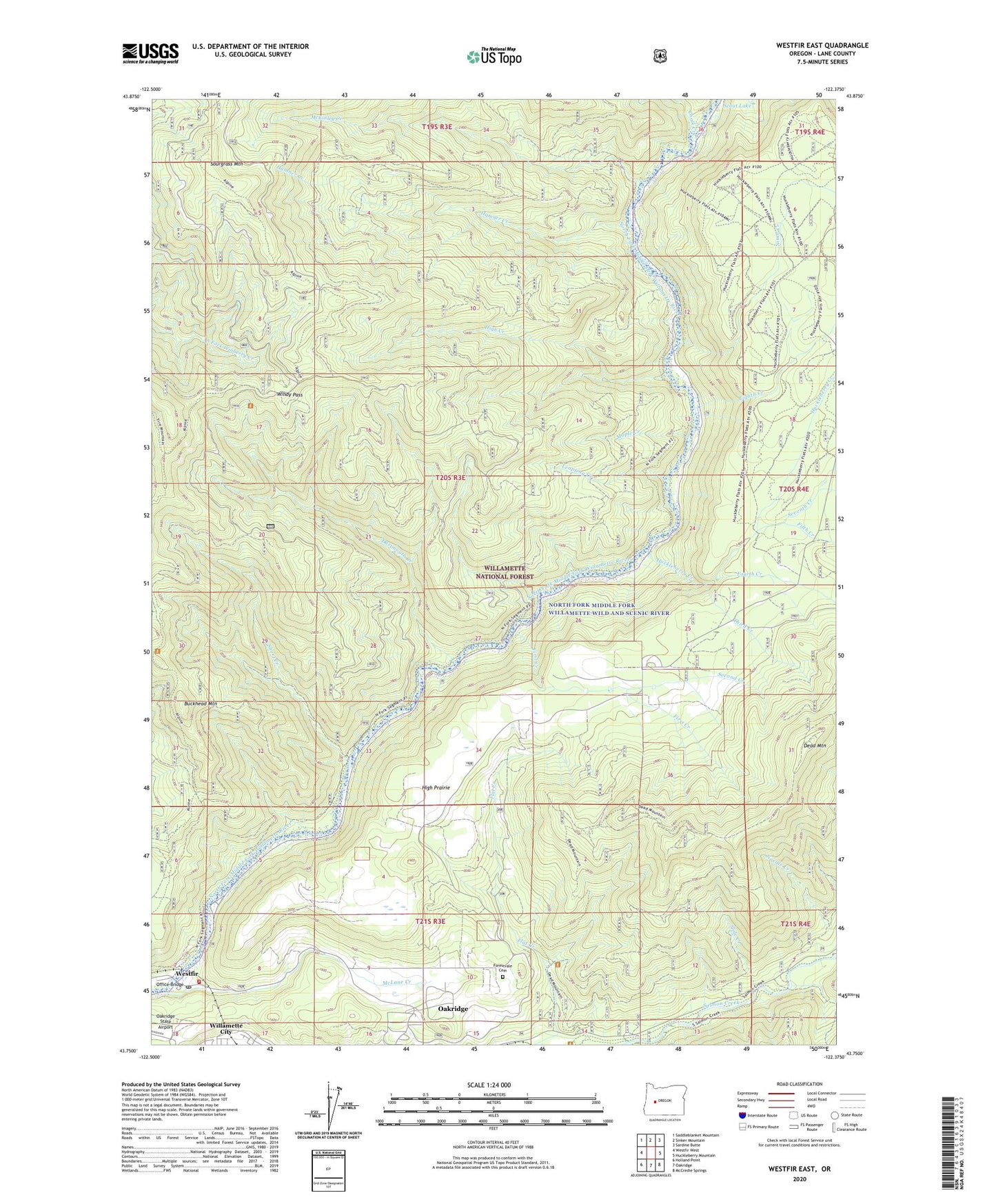
Westfir East Oregon US Topo Map
Couldn't load pickup availability
Also explore the Westfir East Forest Service Topo of this same quad for updated USFS data
2023 topographic map quadrangle Westfir East in the state of Oregon. Scale: 1:24000. Based on the newly updated USGS 7.5' US Topo map series, this map is in the following counties: Lane. The map contains contour data, water features, and other items you are used to seeing on USGS maps, but also has updated roads and other features. This is the next generation of topographic maps. Printed on high-quality waterproof paper with UV fade-resistant inks.
Quads adjacent to this one:
West: Westfir West
Northwest: Saddleblanket Mountain
North: Sinker Mountain
Northeast: Sardine Butte
East: Huckleberry Mountain
Southeast: McCredie Springs
South: Oakridge
Southwest: Holland Point
This map covers the same area as the classic USGS quad with code o43122g4.
Contains the following named places: Alpine Trail, Big Prairie Post Office, Buckhead Mountain, Cain Cabin Trail, Camp Six, Catching Reservoir, Chalk Creek, Circle Bar Golf Club, Dam Number One, Dartmouth Creek, Davis Weber Lumber Company, Dead Mountain, Eighth Creek, Fifth Creek, First Creek, Flat Creek Work Station, Forestvale Cemetery, Fourth Creek, Hamner Creek, Hamner Creek Way, High Creek, High Prairie, Huckleberry Creek, Leapfrog Creek, Maple Creek, McKinley Creek, McLane Creek, Ninth Creek, Oakridge State Airport, Office Bridge, Salal Creek, Scout Lake, Second Creek, Seventh Creek, Short Creek, Sixth Creek, Slide Creek, Sourgrass Mountain, Third Creek, Tunnel, Westfir, Westfir City Hall, Westfir Fire Department, Westfir Post Office, Westfir Water Treatment, Windy Pass