MyTopo
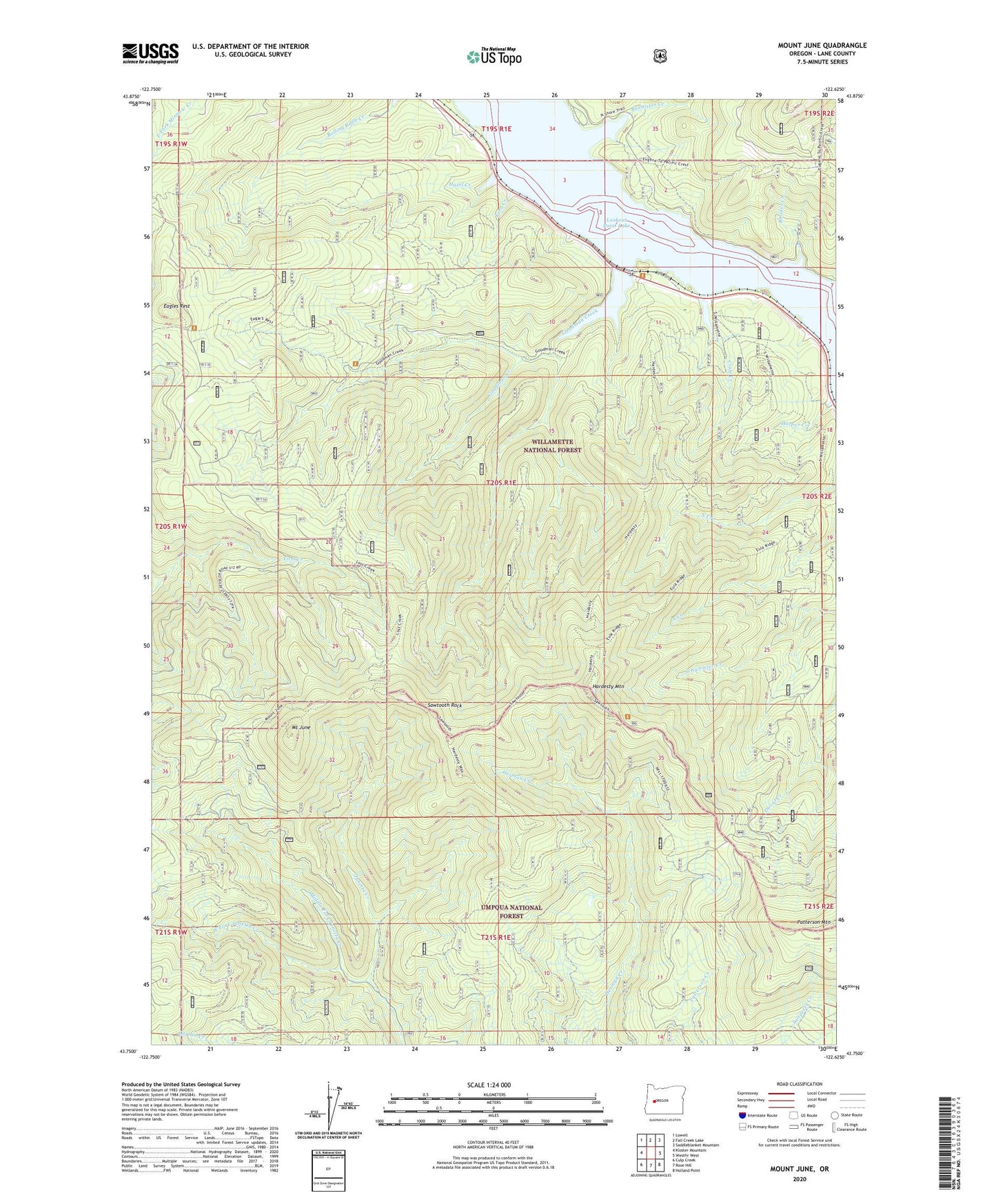
Mount June Oregon US Topo Map
Couldn't load pickup availability
Also explore the Mount June Forest Service Topo of this same quad for updated USFS data
2024 topographic map quadrangle Mount June in the state of Oregon. Scale: 1:24000. Based on the newly updated USGS 7.5' US Topo map series, this map is in the following counties: Lane. The map contains contour data, water features, and other items you are used to seeing on USGS maps, but also has updated roads and other features. This is the next generation of topographic maps. Printed on high-quality waterproof paper with UV fade-resistant inks.
Quads adjacent to this one:
West: Kloster Mountain
Northwest: Lowell
North: Fall Creek Lake
Northeast: Saddleblanket Mountain
East: Westfir West
Southeast: Holland Point
South: Rose Hill
Southwest: Culp Creek
This map covers the same area as the classic USGS quad with code o43122g6.
Contains the following named places: Ash Swale Shelter, Bannister Creek, Coon Creek, Crale, Crale Creek, Eagles Rest, Eagles Rest Trail, Fern Creek, Goodman Creek, Hardesty Lookout Tower, Hardesty Mountain, Hardesty Trail, Hazel Creek, Ivan Oakes Park, Ivan Oaks Boat Ramp, Lookout Point Lake, Middle Fork Junetta Creek, Mount June, Patterson Mountain, Reserve, Rhodes Creek, Sawtooth Rock, Signal Point Recreation Area, West Fork Junetta Creek