
MyTopo
Sand Hollow Oregon US Topo Map
Couldn't load pickup availability
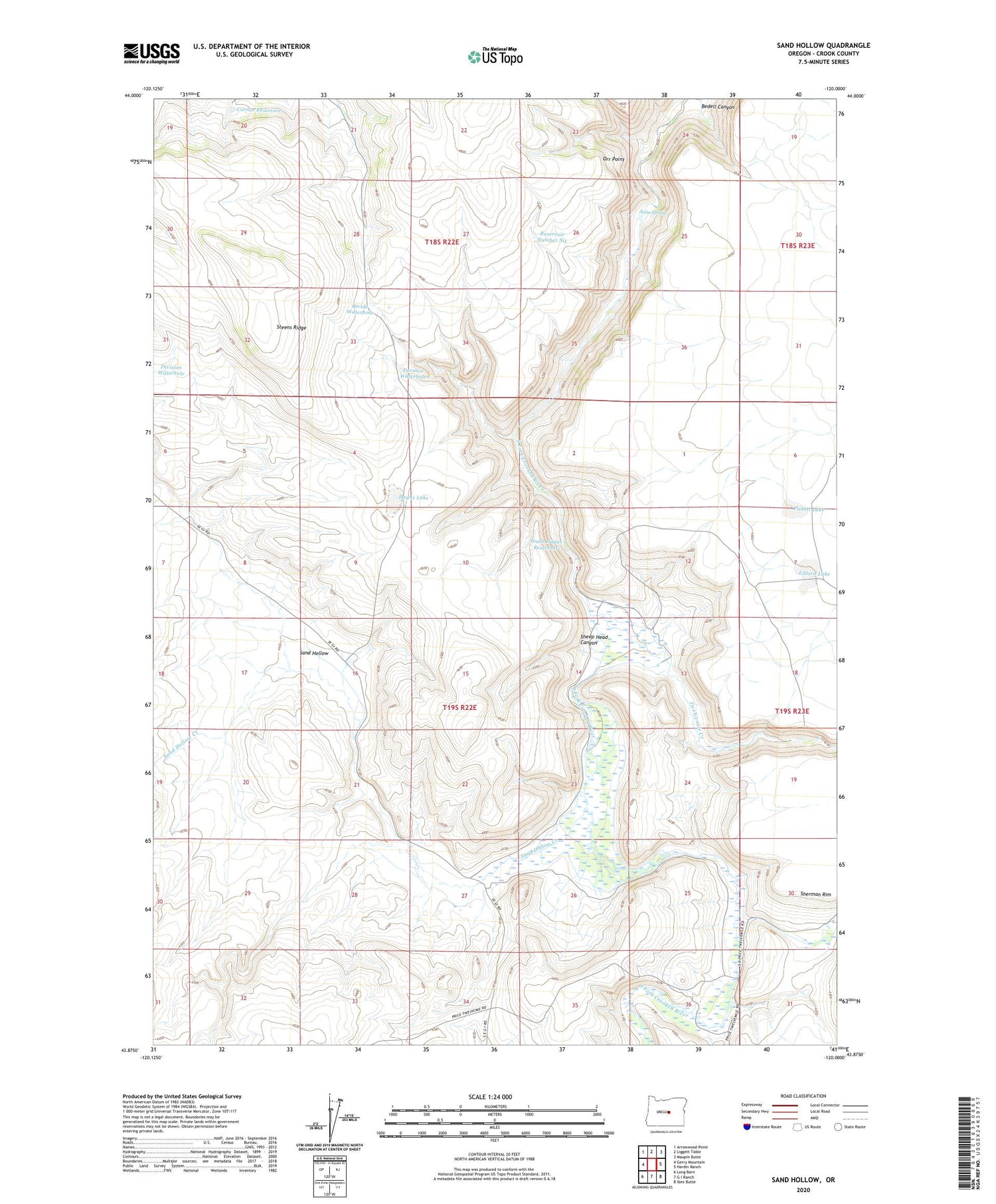
2020 topographic map quadrangle Sand Hollow in the state of Oregon. Scale: 1:24000. Based on the newly updated USGS 7.5' US Topo map series, this map is in the following counties: Crook. The map contains contour data, water features, and other items you are used to seeing on USGS maps, but also has updated roads and other features. This is the next generation of topographic maps. Printed on high-quality waterproof paper with UV fade-resistant inks.
Quads adjacent to this one:
West: Gerry Mountain
Northwest: Arrowwood Point
North: Liggett Table
Northeast: Maupin Butte
East: Hardin Ranch
Southeast: Ibex Butte
South: G I Ranch
Southwest: Long Barn
Contains the following named places: Bedell Canyon, Coffelt Ranch, Cold Spring Ranch, Coldspring Post Office, Corner Reservoir, Dagus Lake, Divide Waterhole, Division Waterhole, Furnace Waterhole, Hackleman Ranch, Lillard Lake, Lower Sherman Ranch, Orr Point, Pickett Lake, Reservoir Number Six, Sand Hollow, Sand Hollow Creek, Sand Hollow Well, Sheep Head Canyon, Soda Spring, South Dagus Reservoir, Steens Ridge, Twelvemile Creek


