MyTopo
Scotty Creek Oregon US Topo Map
Couldn't load pickup availability
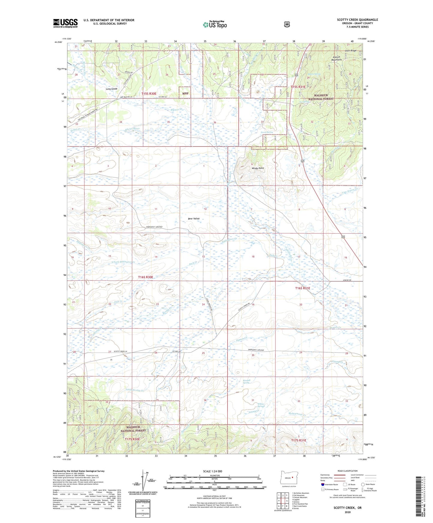
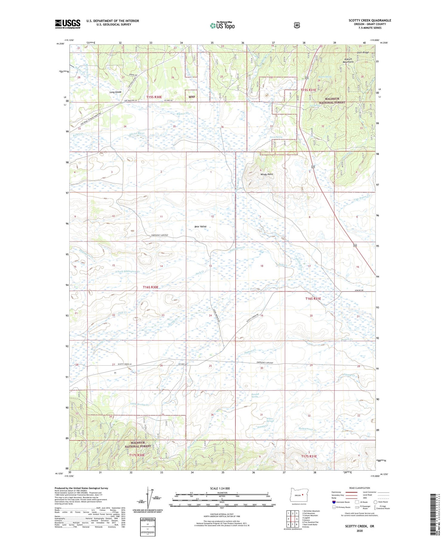
2020 topographic map quadrangle Scotty Creek in the state of Oregon. Scale: 1:24000. Based on the newly updated USGS 7.5' US Topo map series, this map is in the following counties: Grant. The map contains contour data, water features, and other items you are used to seeing on USGS maps, but also has updated roads and other features. This is the next generation of topographic maps. Printed on high-quality waterproof paper with UV fade-resistant inks.
Quads adjacent to this one:
West: Logdell
Northwest: McClellan Mountain
North: Fall Mountain
Northeast: Canyon Mountain
East: Seneca
Southeast: Silvies
South: Rail Creek Butte
Southwest: Five Hundred Flat
Contains the following named places: Allen Creek, Bear Valley, Blanton Post Office, Camp Creek, Cerny Airport, Damon Creek, Eddington Creek, Ferris Spring, Geary Creek, Holliday Ranch, Homer Post Office, Jack Creek, Jenkins Creek, Keller Creek, Klink Reservoir, Little Scotty Creek, Long Glade, Lowe Ranch, Mason Spring, Mothers Creek, Ninety-Six Ranch, Randall Spring, S-2 Spring, Scotty Creek, Seneca Cow Camp, South Fork Eddington Creek, Starr Creek, Swick Creek, Van Aspen Creek, Willow Springs, Windfall Creek, Windy Point, Wymer Creek, ZIP Code: 97873