MyTopo
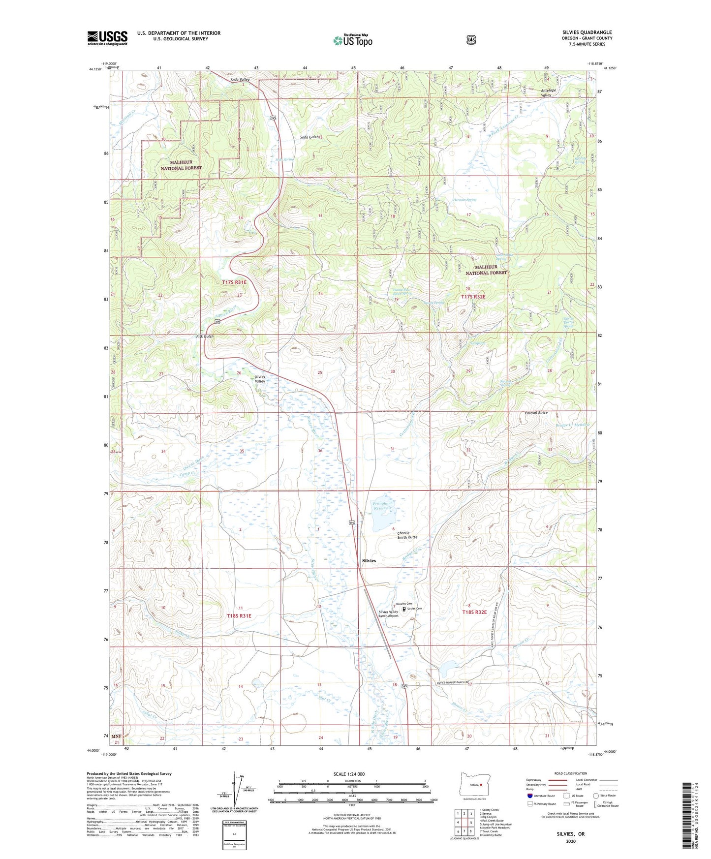
Silvies Oregon US Topo Map
Couldn't load pickup availability
Also explore the Silvies Forest Service Topo of this same quad for updated USFS data
2024 topographic map quadrangle Silvies in the state of Oregon. Scale: 1:24000. Based on the newly updated USGS 7.5' US Topo map series, this map is in the following counties: Grant. The map contains contour data, water features, and other items you are used to seeing on USGS maps, but also has updated roads and other features. This is the next generation of topographic maps. Printed on high-quality waterproof paper with UV fade-resistant inks.
Quads adjacent to this one:
West: Rail Creek Butte
Northwest: Scotty Creek
North: Seneca
Northeast: Big Canyon
East: Jump-off Joe Mountain
Southeast: Calamity Butte
South: Trout Creek
Southwest: Myrtle Park Meadows
This map covers the same area as the classic USGS quad with code o44118a8.
Contains the following named places: Antelope Valley, Bennett Dam, Bill Pete Spring, Bridge Creek, Camp Creek, Charlie Smith Butte, Cottonwood Creek, Fisk Gulch, Flat Creek, Funny Bug Basin Spring, Hankins Cemetery, Hankins Ranch, Herman Spring, House Creek, Jack Andy Creek, Jump Creek, Lake Pons Dam, Owens Ditch, Parasol Butte, Poison Creek, Pronghorn Reservoir, Rann Post Office, S S Spring, Scotty Spring, Silvies, Silvies Cemetery, Silvies Landing, Silvies Post Office, Silvies Valley Ranch, Silvies Valley Ranch Airport, Soda Gulch, Soda Smith Spring, Soda Spring, Soda Valley, Stevens Spring, Thirty-Thirty Spring