MyTopo
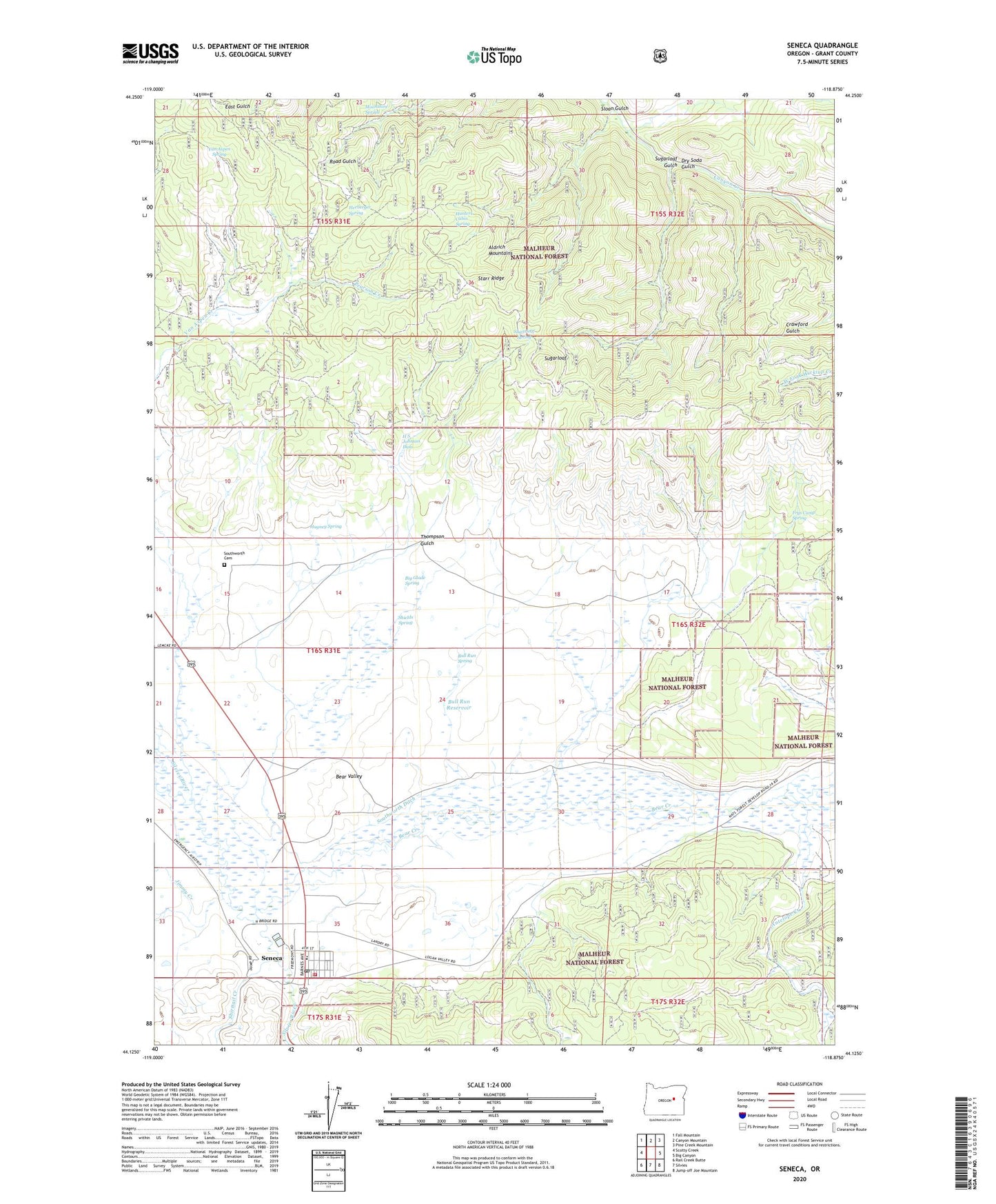
Seneca Oregon US Topo Map
Couldn't load pickup availability
Also explore the Seneca Forest Service Topo of this same quad for updated USFS data
2024 topographic map quadrangle Seneca in the state of Oregon. Scale: 1:24000. Based on the newly updated USGS 7.5' US Topo map series, this map is in the following counties: Grant. The map contains contour data, water features, and other items you are used to seeing on USGS maps, but also has updated roads and other features. This is the next generation of topographic maps. Printed on high-quality waterproof paper with UV fade-resistant inks.
Quads adjacent to this one:
West: Scotty Creek
Northwest: Fall Mountain
North: Canyon Mountain
Northeast: Pine Creek Mountain
East: Big Canyon
Southeast: Jump-off Joe Mountain
South: Silvies
Southwest: Rail Creek Butte
This map covers the same area as the classic USGS quad with code o44118b8.
Contains the following named places: Antelope Creek, Bear Creek, Big Glade Spring, Biggs Ranch, Bull Run Reservoir, Bull Run Spring, City of Seneca, Dry Soda Gulch, Dry Soda Lookout, East Fork Canyon Creek, Frys Camp Spring, H S Johnson Dam, H S Johnson Reservoir, Hagney Spring, Herberger Spring, Honeymoon Creek, Hunters Cabin Spring, Jimmy Creek, Moonshine Spring, Oliver Ranch, Pearson Creek, Rex Reservoir, Seneca, Seneca City Hall, Seneca Elementary School, Seneca Emergency Airstrip, Seneca Post Office, Seneca Public Works Department Office, Seneca Substation, Seneca Volunteer Fire Department, Seneca Wastewater Treatment Lagoon, Seneca Well, Shields Spring, Shirttail Creek, Sloan Gulch, South Fork Antelope Creek, Southworth Cemetery, Southworth Ditch, Southworth Ranch, Starr Ridge, Sugarloaf, Sugarloaf Gulch, Sugarloaf Spring, Thompson Gulch, Van Aspen Spring, Yeoville Post Office