MyTopo
Siskiyou Pass Oregon US Topo Map
Couldn't load pickup availability
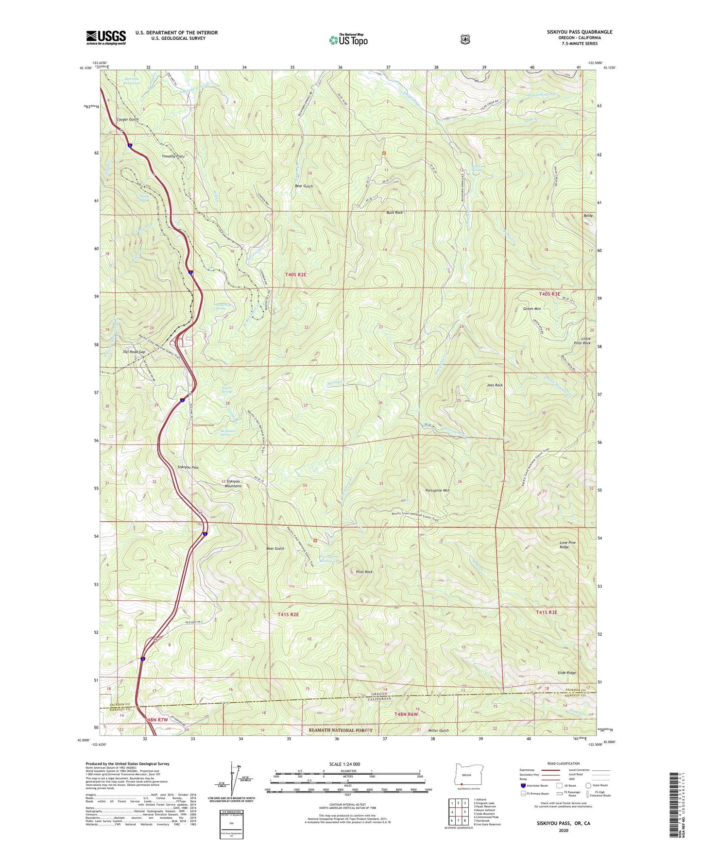
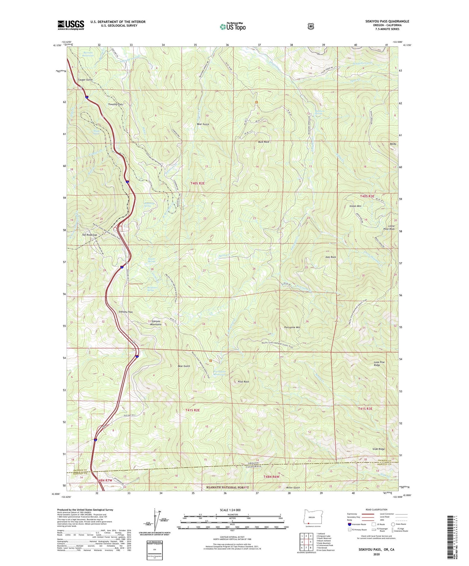
2020 topographic map quadrangle Siskiyou Pass in the state of Oregon. Scale: 1:24000. Based on the newly updated USGS 7.5' US Topo map series, this map is in the following counties: Jackson, Siskiyou. The map contains contour data, water features, and other items you are used to seeing on USGS maps, but also has updated roads and other features. This is the next generation of topographic maps. Printed on high-quality waterproof paper with UV fade-resistant inks.
Quads adjacent to this one:
West: Mount Ashland
Northwest: Ashland
North: Emigrant Lake
Northeast: Hyatt Reservoir
East: Soda Mountain
Southeast: Iron Gate Reservoir
South: Hornbrook
Southwest: Cottonwood Peak
Contains the following named places: Baldy, Baldy Creek, Barrats Reservoir, Bean Cabin, Bear Gulch, Buck Rock, Buck Rock Tunnel, Buckhorn Springs, Callahans Mountain Lodge Wastewater Treatment Facility, Cougar Gulch, Dollarhide, Dollarhide Curve, Dollarhide Spring, Foliage, Green Mountain, Green Mountain Creek, Green Springs Powerplant, Joes Rock, Little Pilot Rock, McAllister Spring, North Fork Barron Creek, Pilot Rock, Porcupine Creek, Porcupine Mountain, Porcupine Reservoir, Powder Springs, Resort Post Office, Schoolhouse Creek, Shady Spring, Siskiyou, Siskiyou Pass, Siskiyou Post Office, Slide Creek, Slide Ridge, Soda Spring, Soda Springs Post Office, South Fork Barron Creek, Spring Creek, Steinman, Steinman Creek, Steinman Post Office, Timothy Flats, Toll Road Gap, Tyler Creek, Viaduct, Viaduct Creek, Wall Creek, West Branch Carter Creek