MyTopo
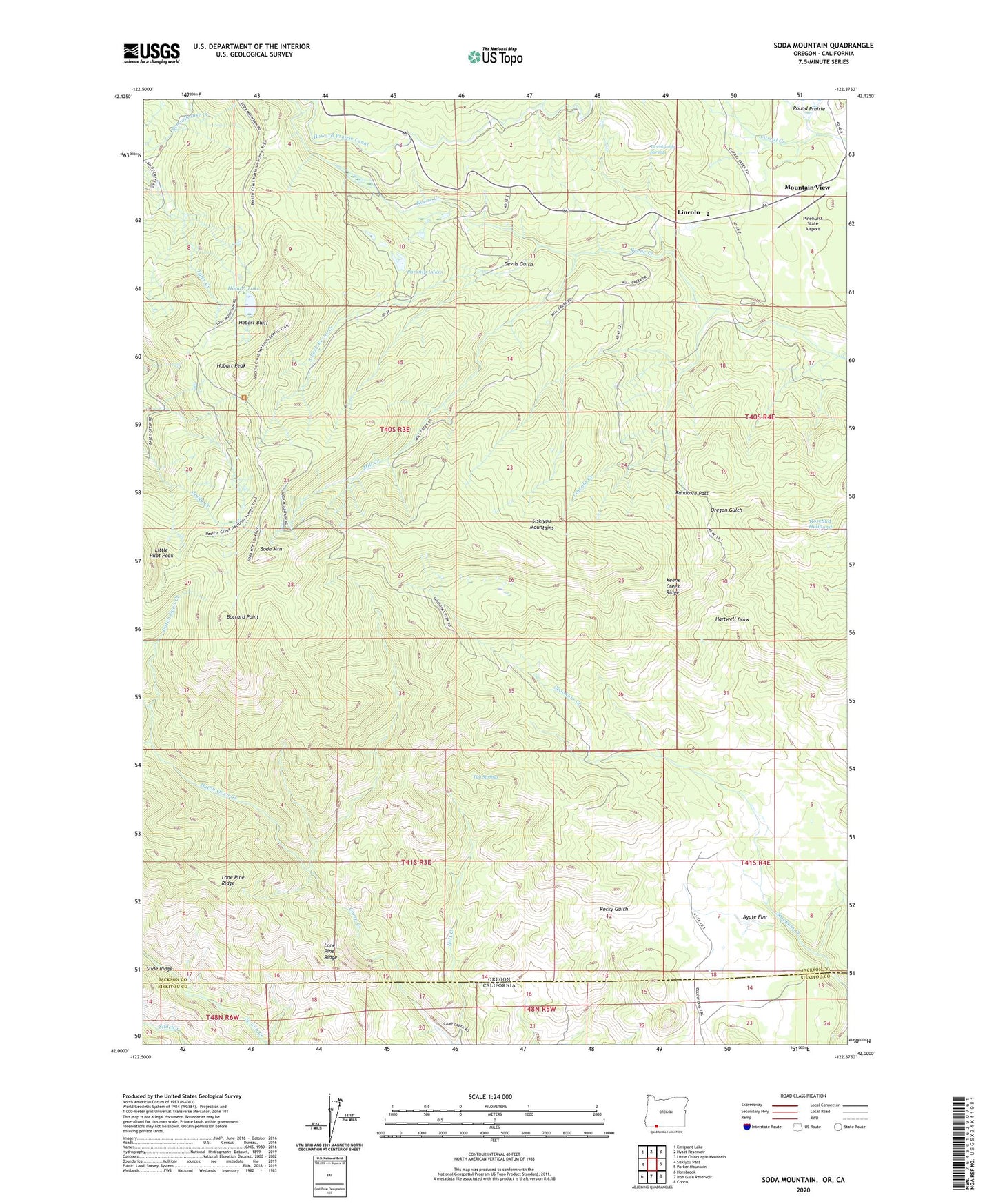
Soda Mountain Oregon US Topo Map
Couldn't load pickup availability
Also explore the Soda Mountain Forest Service Topo of this same quad for updated USFS data
2023 topographic map quadrangle Soda Mountain in the state of Oregon. Scale: 1:24000. Based on the newly updated USGS 7.5' US Topo map series, this map is in the following counties: Jackson, Siskiyou. The map contains contour data, water features, and other items you are used to seeing on USGS maps, but also has updated roads and other features. This is the next generation of topographic maps. Printed on high-quality waterproof paper with UV fade-resistant inks.
Quads adjacent to this one:
West: Siskiyou Pass
Northwest: Emigrant Lake
North: Hyatt Reservoir
Northeast: Little Chinquapin Mountain
East: Parker Mountain
Southeast: Copco
South: Iron Gate Reservoir
Southwest: Hornbrook
This map covers the same area as the classic USGS quad with code o42122a4.
Contains the following named places: Agate Flat, Boccard Point, Cabin Sixty-nine, Devils Gulch, Dutch Oven Creek, Hobart Bluff, Hobart Lake, Hobart Peak, Keene Creek Ridge, Lincoln, Lincoln Creek, Little Pilot Peak, Lone Pine Ridge, Mill Creek, Mountain View, Parsnip Lakes, Pinehurst State Airport, Randcore Pass, Rosebud Helipond, Round Prairie, Schoolhouse Ranch, Soda Mountain, Soda Mountain Wilderness, South Fork Keene Creek, Tub Springs, Tubb Springs State Wayside, Twentymile Springs