MyTopo
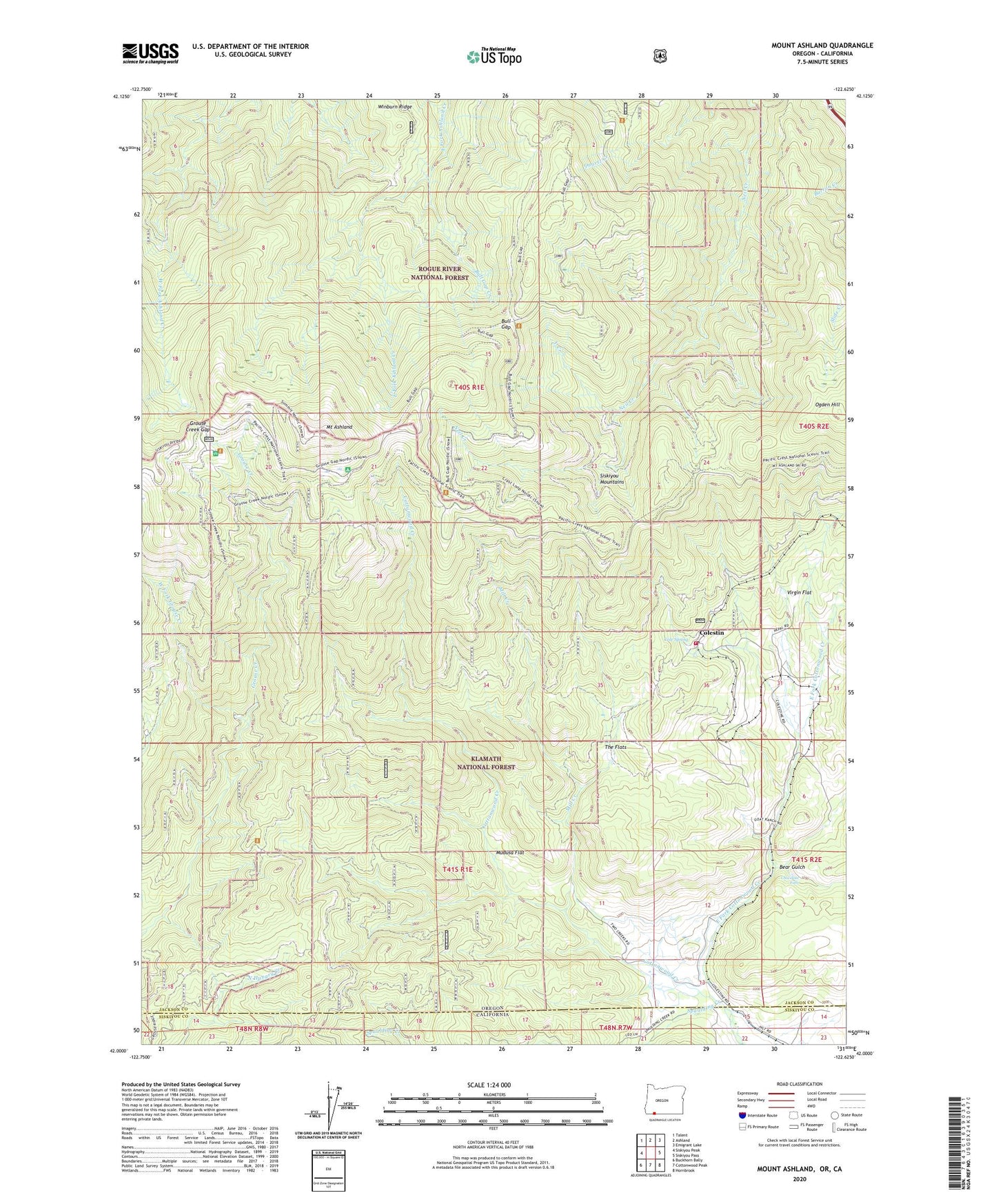
Mount Ashland Oregon US Topo Map
Couldn't load pickup availability
Also explore the Mount Ashland Forest Service Topo of this same quad for updated USFS data
2023 topographic map quadrangle Mount Ashland in the states of Oregon, California. Scale: 1:24000. Based on the newly updated USGS 7.5' US Topo map series, this map is in the following counties: Jackson, Siskiyou. The map contains contour data, water features, and other items you are used to seeing on USGS maps, but also has updated roads and other features. This is the next generation of topographic maps. Printed on high-quality waterproof paper with UV fade-resistant inks.
Quads adjacent to this one:
West: Siskiyou Peak
Northwest: Talent
North: Ashland
Northeast: Emigrant Lake
East: Siskiyou Pass
Southeast: Hornbrook
South: Cottonwood Peak
Southwest: Buckhorn Bally
This map covers the same area as the classic USGS quad with code o42122a6.
Contains the following named places: Bear Gulch, Bull Gap, Bull Gap Campground, Bull Gap Creek, Chocolate Falls, Cole, Cole Spring, Colestin, Colestin Post Office, Colestin Rural Fire Protection District, Deter Post Office, East Fork Cottonwood Creek, Fonda, Four Corners, Gregory, Gregory Loop, Grouse Creek Gap, Grouse Gap Shelter, KTMT-FM, KTVL-TV, Mill Creek, Mill Creek Plantation, Mount Ashland, Mount Ashland Recreation Site, Mount Ashland Ski Area, Mount Ashland Trail, Mudusa Flat, Ogden Hill, Orcal, Spaulding Creek, The Flats, Three Corners, Trail Camp, Virgin Flat, West Fork Grouse Creek, White Point, Y Creek