MyTopo
Steamboat Point Oregon US Topo Map
Couldn't load pickup availability
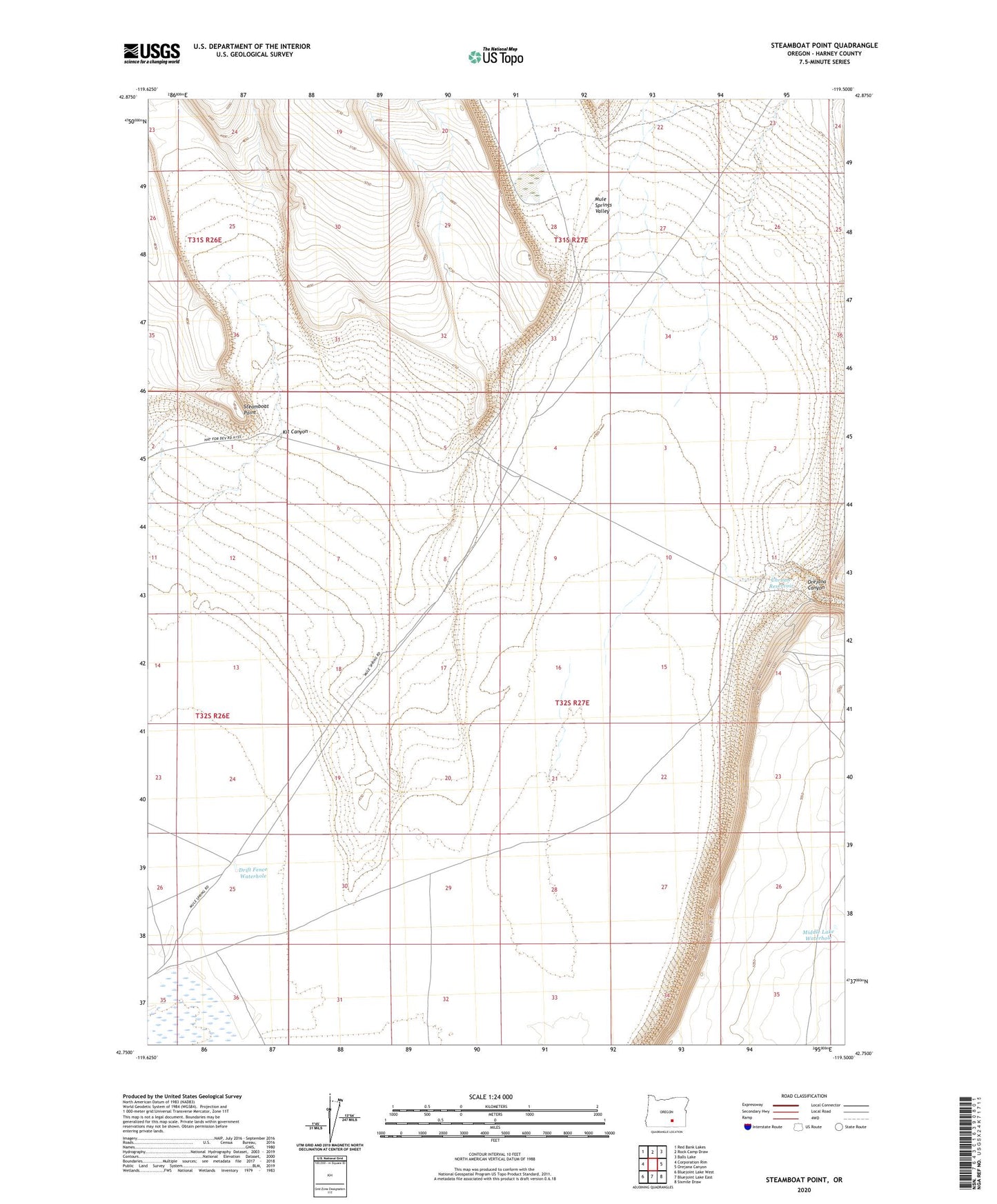
2023 topographic map quadrangle Steamboat Point in the state of Oregon. Scale: 1:24000. Based on the newly updated USGS 7.5' US Topo map series, this map is in the following counties: Harney. The map contains contour data, water features, and other items you are used to seeing on USGS maps, but also has updated roads and other features. This is the next generation of topographic maps. Printed on high-quality waterproof paper with UV fade-resistant inks.
Quads adjacent to this one:
West: Corporation Rim
Northwest: Red Bank Lakes
North: Rock Camp Draw
Northeast: Balls Lake
East: Orejana Canyon
Southeast: Sixmile Draw
South: Bluejoint Lake East
Southwest: Bluejoint Lake West
This map covers the same area as the classic USGS quad with code o42119g5.
Contains the following named places: Chrome Reservoir, Drift Fence Waterhole, Kit Canyon, Middle Lake Waterhole, Orejana Canyon, Steamboat Point