MyTopo
Rock Camp Draw Oregon US Topo Map
Couldn't load pickup availability
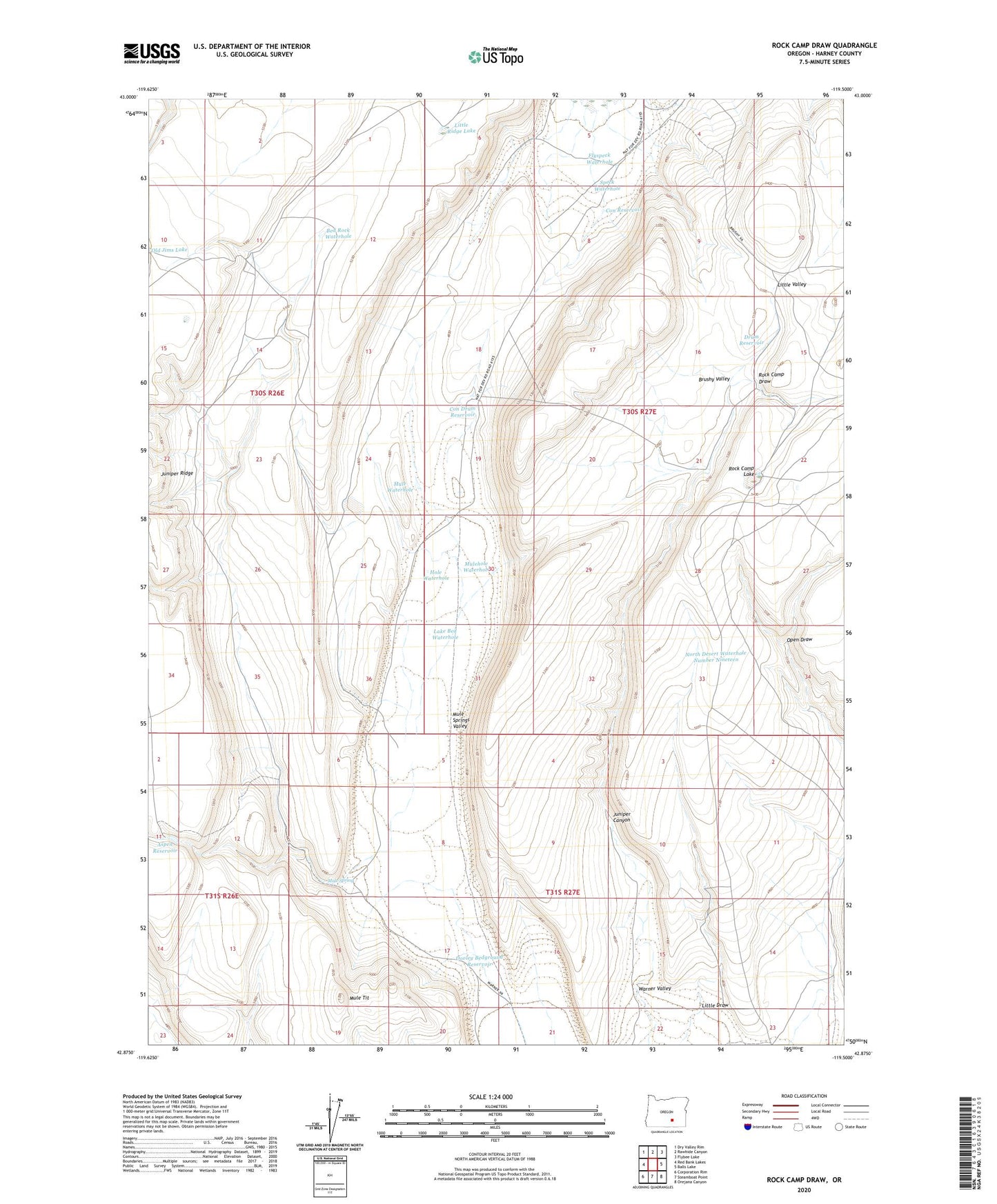
2024 topographic map quadrangle Rock Camp Draw in the state of Oregon. Scale: 1:24000. Based on the newly updated USGS 7.5' US Topo map series, this map is in the following counties: Harney. The map contains contour data, water features, and other items you are used to seeing on USGS maps, but also has updated roads and other features. This is the next generation of topographic maps. Printed on high-quality waterproof paper with UV fade-resistant inks.
Quads adjacent to this one:
West: Red Bank Lakes
Northwest: Dry Valley Rim
North: Rawhide Canyon
Northeast: Flybee Lake
East: Balls Lake
Southeast: Orejana Canyon
South: Steamboat Point
Southwest: Corporation Rim
This map covers the same area as the classic USGS quad with code o42119h5.
Contains the following named places: Anderson Cabin, Aspen Reservoir, Bed Rock Waterhole, Brushy Valley, Con Drum Reservoir, Con Reservoir, Dooley Bedground Reservoir, Drum Reservoir, Flyspeck Waterhole, Hemmy Cabin, Hole Waterhole, Juniper Canyon, Juniper Ridge, Lake Bed Waterhole, Little Draw, Little Ridge Lake, Monahan Lake, Mule Spring, Mule Spring Reservoir, Mule Springs Valley, Mule Tit, Mule Waterhole, Mulehole Waterhole, North Desert Waterhole Number Nineteen, North Desert Waterhole Number Thirty-Two, Old Jims Lake, Open Draw, Rock Camp Draw, Rock Camp Lake, Speck Waterhole