MyTopo
Strawberry Mountain Oregon US Topo Map
Couldn't load pickup availability
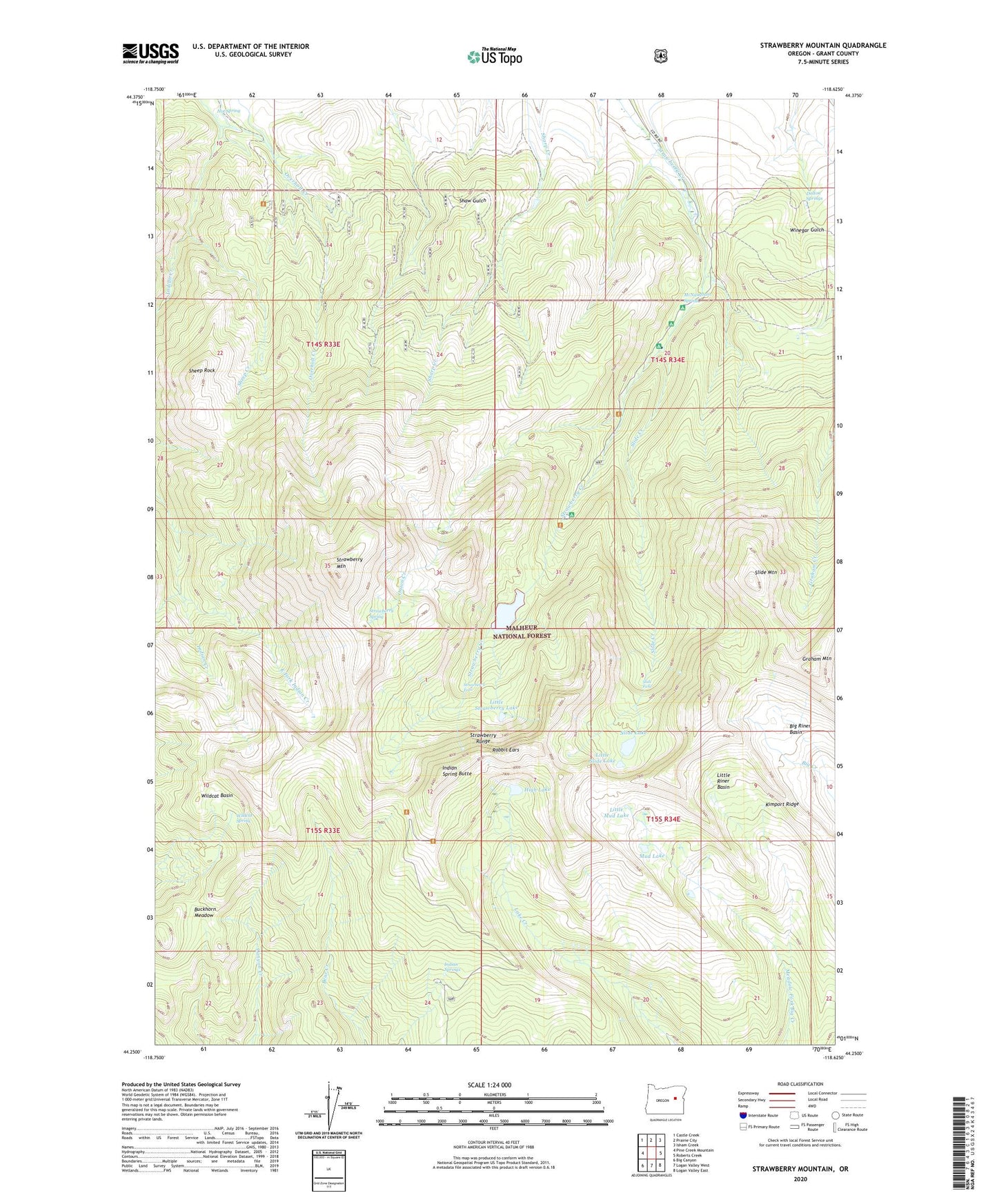
2020 topographic map quadrangle Strawberry Mountain in the state of Oregon. Scale: 1:24000. Based on the newly updated USGS 7.5' US Topo map series, this map is in the following counties: Grant. The map contains contour data, water features, and other items you are used to seeing on USGS maps, but also has updated roads and other features. This is the next generation of topographic maps. Printed on high-quality waterproof paper with UV fade-resistant inks.
Quads adjacent to this one:
West: Pine Creek Mountain
Northwest: Castle Creek
North: Prairie City
Northeast: Isham Creek
East: Roberts Creek
Southeast: Logan Valley East
South: Logan Valley West
Southwest: Big Canyon
Contains the following named places: Big Riner Basin, Buckhorn Meadow, Buckhorn Meadows Trail, Canyon Creek Trail, Dalton Springs, East Fork Indian Creek, Graham Mountain, High Lake, High Lake Rim Recreation Site, High Lake Rim Trailhead, Hot Spring, Indian Creek Trail, Indian Spring Butte, Indian Springs, Indian Springs Campground, Kimport Ridge, Little Mud Lake, Little Riner Basin, Little Slide Lake, Little Strawberry Lake, Marks-Thompson Mine, McNaughton Spring, McNaughton Spring Recreation Site, Meadow Fork Trail, Mud Lake, Mud Lake Trail, Onion Creek, Onion Creek Trail, Overholt Creek, Pine Creek Trail, Rabbit Ears, Roads End Camp, Roads End Trailhead, Sheep Creek, Sheep Rock, Slide Basin Trail, Slide Creek, Slide Creek Recreation Site, Slide Falls, Slide Lake, Slide Mountain, Strawberry Basin Trail, Strawberry Falls, Strawberry Lake, Strawberry Lake Camp, Strawberry Mountain, Strawberry Range, Strawberry Recreation Site, Strawberry Spring, Twin Springs Trail, Wildcat Basin, Wildcat Spring