MyTopo
Logan Valley East Oregon US Topo Map
Couldn't load pickup availability
Also explore the Logan Valley East Forest Service Topo of this same quad for updated USFS data
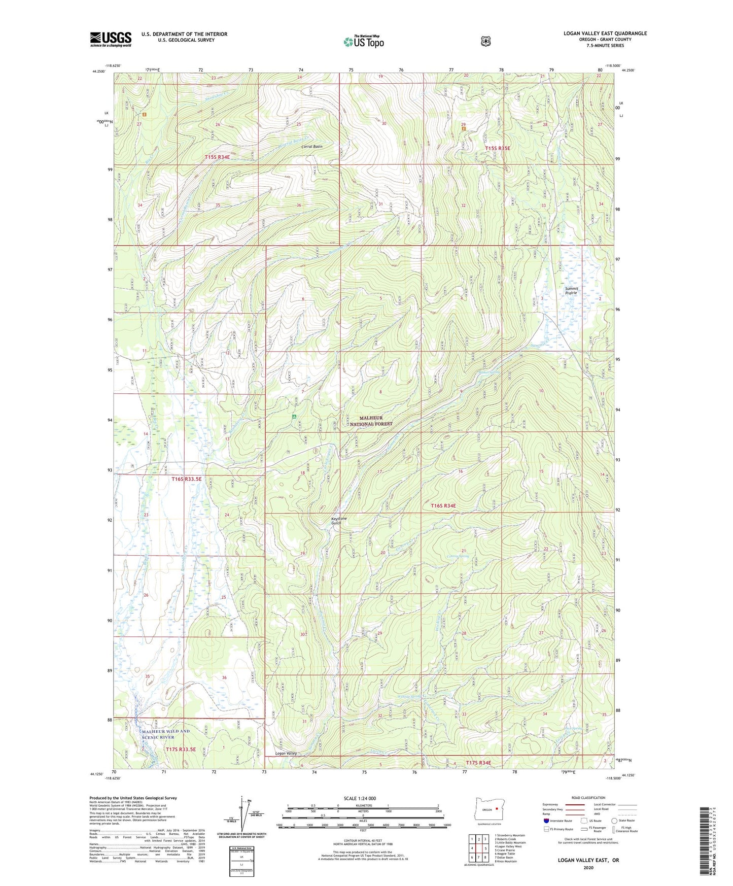
2024 topographic map quadrangle Logan Valley East in the state of Oregon. Scale: 1:24000. Based on the newly updated USGS 7.5' US Topo map series, this map is in the following counties: Grant. The map contains contour data, water features, and other items you are used to seeing on USGS maps, but also has updated roads and other features. This is the next generation of topographic maps. Printed on high-quality waterproof paper with UV fade-resistant inks.
Quads adjacent to this one:
West: Logan Valley West
Northwest: Strawberry Mountain
North: Roberts Creek
Northeast: Little Baldy Mountain
East: Crane Prairie
Southeast: Knox Mountain
South: Dollar Basin
Southwest: Magpie Table
This map covers the same area as the classic USGS quad with code o44118b5.
Contains the following named places: Basket Spring, Big Creek Recreation Site, Bosonberg Creek, Conroy Creek, Conroy Spring, Corral Basin, Corral Basin Creek, Engineers Springs, French Cabin, Joice Spring, Keystone Gulch, Kimberling Cabin, Larch Creek, Little Logan Creek, Logan Valley, Meadow Fork Big Creek, Sky Line Camp, Skyline Trailhead, Snowshoe Camp, Snowshoe Creek, Snowshoe Trailhead, Summit Prairie, Summit Prairie Truck Barns, Tamarack Creek, Wickiup Campground, Wickiup Creek, Wickiup Spring