MyTopo
Sugarpine Creek Oregon US Topo Map
Couldn't load pickup availability
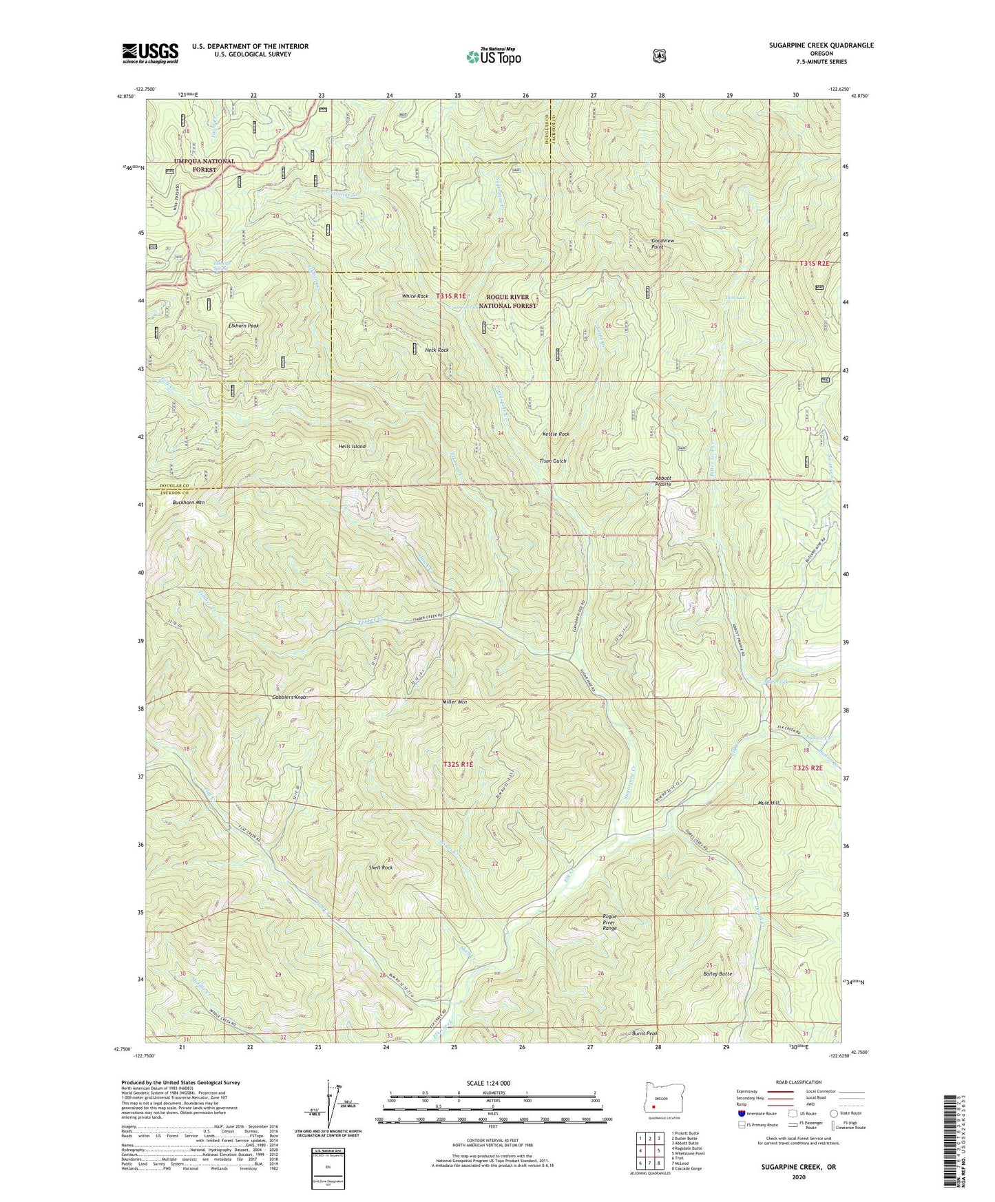
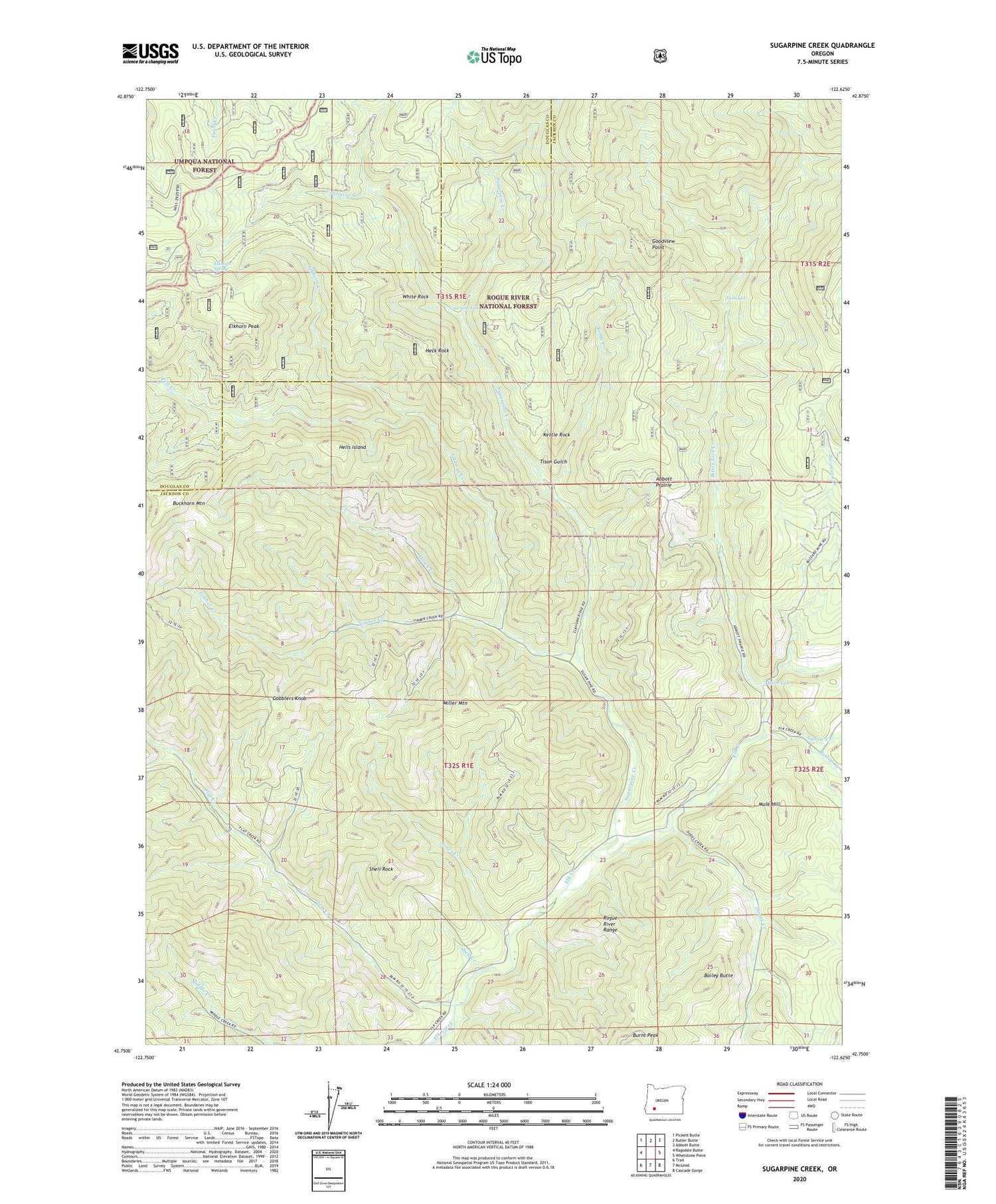
2020 topographic map quadrangle Sugarpine Creek in the state of Oregon. Scale: 1:24000. Based on the newly updated USGS 7.5' US Topo map series, this map is in the following counties: Jackson, Douglas. The map contains contour data, water features, and other items you are used to seeing on USGS maps, but also has updated roads and other features. This is the next generation of topographic maps. Printed on high-quality waterproof paper with UV fade-resistant inks.
Quads adjacent to this one:
West: Ragsdale Butte
Northwest: Pickett Butte
North: Butler Butte
Northeast: Abbott Butte
East: Whetstone Point
Southeast: Cascade Gorge
South: McLeod
Southwest: Trail
Contains the following named places: Abbott Prairie, Bailey Butte, Bitter Lick, Bitter Lick Creek, Buckhorn Cabin, Buckhorn Mountain, Button Creek, Coalmine Creek, Coalmine Lick, Dodes Creek, Elkhorn Creek, Elkhorn Peak, Elkhorn Spring, Fawn Camp, Finger Rock, Flat Creek, Gobblers Knob, Goodview Point, Hawk Creek, Hawk Creek Station, Heck Rock, Hells Island, Johns Camp, Jones Creek, Kettle Creek, Kettle Rock, Larson Place, Miller Mountain, Mule Hill, Pelt Creek, Shell Creek, Shell Rock, Squaw Creek, Sugarpine Creek, Swanson Creek, Timber Creek, Tison Gulch, Twin Lick, Ulvstad Post Office, White Rock