MyTopo
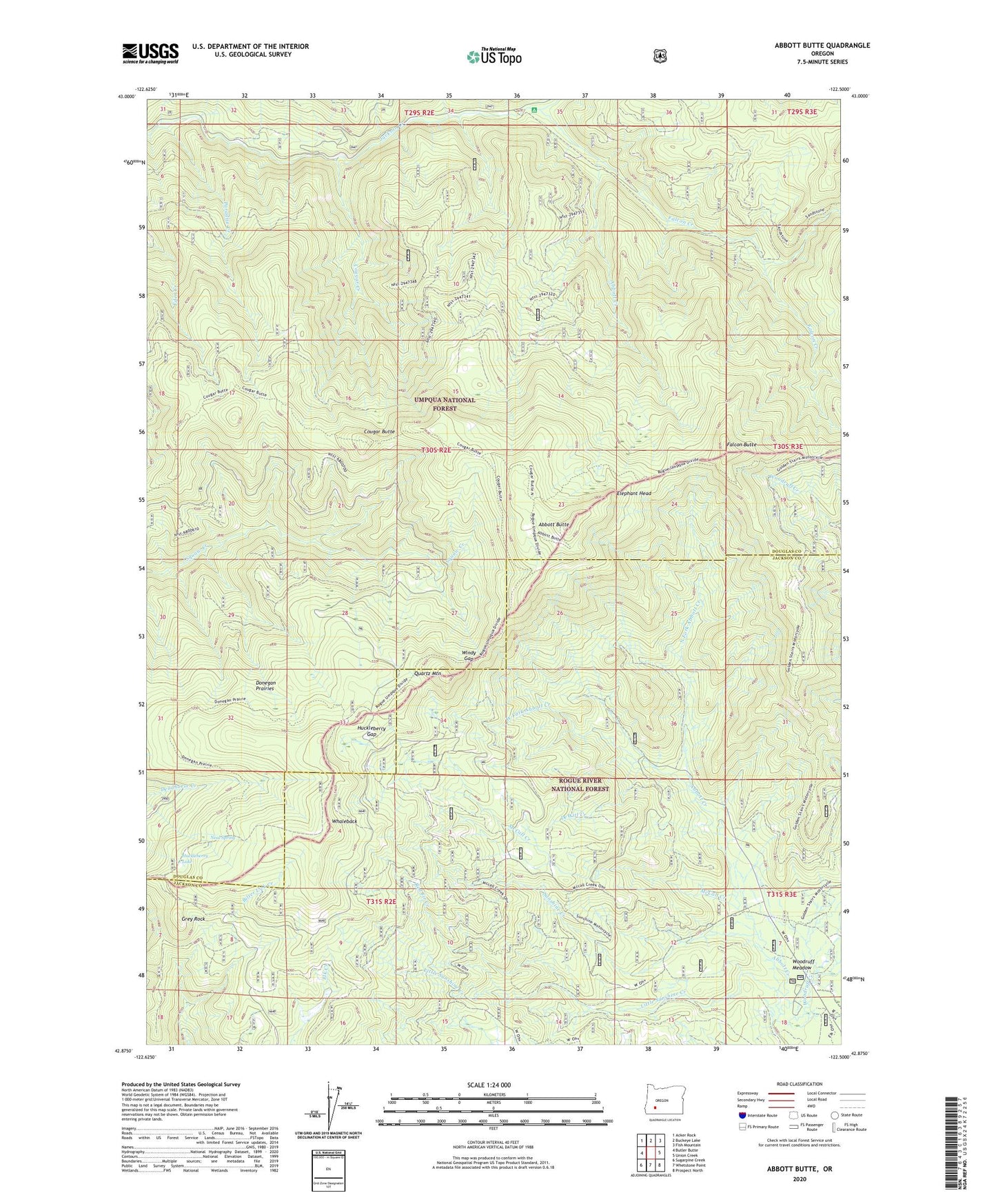
Abbott Butte Oregon US Topo Map
Couldn't load pickup availability
Also explore the Abbott Butte Forest Service Topo of this same quad for updated USFS data
2023 topographic map quadrangle Abbott Butte in the state of Oregon. Scale: 1:24000. Based on the newly updated USGS 7.5' US Topo map series, this map is in the following counties: Douglas, Jackson. The map contains contour data, water features, and other items you are used to seeing on USGS maps, but also has updated roads and other features. This is the next generation of topographic maps. Printed on high-quality waterproof paper with UV fade-resistant inks.
Quads adjacent to this one:
West: Butler Butte
Northwest: Acker Rock
North: Buckeye Lake
Northeast: Fish Mountain
East: Union Creek
Southeast: Prospect North
South: Whetstone Point
Southwest: Sugarpine Creek
This map covers the same area as the classic USGS quad with code o42122h5.
Contains the following named places: Abbott Butte, Abbott Butte Lookout, Abbott Creek, Abbott Creek Recreation Site, Abbott Creek Research Natural Area, Big Bear Camp, Buck Basin Burn, Cougar Butte, Cougar Creek, Cow Camp, DeWitt Creek, Donegan Prairies, Elephant Head, Falcon Butte, Falcon Creek, Five Sticks Camp, Freddy Camp, Golden Stairs Trail, Grey Rock, Huckleberry Gap, Huckleberry Lake, Huckleberry Lake Campground, Little Bear Camp, Little Sunshine Creek, McCall Creek, Neal Spring, Neal Springs Campground, North Fork Abbott Creek, Paradise Camp, Paradise Creek, Quartz Mountain, Red Fir Creek, Saddle Camp, Sandstone Trail, Sunshine Creek, Tripod Camp, Umpqua Rogue Trail, West Fork Abbott Creek, Whaleback, Windy Gap, Woodruff Creek, Woodruff Meadow