MyTopo
Surveyor Mountain Oregon US Topo Map
Couldn't load pickup availability
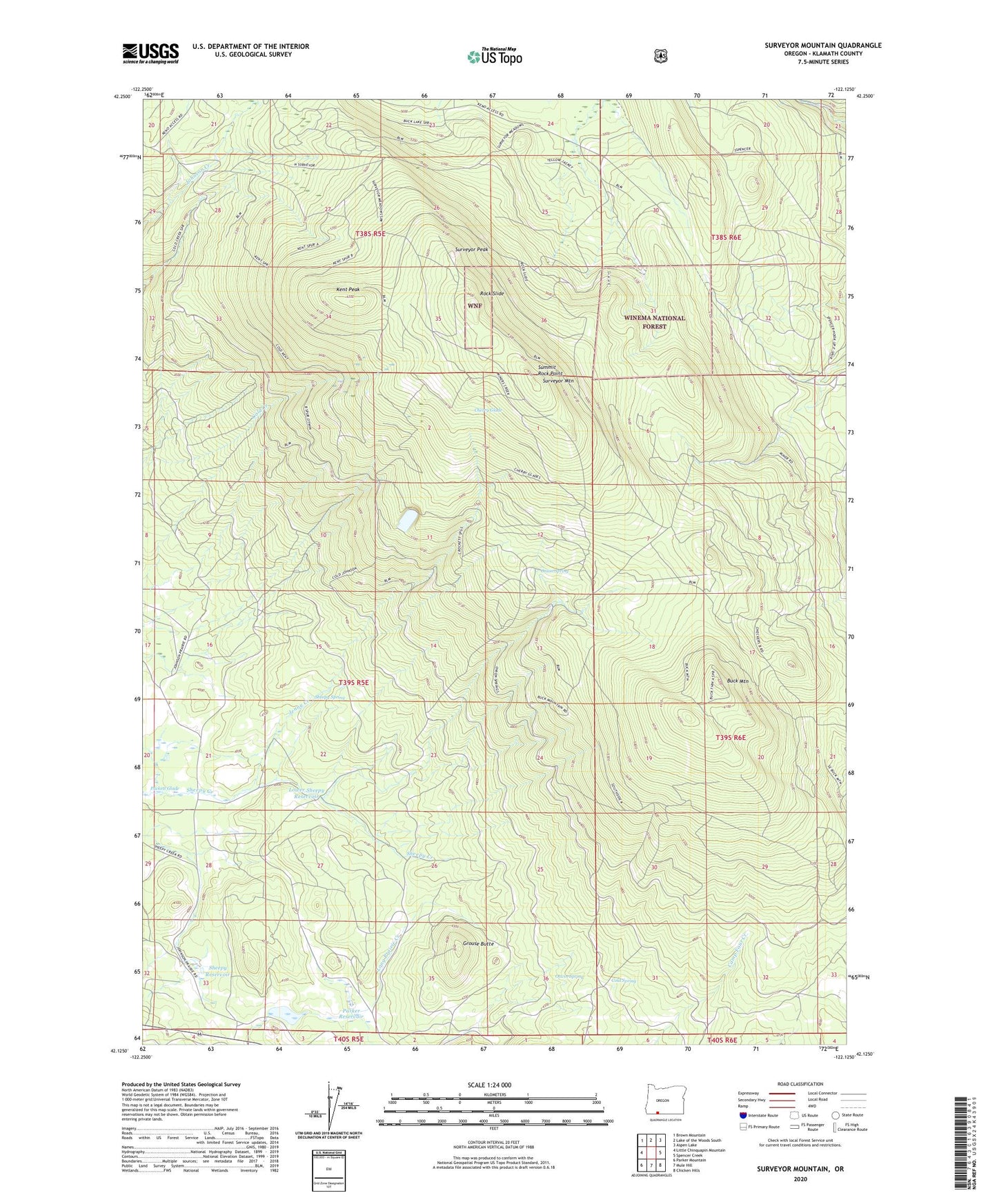
2020 topographic map quadrangle Surveyor Mountain in the state of Oregon. Scale: 1:24000. Based on the newly updated USGS 7.5' US Topo map series, this map is in the following counties: Klamath. The map contains contour data, water features, and other items you are used to seeing on USGS maps, but also has updated roads and other features. This is the next generation of topographic maps. Printed on high-quality waterproof paper with UV fade-resistant inks.
Quads adjacent to this one:
West: Little Chinquapin Mountain
Northwest: Brown Mountain
North: Lake of the Woods South
Northeast: Aspen Lake
East: Spencer Creek
Southeast: Chicken Hills
South: Mule Hill
Southwest: Parker Mountain
Contains the following named places: Buck Mountain, Cherry Glade, Cold Spring, Grouse Butte, Jenny Creek, Kent Peak, King Cole, Lower Sheepy Reservoir, Maggard, Onion Spring, Otwin Spring, Parker, Parker Reservoir, Puckett Glade, Rock Slide, Sheepy Reservoir, Sheepy Spring, Summit Rock Point, Surveyor Mountain, Surveyor Peak