MyTopo
Parker Mountain Oregon US Topo Map
Couldn't load pickup availability
Also explore the Parker Mountain Forest Service Topo of this same quad for updated USFS data
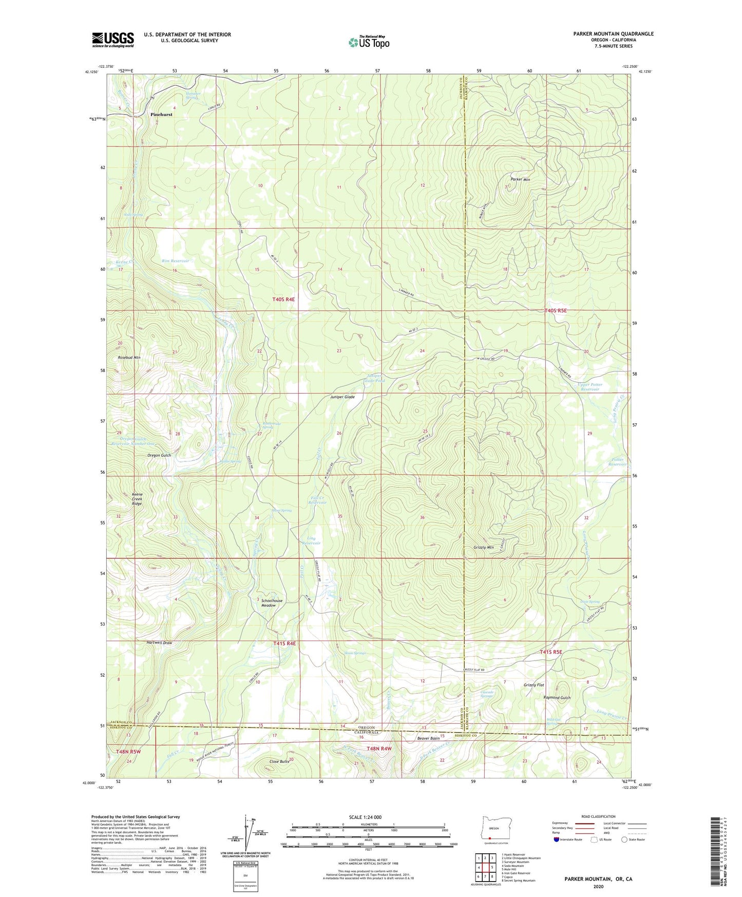
2023 topographic map quadrangle Parker Mountain in the states of Oregon, California. Scale: 1:24000. Based on the newly updated USGS 7.5' US Topo map series, this map is in the following counties: Jackson, Klamath, Siskiyou. The map contains contour data, water features, and other items you are used to seeing on USGS maps, but also has updated roads and other features. This is the next generation of topographic maps. Printed on high-quality waterproof paper with UV fade-resistant inks.
Quads adjacent to this one:
West: Soda Mountain
Northwest: Hyatt Reservoir
North: Little Chinquapin Mountain
Northeast: Surveyor Mountain
East: Mule Hill
Southeast: Secret Spring Mountain
South: Copco
Southwest: Iron Gate Reservoir
This map covers the same area as the classic USGS quad with code o42122a3.
Contains the following named places: Beaver Basin, Beaver Creek, Box D Ranch, Box O Ranch, Cascade Springs, Close Butte, Corral Creek, Dixie, Dixie Spring, Fall Creek Ranch, Fall Creek Reservoir, Grizzly Flat, Grizzly Mountain, Hamaker Spring, Hartwell Draw, Juniper Glade, Juniper Glade Pond, Keene Creek, Leonard Ranch, Ling Reservoir, Open Triangle Tee Ranch, Oregon Gulch, Oregon Gulch Reservoir Number One, Parker Mountain, Pinehurst, Pinehurst Post Office, Potter Reservoir, Rattlesnake Spring, Rim Reservoir, Rosebud Mountain, Rosebud Reservoir, Schoolhouse Meadow, Shake, Shake Post Office, Shoat Spring, Skookum Creek, Sloan Creek, Sloan Springs, Snow Post Office, Soda Spring, Spring Creek, Taylor Ranch, Upper Potter Reservoir, Wallis Spring, Wild Gal Spring