
MyTopo
Susanville Oregon US Topo Map
Couldn't load pickup availability
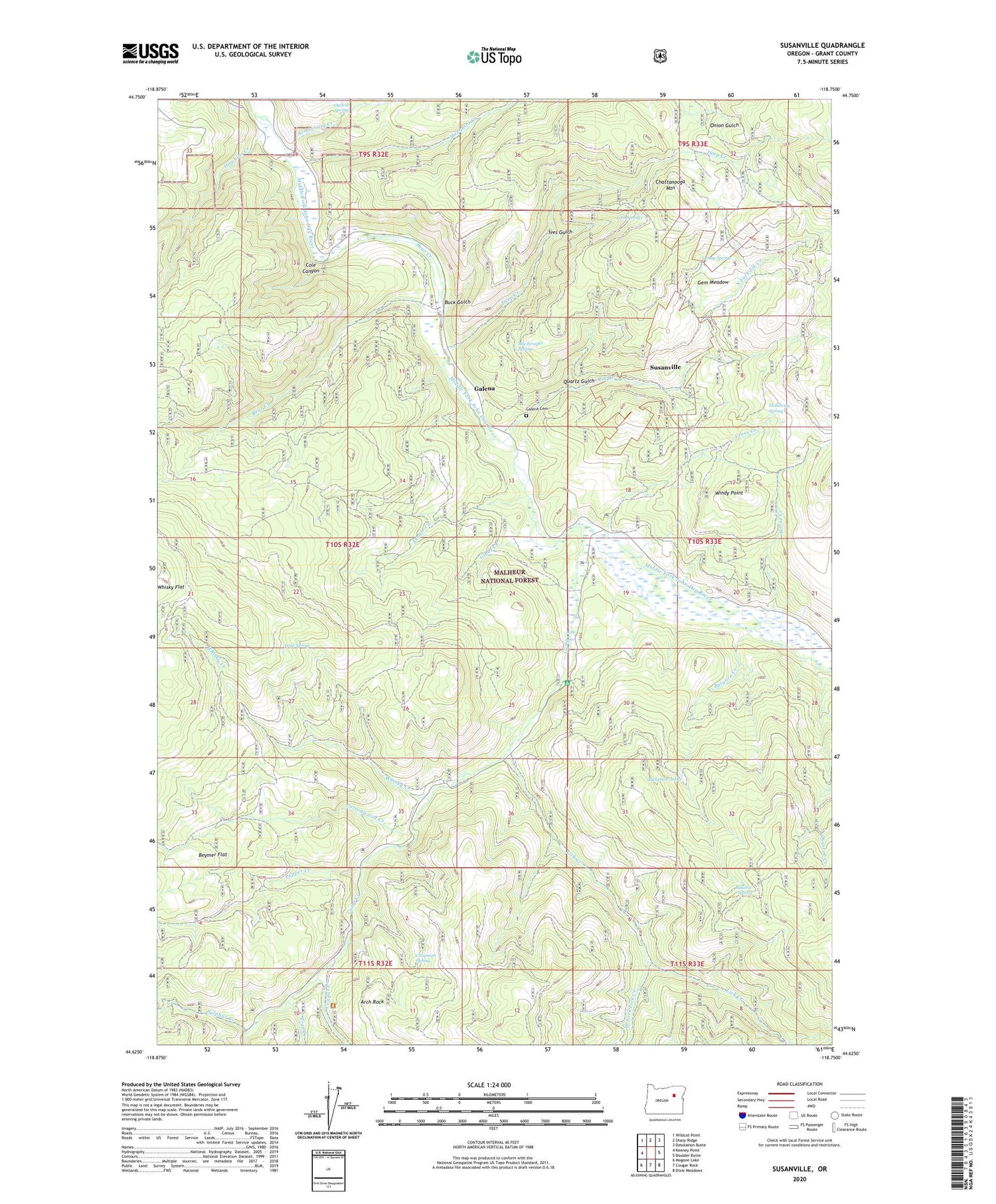
2020 topographic map quadrangle Susanville in the state of Oregon. Scale: 1:24000. Based on the newly updated USGS 7.5' US Topo map series, this map is in the following counties: Grant. The map contains contour data, water features, and other items you are used to seeing on USGS maps, but also has updated roads and other features. This is the next generation of topographic maps. Printed on high-quality waterproof paper with UV fade-resistant inks.
Quads adjacent to this one:
West: Keeney Point
Northwest: Wildcat Point
North: Sharp Ridge
Northeast: Desolation Butte
East: Boulder Butte
Southeast: Dixie Meadows
South: Cougar Rock
Southwest: Magone Lake
Contains the following named places: Arch Rock, Armstrong Creek, Balance Creek, Balance Lake, Balance Spring, Bear Creek, Beymer Flat, Buck Gulch, Camp Creek, Chapman Spring, Chattanooga Mountain, Cole Canyon, Cottonwood Creek, Cougar Creek, Cress Creek, Crockett Knob, Crockett Knob Lookout, Deep Creek, Denny Spring, Dunston Creek, Elk Creek, Flat Camp, Galena, Galena Cemetery, Galena Post Office, Gem Meadow, Gem Mine, Gibbs Creek, Hawkins Creek, Holloway Spring, Horse Creek, Ives Gulch, Ives Spring, Jungle Creek, Lick Creek, Lower Camp Creek Recreation Site, Mosquito Creek, North Fork Elk Creek, Ogilvie Spring, O'Rorke Ranch, Pepper Creek, Quartz Gulch, Sky Scraper Spring, Sulphur Creek, Susanville, Susanville Post Office, Trail Creek, Trail Spring, West Fork Lick Creek, Whisky Creek, Windy Point


