MyTopo
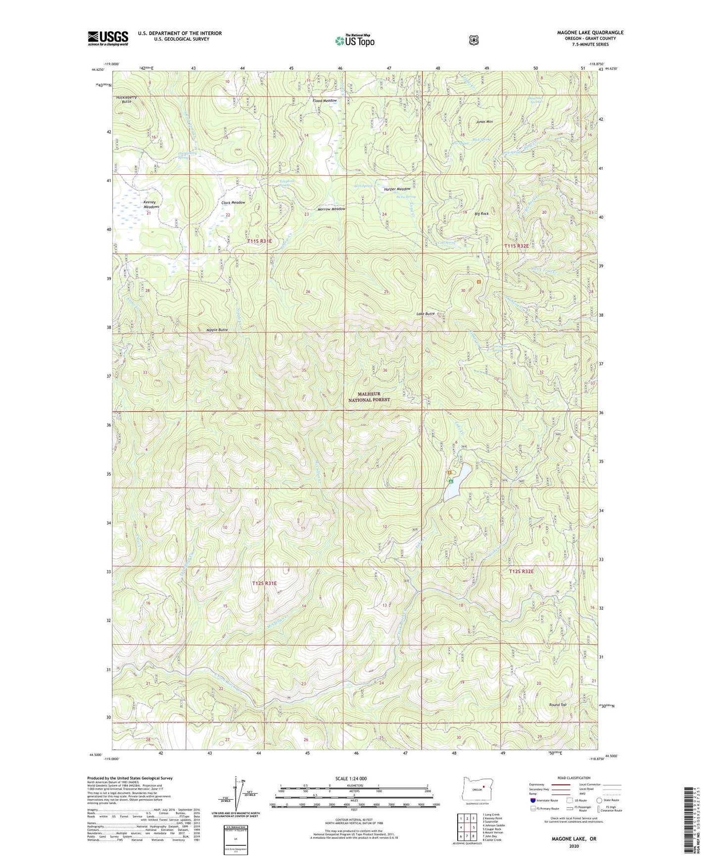
Magone Lake Oregon US Topo Map
Couldn't load pickup availability
Also explore the Magone Lake Forest Service Topo of this same quad for updated USFS data
2023 topographic map quadrangle Magone Lake in the state of Oregon. Scale: 1:24000. Based on the newly updated USGS 7.5' US Topo map series, this map is in the following counties: Grant. The map contains contour data, water features, and other items you are used to seeing on USGS maps, but also has updated roads and other features. This is the next generation of topographic maps. Printed on high-quality waterproof paper with UV fade-resistant inks.
Quads adjacent to this one:
West: Johnson Saddle
Northwest: Long Creek
North: Keeney Point
Northeast: Susanville
East: Cougar Rock
Southeast: Castle Creek
South: John Day
Southwest: Mount Vernon
This map covers the same area as the classic USGS quad with code o44118e8.
Contains the following named places: Allen Spring, Big Rock, Buck Spring, Clark Meadow, Cold Spring, Cold Spring Camp, Deadman Spring, Deep Spring, Fir Spring, Flood Meadow, Harper Meadow, Herburger Cabin, Hi Yu Guard Station, Hi Yu Spring, Huckleberry Butte, Huckleberry Camp, Huckleberry Spring, Jonas Mountain, Jugow Creek, Keeney Meadows, Lake Butte, Lake Creek, Magone Lake, Magone Lake Recreation Area Boat Launch, Magone Lake Recreation Site, McClellan Creek, Morrow Meadow, Nipple Butte, Nipple Creek, Porcupine Camp, Porcupine Spring, Round Top, Sulphur Creek Trail, Telephone Spring, Telephone Spring Camp, Thompson Creek, Tinker Creek