MyTopo
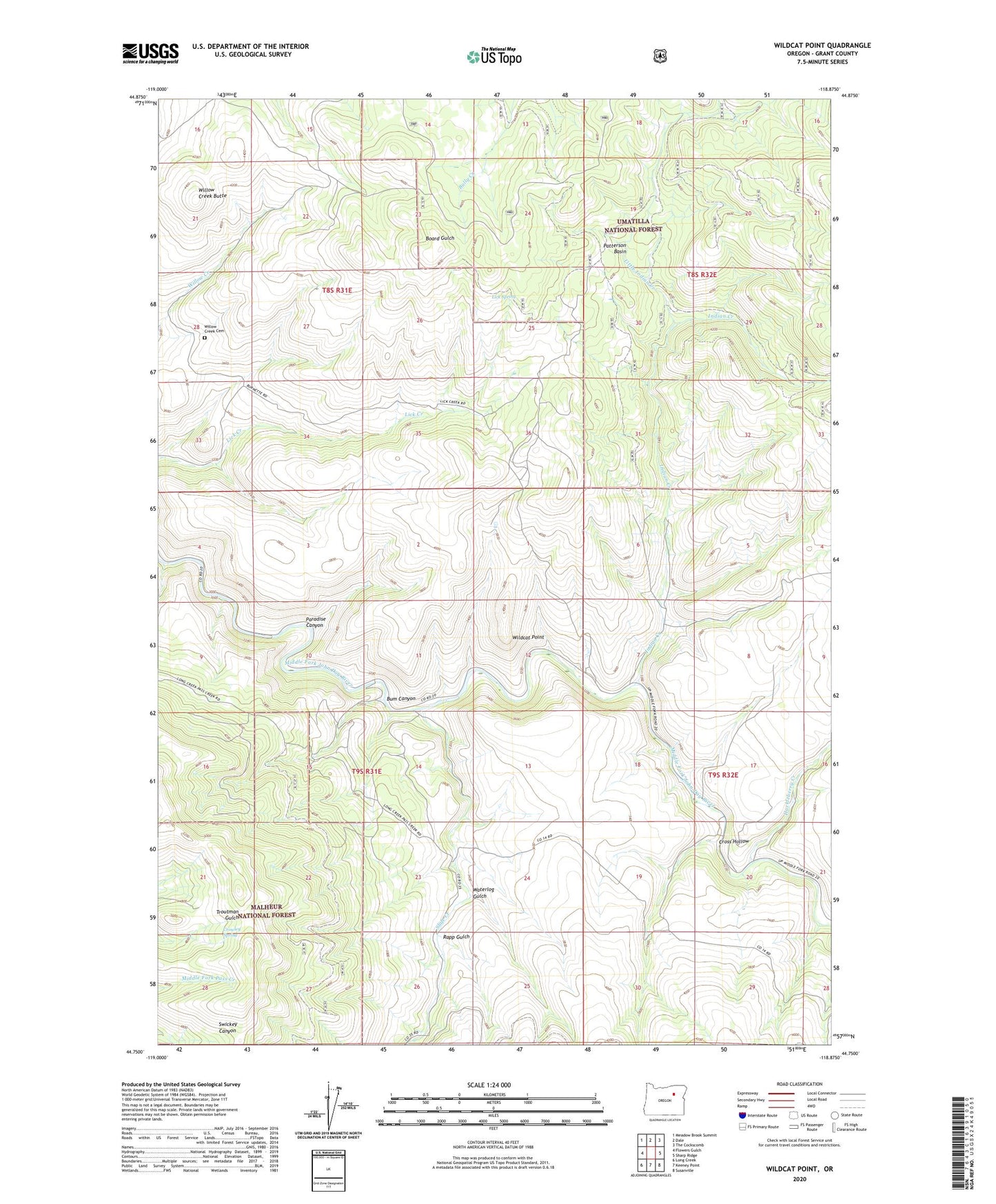
Wildcat Point Oregon US Topo Map
Couldn't load pickup availability
Also explore the Wildcat Point Forest Service Topo of this same quad for updated USFS data
2023 topographic map quadrangle Wildcat Point in the state of Oregon. Scale: 1:24000. Based on the newly updated USGS 7.5' US Topo map series, this map is in the following counties: Grant. The map contains contour data, water features, and other items you are used to seeing on USGS maps, but also has updated roads and other features. This is the next generation of topographic maps. Printed on high-quality waterproof paper with UV fade-resistant inks.
Quads adjacent to this one:
West: Flowers Gulch
Northwest: Meadow Brook Summit
North: Dale
Northeast: The Cockscomb
East: Sharp Ridge
Southeast: Susanville
South: Keeney Point
Southwest: Long Creek
This map covers the same area as the classic USGS quad with code o44118g8.
Contains the following named places: Bullrun Creek, Bum Canyon, Cross Hollow, Crowley Spring, Huckleberry Creek, Indian Creek, Kilbride Post Office, Lick Spring, Little Indian Creek, Paradise Canyon, Patterson Basin, Rapp Gulch, Slide Creek, Waterlog Gulch, Wildcat Point, Willow Creek Butte, Willow Creek Cemetery