MyTopo
Swan Lake Point Oregon US Topo Map
Couldn't load pickup availability
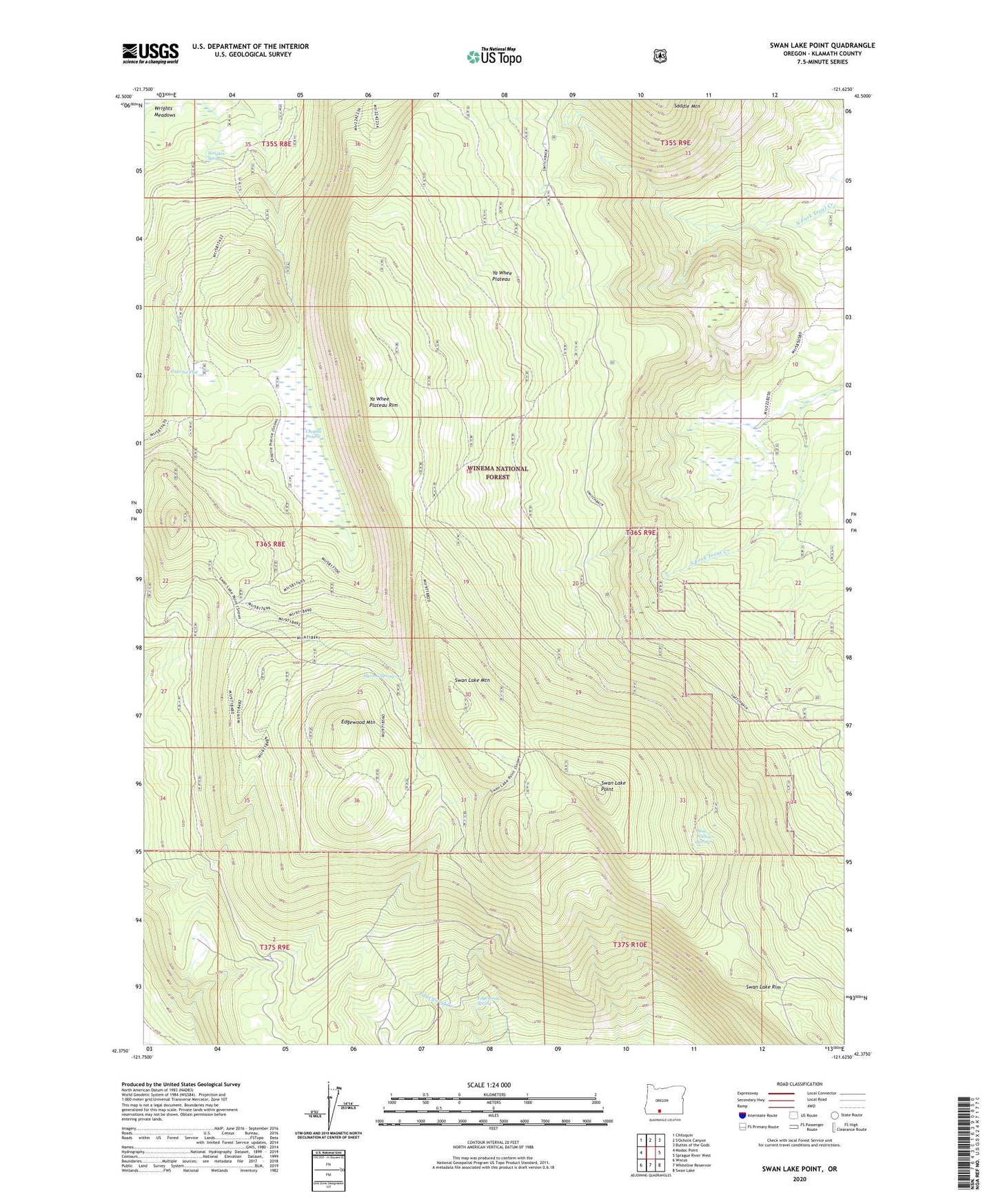
2020 topographic map quadrangle Swan Lake Point in the state of Oregon. Scale: 1:24000. Based on the newly updated USGS 7.5' US Topo map series, this map is in the following counties: Klamath. The map contains contour data, water features, and other items you are used to seeing on USGS maps, but also has updated roads and other features. This is the next generation of topographic maps. Printed on high-quality waterproof paper with UV fade-resistant inks.
Quads adjacent to this one:
West: Modoc Point
Northwest: Chiloquin
Northeast: Buttes of the Gods
East: Sprague River West
Southeast: Swan Lake
South: Whiteline Reservoir
Southwest: Wocus
Contains the following named places: Algoma Spring, Bad Lands, Bear Wallows Spring, Choptie Prairie, Edgewood Mountain, Edgewood Spring, Four-bit Flat, Lavenik Cinder Pit, Middle Fork Trout Creek, Swan Lake Mountain, Swan Lake Point, Swan Lake Rim, Trout Creek Ranch, Wrights Spring, Ya Whee Plateau, Ya Whee Plateau Rim