MyTopo
Vines Hill Oregon US Topo Map
Couldn't load pickup availability
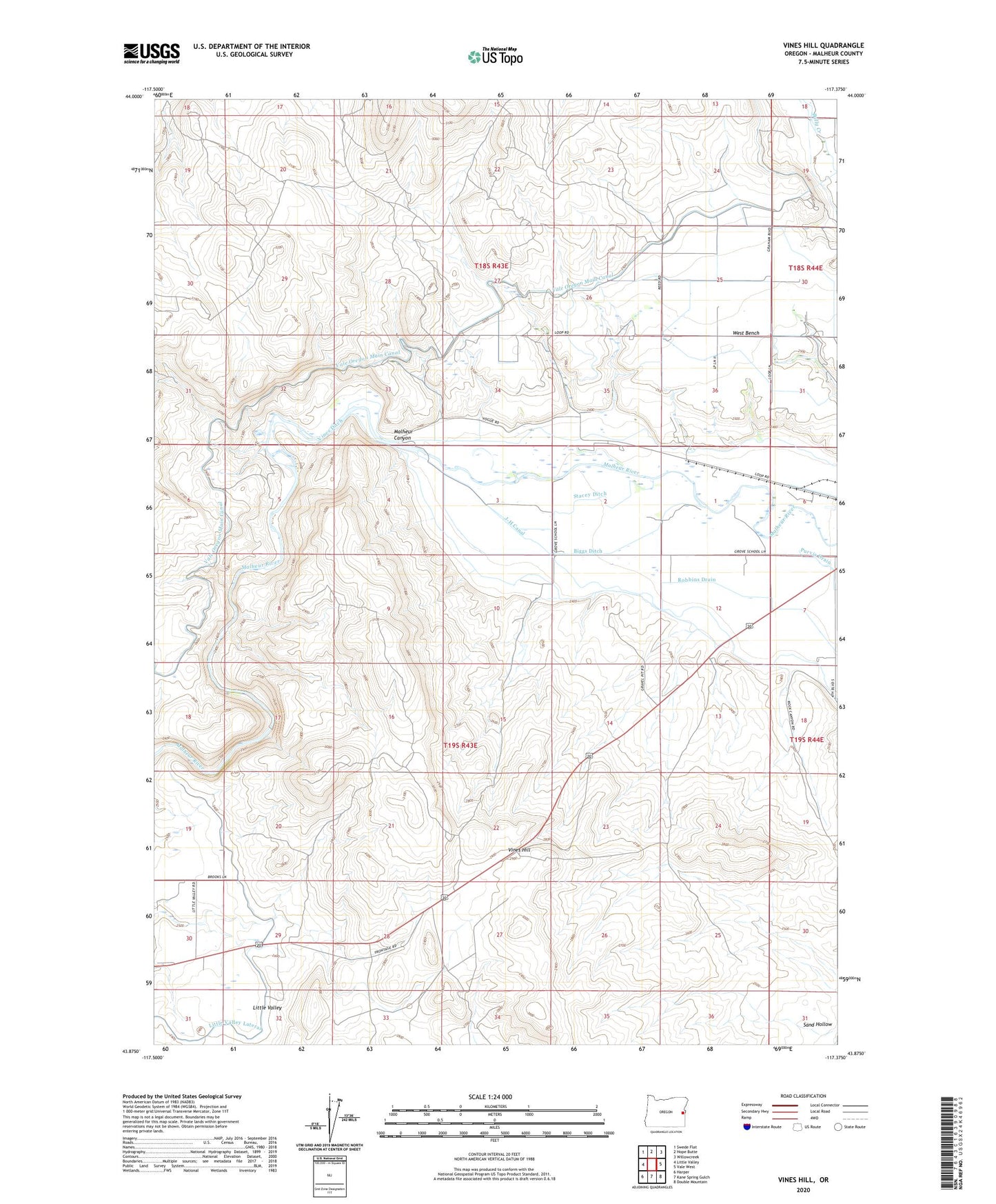
2023 topographic map quadrangle Vines Hill in the state of Oregon. Scale: 1:24000. Based on the newly updated USGS 7.5' US Topo map series, this map is in the following counties: Malheur. The map contains contour data, water features, and other items you are used to seeing on USGS maps, but also has updated roads and other features. This is the next generation of topographic maps. Printed on high-quality waterproof paper with UV fade-resistant inks.
Quads adjacent to this one:
West: Little Valley
Northwest: Swede Flat
North: Hope Butte
Northeast: Willowcreek
East: Vale West
Southeast: Double Mountain
South: Kane Spring Gulch
Southwest: Harper
This map covers the same area as the classic USGS quad with code o43117h4.
Contains the following named places: Ballwood, Biggs Ditch, Little Valley, Little Valley Lateral, Malheur Canyon, Stacey Ditch, Vines Ditch, Vines Hill, West Bench