MyTopo
Telocaset Oregon US Topo Map
Couldn't load pickup availability
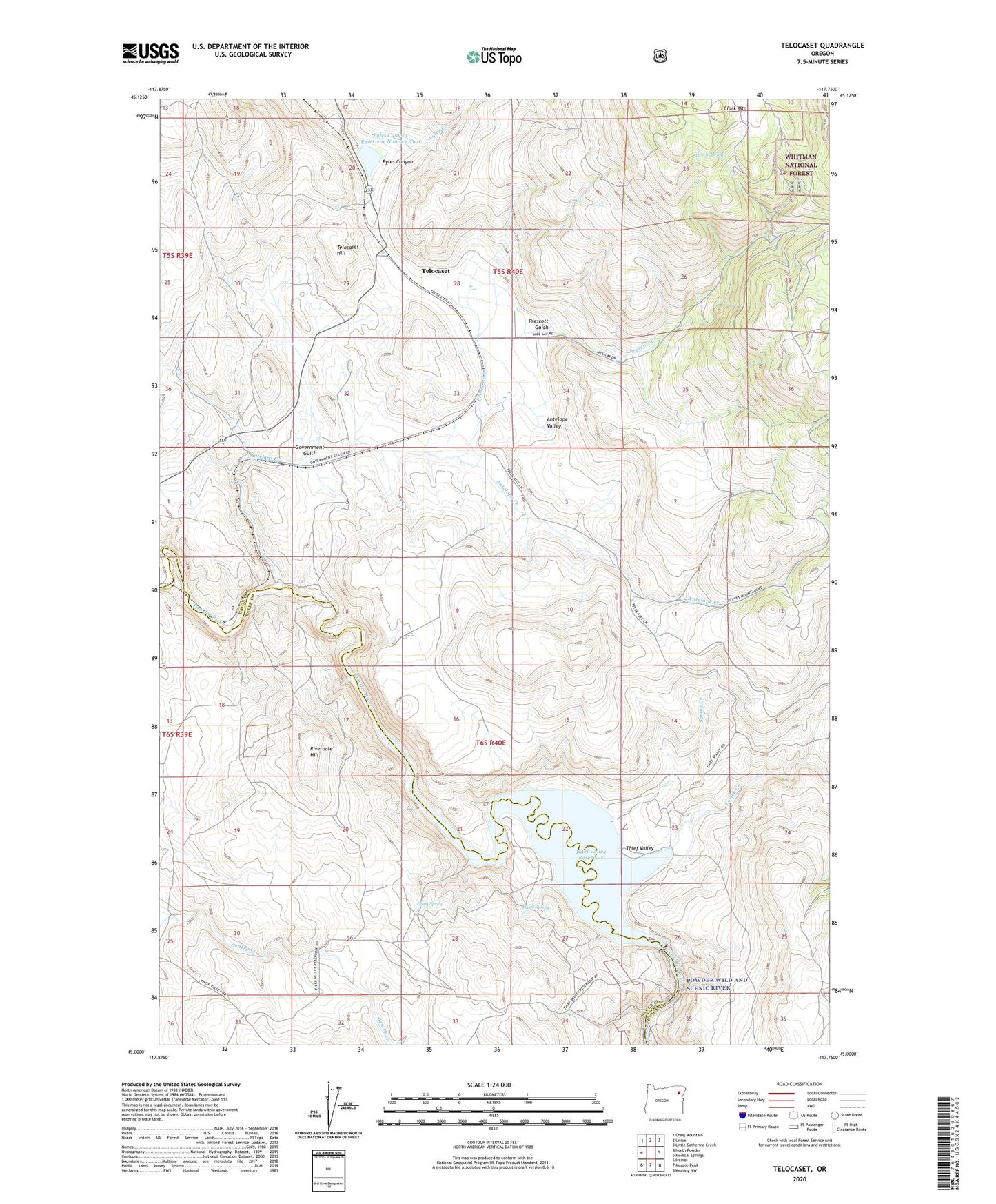
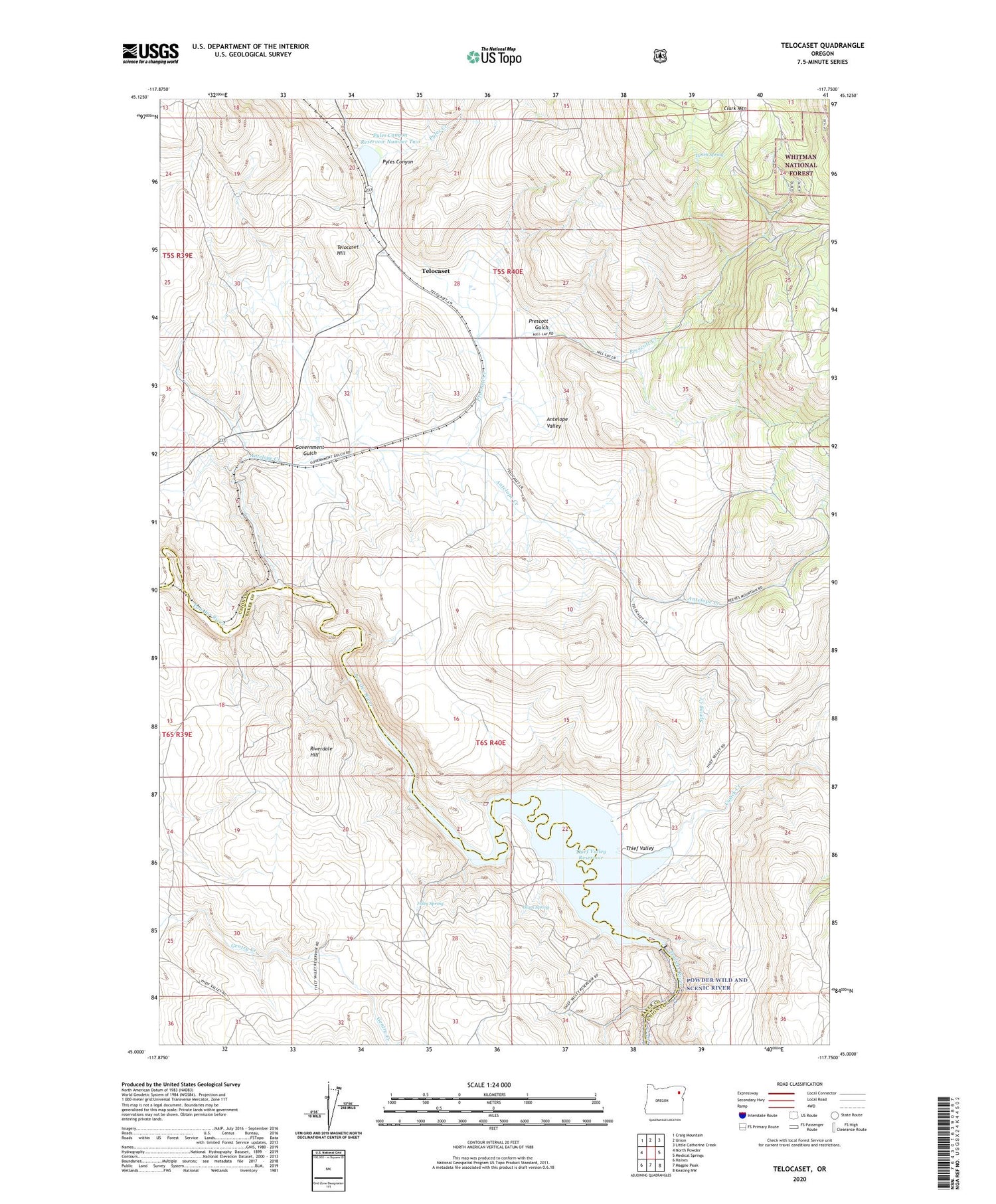
2020 topographic map quadrangle Telocaset in the state of Oregon. Scale: 1:24000. Based on the newly updated USGS 7.5' US Topo map series, this map is in the following counties: Union, Baker. The map contains contour data, water features, and other items you are used to seeing on USGS maps, but also has updated roads and other features. This is the next generation of topographic maps. Printed on high-quality waterproof paper with UV fade-resistant inks.
Quads adjacent to this one:
West: North Powder
Northwest: Craig Mountain
North: Union
Northeast: Little Catherine Creek
East: Medical Springs
Southeast: Keating NW
South: Magpie Peak
Southwest: Haines
Contains the following named places: Antelope Creek, Antelope Valley, Clark Mountain, Cromwell Post Office, Cusick Creek, Foley Spring, Glass Spring, Government Gulch, Lynch Spring, Prescott Creek, Prescott Gulch, Pyles Canyon Reservoir Number Two, Riverdale Hill, Sago, Spring Creek, Telocaset, Telocaset Hill, Telocaset Post Office, Thief Valley, Thief Valley County Park, Thief Valley Dam, Thief Valley Reservoir, Thief Valley Reservoir Boat Ramp