
MyTopo
Tenmile Oregon US Topo Map
Couldn't load pickup availability
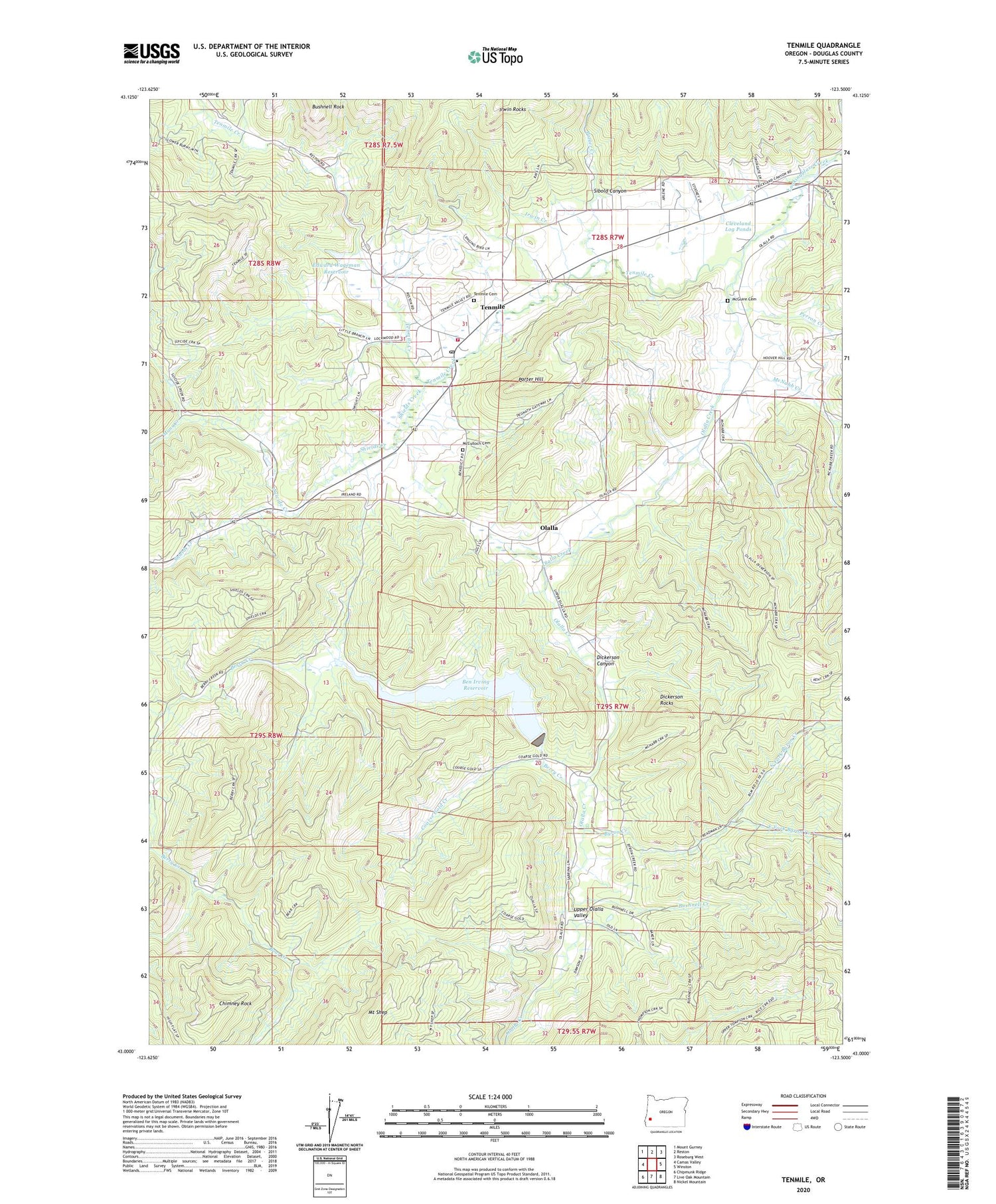
2020 topographic map quadrangle Tenmile in the state of Oregon. Scale: 1:24000. Based on the newly updated USGS 7.5' US Topo map series, this map is in the following counties: Douglas. The map contains contour data, water features, and other items you are used to seeing on USGS maps, but also has updated roads and other features. This is the next generation of topographic maps. Printed on high-quality waterproof paper with UV fade-resistant inks.
Quads adjacent to this one:
West: Camas Valley
Northwest: Mount Gurney
North: Reston
Northeast: Roseburg West
East: Winston
Southeast: Nickel Mountain
South: Live Oak Mountain
Southwest: Chipmunk Ridge
Contains the following named places: Bear Creek, Ben Irving Reservoir, Ben Irving Reservoir County Park Boat Ramp, Berry Creek, Berry Creek Dam, Bushnell Creek, Byron Creek, Chimney Rock, Cleveland Log Ponds, Coarse Gold Creek, Dickerson Canyon, Dickerson Rocks, Edward Wageman Dam, Edward Wageman Reservoir, Irwin Creek, Irwin Rocks, Little Muley Creek, McCulloch Cemetery, McGuire Cemetery, McNabb Creek, Mount Shep, Muns Creek, North Fork Byron Creek, Olalla, Olalla Creek, Olalla Post Office, Perron Creek, Porter Creek, Porter Hill, Shields Creek, Sibold Canyon, Suicide Creek, Tenmile, Tenmile Cemetery, Tenmile Creek, Tenmile Division, Tenmile Post Office, Tenmile Rural Fire Protection District, Tenmile Valley, Upper Olalla School, Upper Olalla Valley, Weaver Creek, ZIP Code: 97481


