MyTopo
The Narrows Oregon US Topo Map
Couldn't load pickup availability
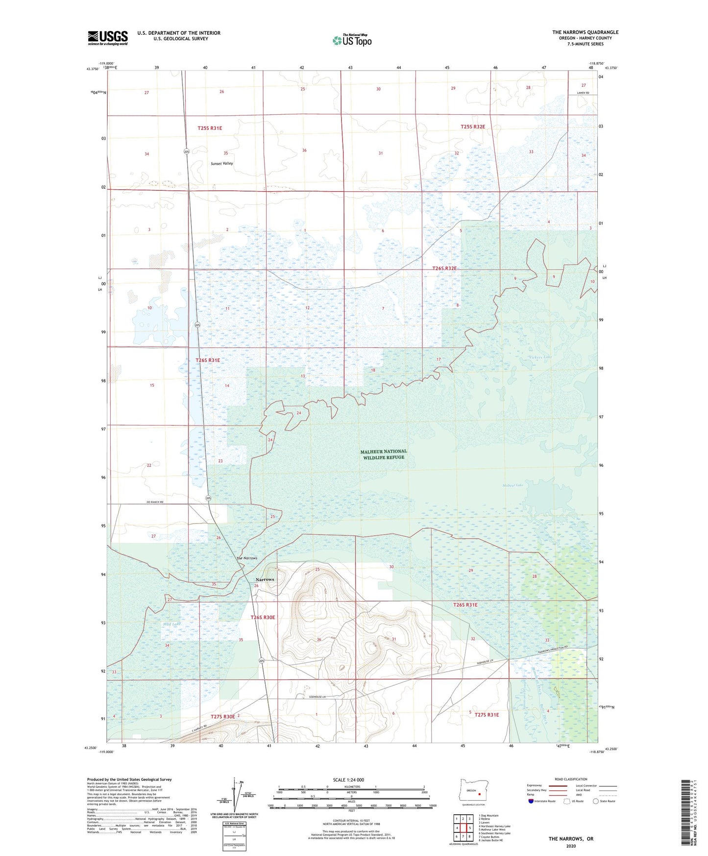
2023 topographic map quadrangle The Narrows in the state of Oregon. Scale: 1:24000. Based on the newly updated USGS 7.5' US Topo map series, this map is in the following counties: Harney. The map contains contour data, water features, and other items you are used to seeing on USGS maps, but also has updated roads and other features. This is the next generation of topographic maps. Printed on high-quality waterproof paper with UV fade-resistant inks.
Quads adjacent to this one:
West: Northeast Harney Lake
Northwest: Dog Mountain
North: Redess
Northeast: Lawen
East: Malheur Lake West
Southeast: Jackass Butte NE
South: Coyote Buttes
Southwest: Southeast Harney Lake
This map covers the same area as the classic USGS quad with code o43118c8.
Contains the following named places: Butte Ditch, Caldwell Ranch, Narrows, Narrows Post Office, Rineman Ditch, Simmons Slough, Sunset Valley, Swan Lake Artesian Well, The Narrows, Vickers Lake