MyTopo
Thousand Springs Oregon US Topo Map
Couldn't load pickup availability
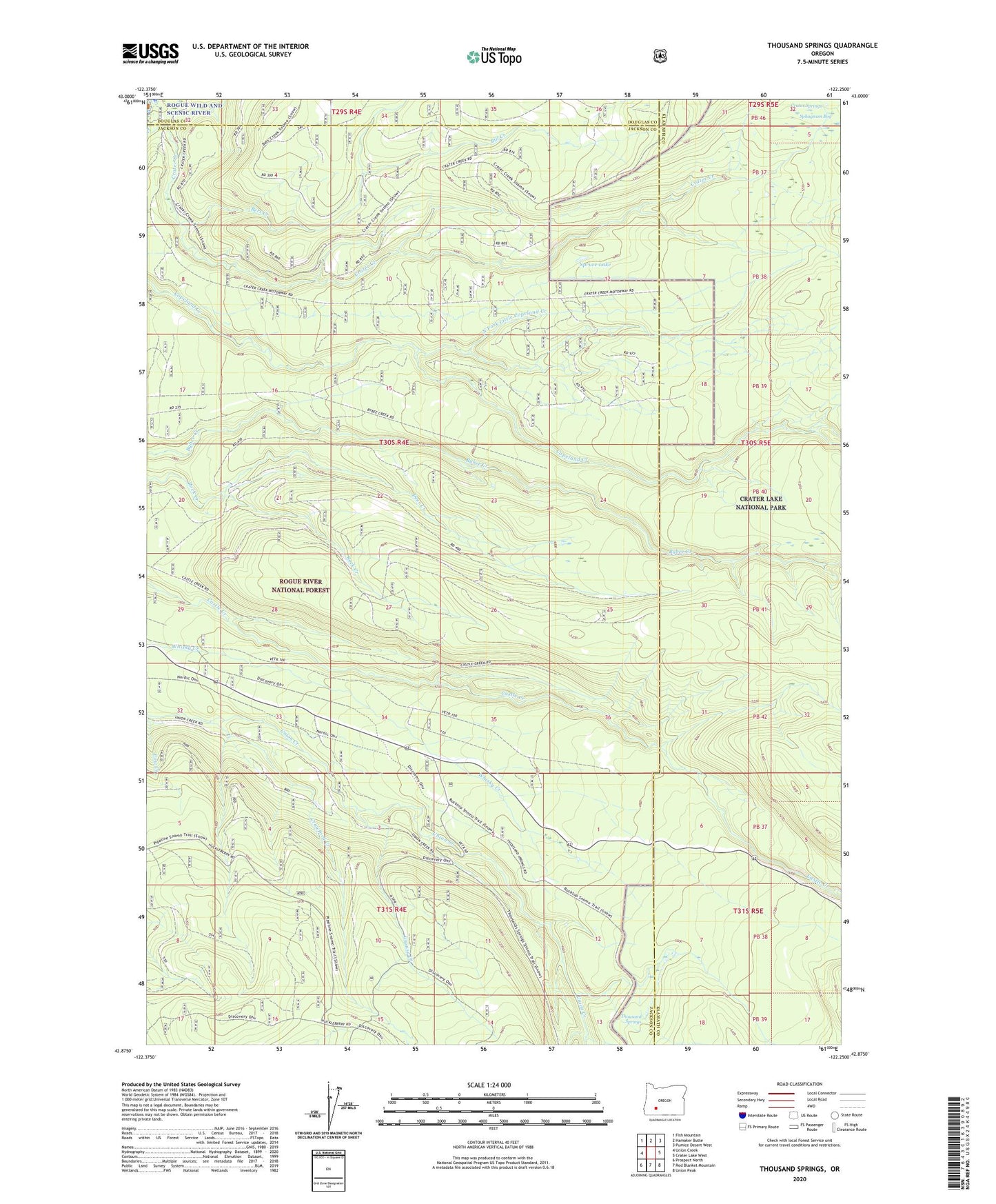
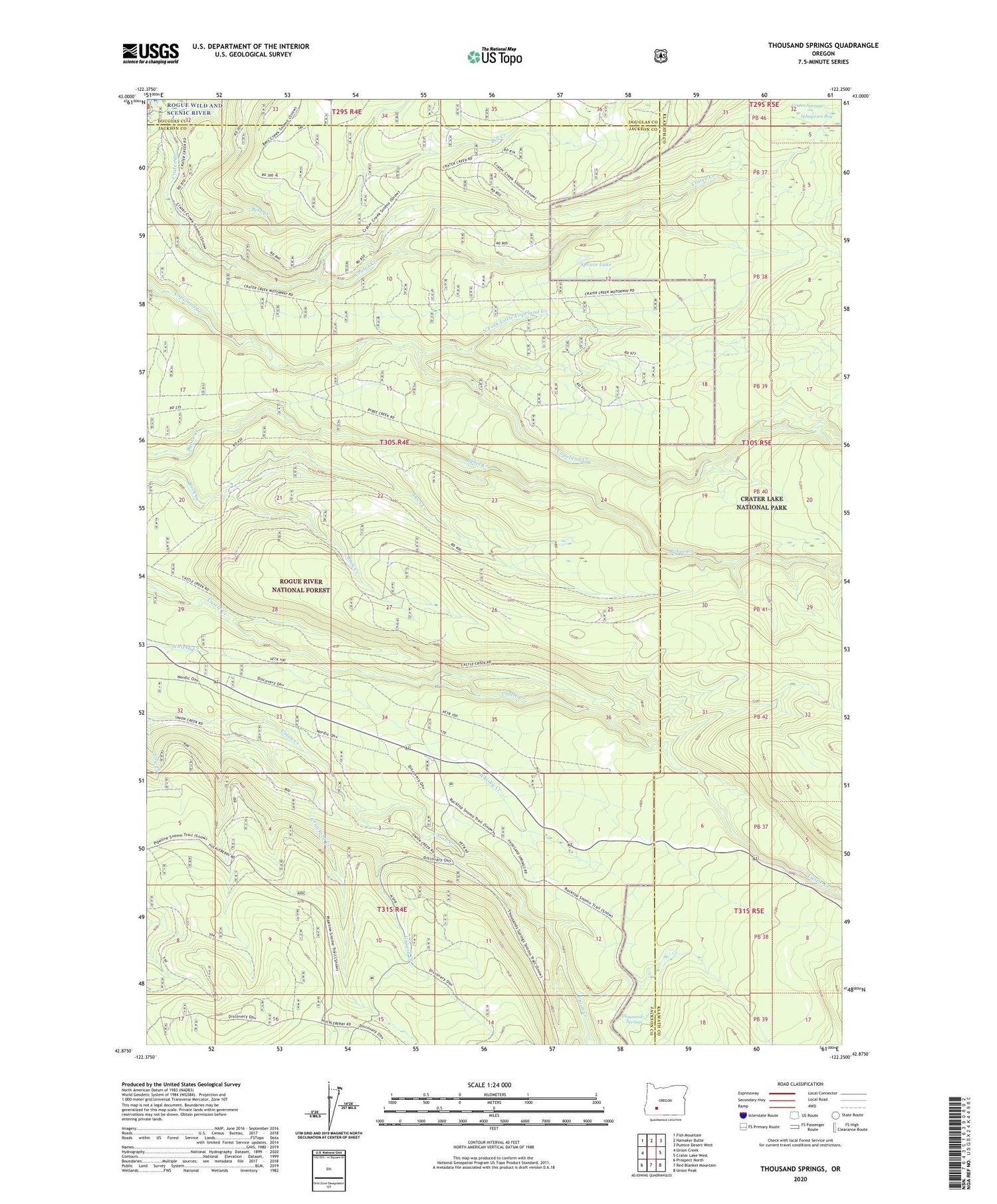
2020 topographic map quadrangle Thousand Springs in the state of Oregon. Scale: 1:24000. Based on the newly updated USGS 7.5' US Topo map series, this map is in the following counties: Jackson, Klamath, Douglas. The map contains contour data, water features, and other items you are used to seeing on USGS maps, but also has updated roads and other features. This is the next generation of topographic maps. Printed on high-quality waterproof paper with UV fade-resistant inks.
Quads adjacent to this one:
West: Union Creek
Northwest: Fish Mountain
North: Hamaker Butte
Northeast: Pumice Desert West
East: Crater Lake West
Southeast: Union Peak
South: Red Blanket Mountain
Southwest: Prospect North
Contains the following named places: Bert Creek, Bill Creek, Copeland Creek Trail, Crater Creek, Crater Springs, Crawford Creek, Deer Creek, Grouse Creek, Huckleberry Guard Station, Huckleberry Mountain Recreation Site, Little Castle Creek, North Fork Copeland Creek, North Fork Little Copeland Creek, Sphagnum Bog, Spruce Lake, Sunday Camp, Thousand Springs, Wagon Camp, Whisky Camp