MyTopo
Hamaker Butte Oregon US Topo Map
Couldn't load pickup availability
Also explore the Hamaker Butte Forest Service Topo of this same quad for updated USFS data
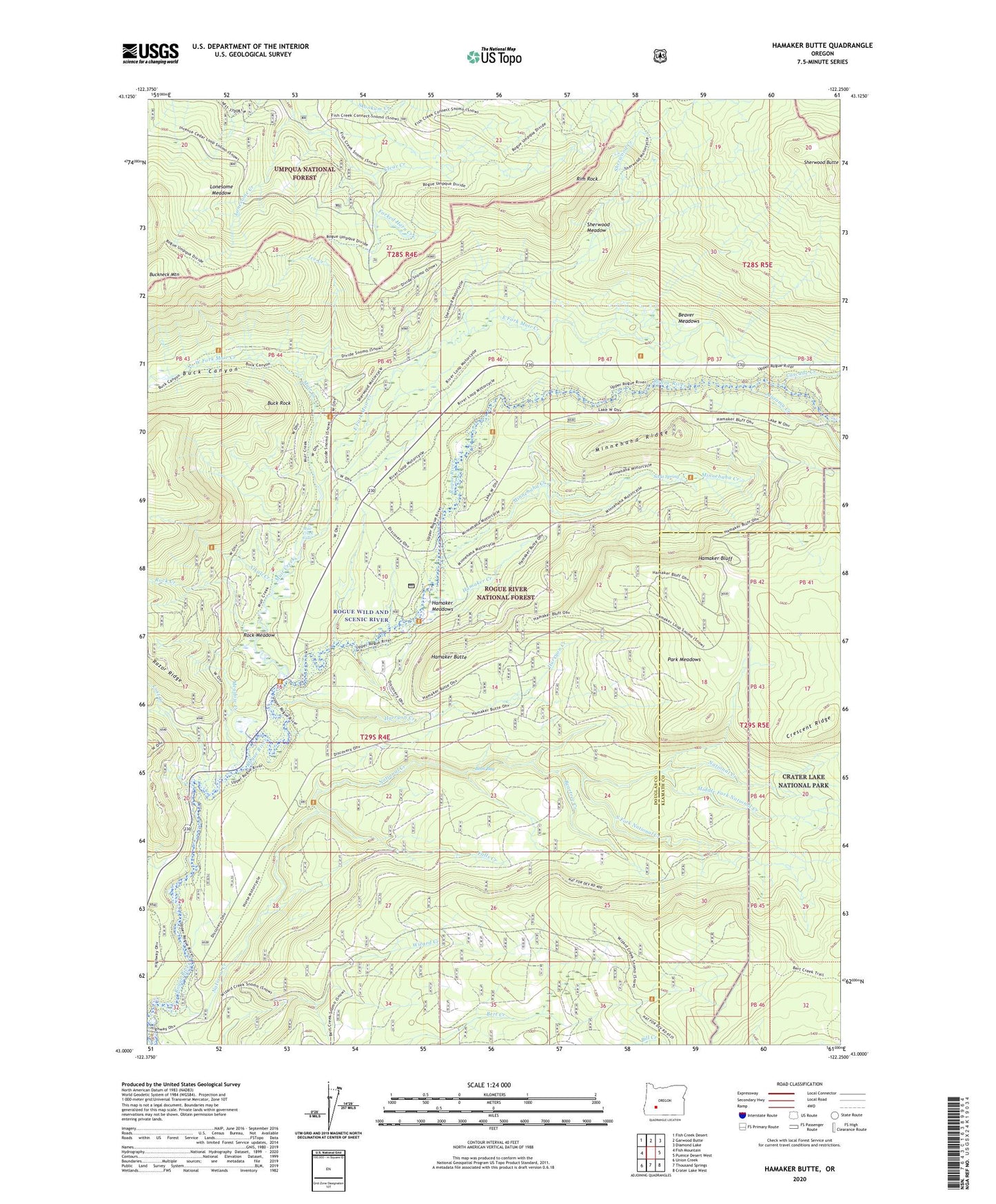
2023 topographic map quadrangle Hamaker Butte in the state of Oregon. Scale: 1:24000. Based on the newly updated USGS 7.5' US Topo map series, this map is in the following counties: Douglas, Klamath. The map contains contour data, water features, and other items you are used to seeing on USGS maps, but also has updated roads and other features. This is the next generation of topographic maps. Printed on high-quality waterproof paper with UV fade-resistant inks.
Quads adjacent to this one:
West: Fish Mountain
Northwest: Fish Creek Desert
North: Garwood Butte
Northeast: Diamond Lake
East: Pumice Desert West
Southeast: Crater Lake West
South: Thousand Springs
Southwest: Union Creek
This map covers the same area as the classic USGS quad with code o43122a3.
Contains the following named places: Alkali Creek, Beartree Creek, Beaver Meadows, Beaver Meadows Trail, Bobs Bay, Buck Camp, Buck Canyon, Buck Rock, Buckneck Mountain, Cascade Creek, Clear Creek Camp, Crescent Ridge, East Fork Muir Creek, Falls Creek, Forked Horn Creek, Hamaker Bluff, Hamaker Butte, Hamaker Creek, Hamaker Meadows, Hamaker Recreation Site, Haymaker Campground, Hurryon Camp, Hurryon Creek, Ice Creek, Log Camp, Lonesome Creek, Lonesome Meadow, Lost Creek, Mazama Creek, Meadow Creek, Middle Fork National Creek, Minnehaha Camp, Minnehaha Creek, Minnehaha Ridge, Minnehaha-Hurryon Trail, Muir Camp, Muir Creek, Muir Creek Falls, National Creek, National Creek Camp, Park Meadows, Prineville Camp, Razor Ridge, Rim Rock, Rim Rock Trail, Rock Creek, Rock Meadow, Sherwood Butte, Sherwood Creek, Sherwood Meadow, Soda Spring, South Fork National Creek, Three Lakes Trail, West Fork Muir Creek