MyTopo
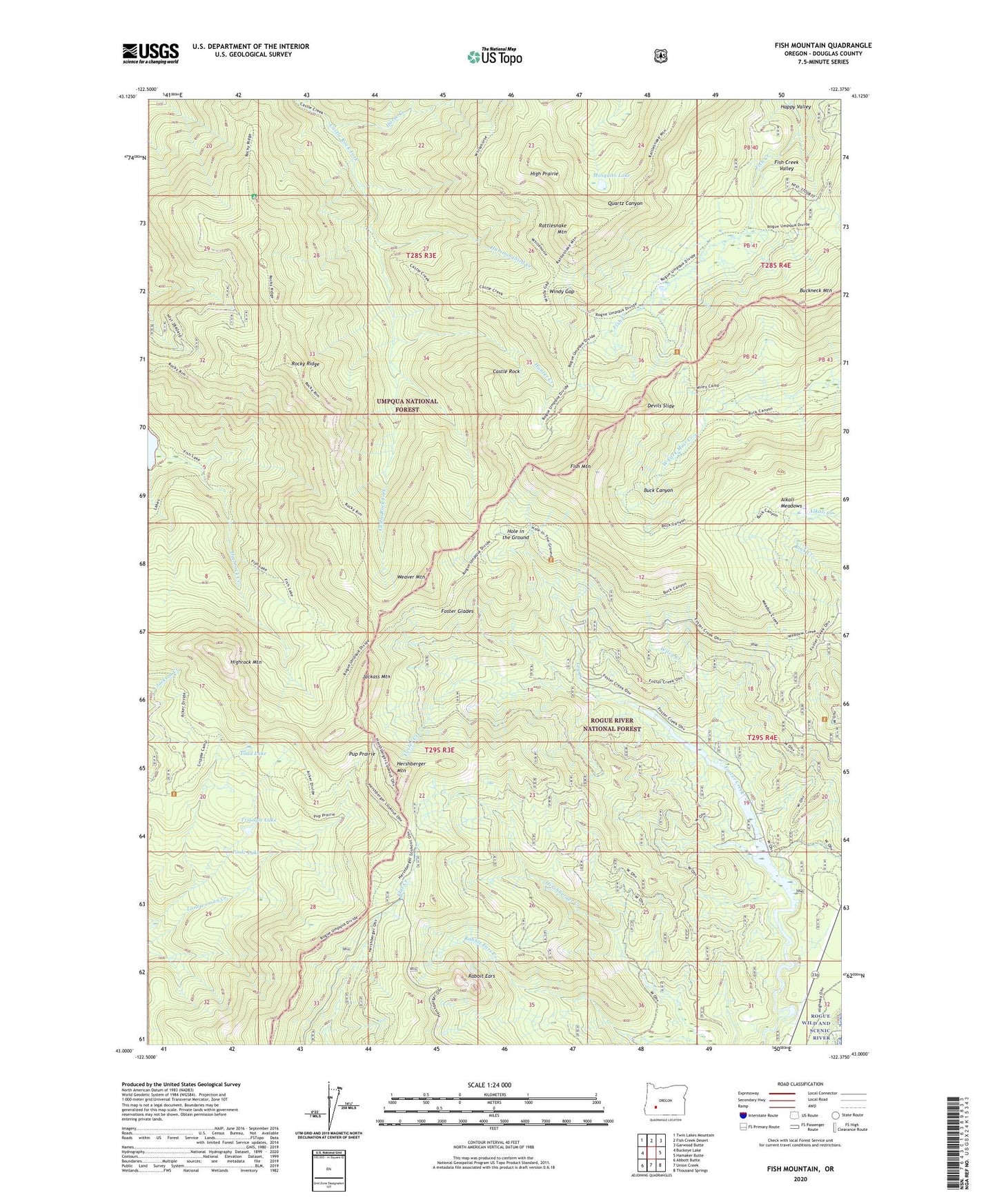
Fish Mountain Oregon US Topo Map
Couldn't load pickup availability
Also explore the Fish Mountain Forest Service Topo of this same quad for updated USFS data
2024 topographic map quadrangle Fish Mountain in the state of Oregon. Scale: 1:24000. Based on the newly updated USGS 7.5' US Topo map series, this map is in the following counties: Douglas. The map contains contour data, water features, and other items you are used to seeing on USGS maps, but also has updated roads and other features. This is the next generation of topographic maps. Printed on high-quality waterproof paper with UV fade-resistant inks.
Quads adjacent to this one:
West: Buckeye Lake
Northwest: Twin Lakes Mountain
North: Fish Creek Desert
Northeast: Garwood Butte
East: Hamaker Butte
Southeast: Thousand Springs
South: Union Creek
Southwest: Abbott Butte
This map covers the same area as the classic USGS quad with code o43122a4.
Contains the following named places: Alkali Camp, Alkali Meadows, Bear Camp, Buck Canyon Trail, Castle Rock, Devils Slide, Fish Creek Shelter, Fish Creek Valley, Fish Lake Trail, Fish Mountain, Foster Glades, Gale Creek, Hershberger Mountain, High Prairie, Highrock Creek, Highrock Mountain, Hole in the Ground, Horse Creek, Hummingbird Creek, Hunter Creek, Jackass Mountain, Lewis Camp, Log Creek, Log Pile Trail, Meadow Creek Trail, Mosquito Lake, Poole Lake, Pup Prairie, Rabbit Ears, Rattlesnake Mountain, Rocky Ridge, Rogue River Range, Rogue-Umpqua Divide Wilderness, Slide Creek, Toad Lake, Triangle Lake, Weaver Mountain, Wiley Camp, Wiley Creek, Windy Gap