MyTopo
Golden Falls Oregon US Topo Map
Couldn't load pickup availability
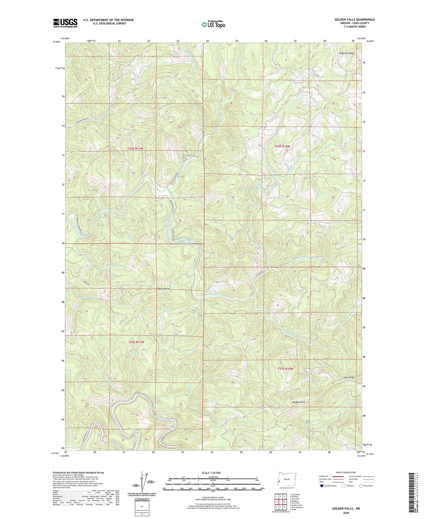
2023 topographic map quadrangle Golden Falls in the state of Oregon. Scale: 1:24000. Based on the newly updated USGS 7.5' US Topo map series, this map is in the following counties: Coos. The map contains contour data, water features, and other items you are used to seeing on USGS maps, but also has updated roads and other features. This is the next generation of topographic maps. Printed on high-quality waterproof paper with UV fade-resistant inks.
Quads adjacent to this one:
West: Allegany
Northwest: Trail Butte
North: Elk Peak
Northeast: Loon Lake
East: Ivers Peak
Southeast: Tioga
South: Coos Mountain
Southwest: Daniels Creek
This map covers the same area as the classic USGS quad with code o43123d8.
Contains the following named places: Big Creek, Conklin Creek, Coos River Fish Hatchery, Darius Creek, East Creek, Eastside Division, Fox Creek, Frog Creek, Glenn Creek, Golden and Silver Falls State Park, Golden Falls, Hewett Falls, Hodges Creek, Little Matson Creek, Matson Creek, McKnight Creek, Millicoma Myrtle Grove State Park, Millicoma River Rearing Pond, Millicoma River Rearing Pond Dam, Nesika County Park, Rodine Creek, Salmon Creek, Schoolhouse Creek, Silver Creek, Silver Falls, South Fork Matson Creek, Taylor Butte, Vaughn Point, West Creek, West Fork Silver Creek