MyTopo
Trail Oregon US Topo Map
Couldn't load pickup availability
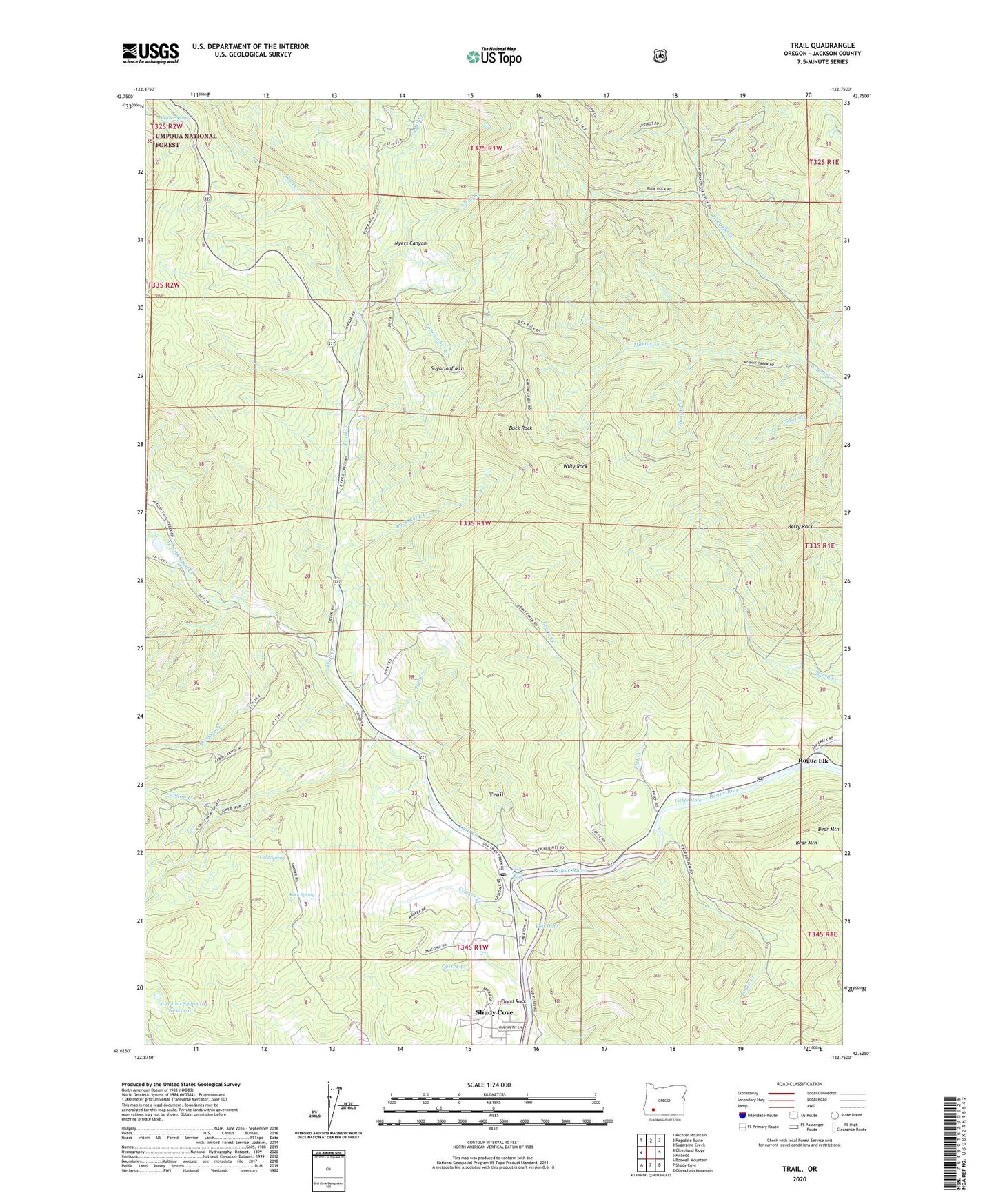
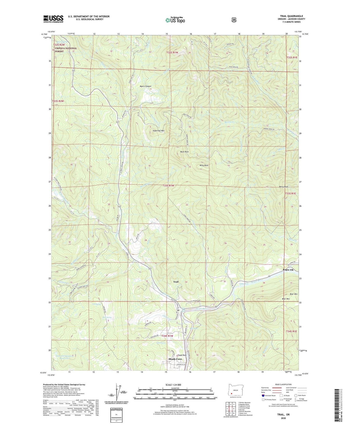
2020 topographic map quadrangle Trail in the state of Oregon. Scale: 1:24000. Based on the newly updated USGS 7.5' US Topo map series, this map is in the following counties: Jackson. The map contains contour data, water features, and other items you are used to seeing on USGS maps, but also has updated roads and other features. This is the next generation of topographic maps. Printed on high-quality waterproof paper with UV fade-resistant inks.
Quads adjacent to this one:
West: Cleveland Ridge
Northwest: Richter Mountain
North: Ragsdale Butte
Northeast: Sugarpine Creek
East: McLeod
Southeast: Obenchain Mountain
South: Shady Cove
Southwest: Boswell Mountain
Contains the following named places: Bear Mountain, Beaver Spring, Berry Rock, Boil Hole, Brush Creek, Buck Rock, Buck Rock Creek, Cable Hole, Canyon Creek, Clear Creek, Cold Spring, Country View Mobile Estates Wastewater Treatment Facility, Cricket Creek, Cusick Creek, Elk Creek, Flat Creek, Flood Rock, Hill Creek, Hungry Creek, Kendale Creek, Lane and Shephard Reservoirs, Lewis Creek, Morine Creek, Myers Canyon, Paradise Creek, Rock Spring, Rogue Elk, Rogue Elk County Park, Rogue Elk Jackson County Park Boat Ramp, Shady Cove Division, Sugarloaf Mountain, Toothacher Creek, Trail, Trail Census Designated Place, Trail Creek, Trail Creek Riffle, Trail Creek Tavern Museum, Trail Forest Service Facility, Trail Post Office, Wall Creek, West Fork Trail Creek, Willy Rock