MyTopo
Boswell Mountain Oregon US Topo Map
Couldn't load pickup availability
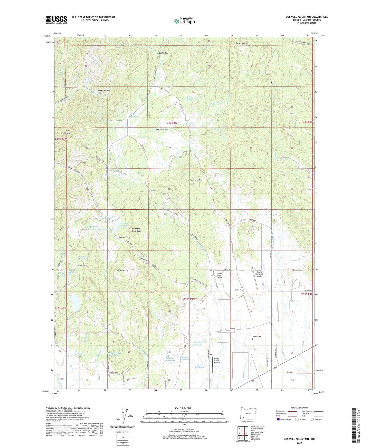
2023 topographic map quadrangle Boswell Mountain in the state of Oregon. Scale: 1:24000. Based on the newly updated USGS 7.5' US Topo map series, this map is in the following counties: Jackson. The map contains contour data, water features, and other items you are used to seeing on USGS maps, but also has updated roads and other features. This is the next generation of topographic maps. Printed on high-quality waterproof paper with UV fade-resistant inks.
Quads adjacent to this one:
West: McConville Peak
Northwest: Skeleton Mountain
North: Cleveland Ridge
Northeast: Trail
East: Shady Cove
Southeast: Eagle Point
South: Sams Valley
Southwest: Gold Hill
This map covers the same area as the classic USGS quad with code o42122e8.
Contains the following named places: Antioch Cemetery, Beagle, Beagle Post Office, Beagle Sky Ranch Airport, Bingham Reservoir, Boswell Mountain, Chimney Rock Butte, Cinnabar Mountain, Cinnabar Mountain Mine, Cliff Ranch, Coulter Reservoir Number One, Coulter Reservoir Number Two, Despain Reservoir, Drake Ranch, Firefly Ranch Airfield, Gribble Reservoir, Hull Mountain, Hunt Reservoir, Kirkham Reservoir, Lucky Hollow, Mack Reservoir, Meadow Graves, Meadows School, Mill Hollow, Moore Reservoir, Mountain King Mine, Mystery Creek, Neil Rock, Patillo Ditches, Peffley Creek, Price Reservoir, Rexrood Springs, Sams Valley Dam, Sams Valley Division, Sams Valley Reservoir, Schmidt Reservoirs, Secluded Lake Reservoir, Short Creek, Simpson Dam, Simpson Reservoir, Snider Creek Airport, Spignet Creek, Spikenard, Spikenard Post Office, Straus Spring, The Meadows, Thomas Mill Post Office, Turtle Rock, War Eagle Mine, ZIP Code: 97503