MyTopo
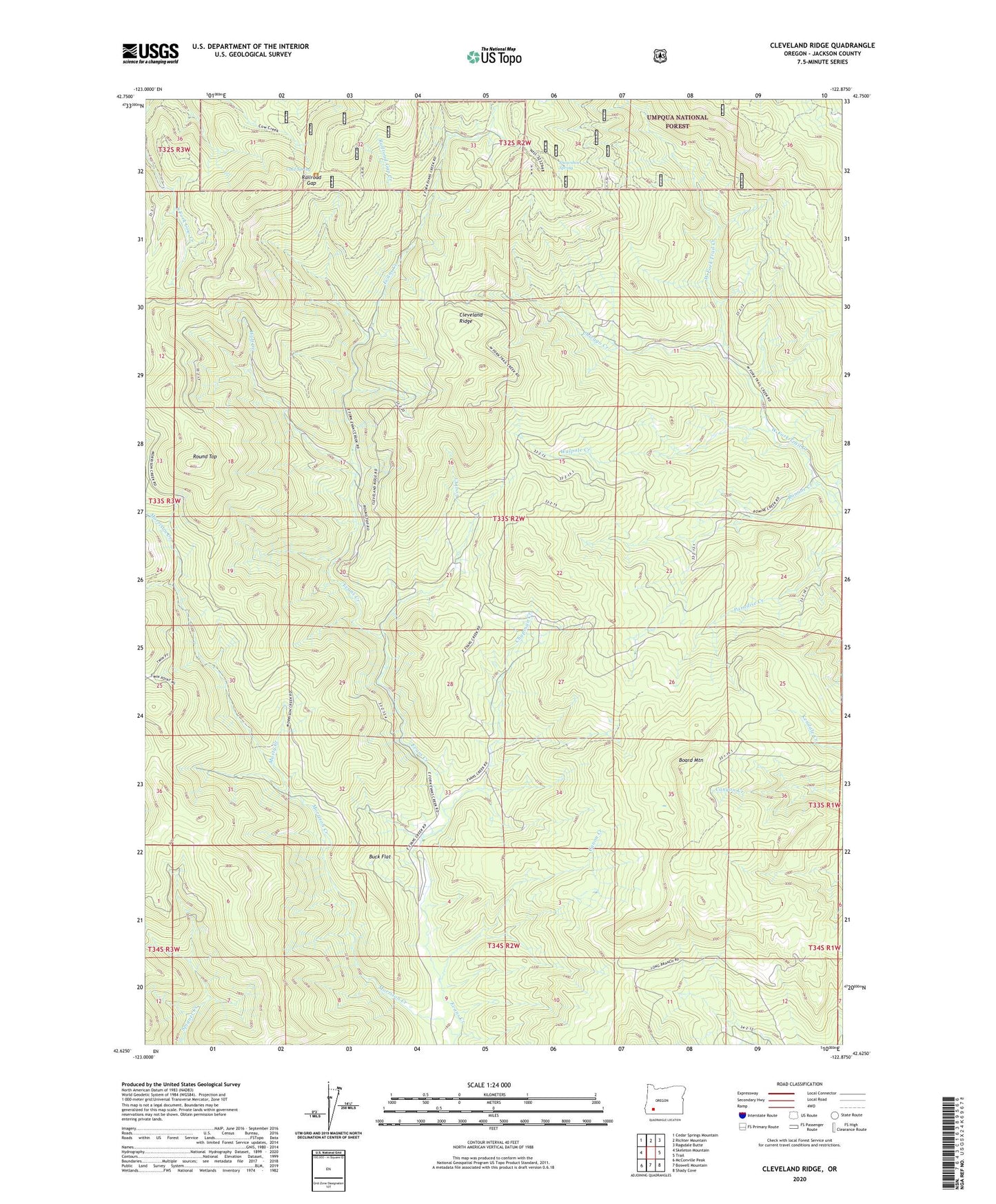
Cleveland Ridge Oregon US Topo Map
Couldn't load pickup availability
Also explore the Cleveland Ridge Forest Service Topo of this same quad for updated USFS data
2023 topographic map quadrangle Cleveland Ridge in the state of Oregon. Scale: 1:24000. Based on the newly updated USGS 7.5' US Topo map series, this map is in the following counties: Jackson. The map contains contour data, water features, and other items you are used to seeing on USGS maps, but also has updated roads and other features. This is the next generation of topographic maps. Printed on high-quality waterproof paper with UV fade-resistant inks.
Quads adjacent to this one:
West: Skeleton Mountain
Northwest: Cedar Springs Mountain
North: Richter Mountain
Northeast: Ragsdale Butte
East: Trail
Southeast: Shady Cove
South: Boswell Mountain
Southwest: McConville Peak
This map covers the same area as the classic USGS quad with code o42122f8.
Contains the following named places: Asbestos, Asbestos Post Office, Board Mountain, Buck Flat, Canon Creek, Chapman Creek, Chicago Cabin, Chicago Creek, Cleveland Ridge, Coal Creek, Cold Spring, Morrison Creek, Musty Creek, Railroad Gap, Railroad Gap Creek, Romine Creek, Round Top, Snowshoe Spring, Walpole Creek, Wolf Creek, Younkers Ranch