MyTopo
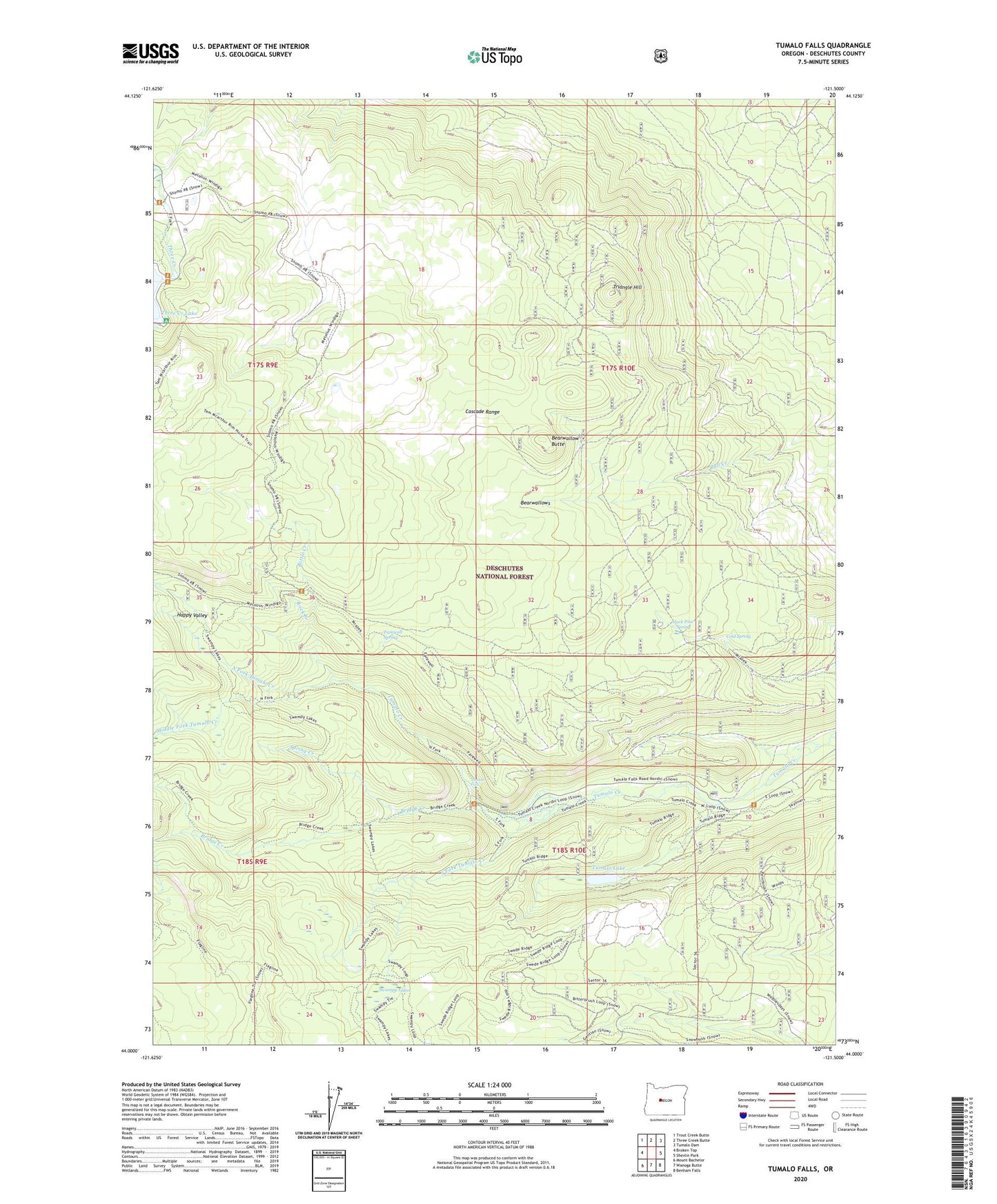
Tumalo Falls Oregon US Topo Map
Couldn't load pickup availability
Also explore the Tumalo Falls Forest Service Topo of this same quad for updated USFS data
2024 topographic map quadrangle Tumalo Falls in the state of Oregon. Scale: 1:24000. Based on the newly updated USGS 7.5' US Topo map series, this map is in the following counties: Deschutes. The map contains contour data, water features, and other items you are used to seeing on USGS maps, but also has updated roads and other features. This is the next generation of topographic maps. Printed on high-quality waterproof paper with UV fade-resistant inks.
Quads adjacent to this one:
West: Broken Top
Northwest: Trout Creek Butte
North: Three Creek Butte
Northeast: Tumalo Dam
East: Shevlin Park
Southeast: Benham Falls
South: Wanoga Butte
Southwest: Mount Bachelor
This map covers the same area as the classic USGS quad with code o44121a5.
Contains the following named places: Bearwallow Butte, Bearwallows, Bend City Water Intake, Big Three Creek Lake Dam, Bottle Creek, Bridge Creek, Cold Spring, Farewell Spring, Happy Valley, Jack Pine Spring, Middle Fork Tumalo Creek, North Fork Tumalo Creek, Rock Creek, Skyliner Sno-Park, South Fork Shelter, South Fork Tumalo Creek, Spring Creek, Swampy Lakes, Swampy Lakes Shelter, Swampy Lakes Trail, Swede Ridge Shelter, Three Creek Lake Recreation Site, Three Creek Meadow Horse Camp, Three Creek Meadow Recreation Site, Triangle Hill, Tumalo Falls, Tumalo Falls Recreation Site, Tumalo Lake